
Aalten facts for kids
Quick facts for kids
Aalten
|
|||
|---|---|---|---|

Aalten town hall
|
|||
|
|||
.svg)
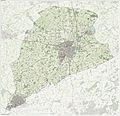
Location in Gelderland
|
|||
| Country | Netherlands | ||
| Province | Gelderland | ||
| Government | |||
| • Body | Municipal council | ||
| Area | |||
| • Total | 97.03 km2 (37.46 sq mi) | ||
| • Land | 96.51 km2 (37.26 sq mi) | ||
| • Water | 0.52 km2 (0.20 sq mi) | ||
| Elevation | 31 m (102 ft) | ||
| Population
(May 2014)
|
|||
| • Total | 27,008 | ||
| • Density | 280/km2 (700/sq mi) | ||
| Demonym(s) | Aaltenaar | ||
| Time zone | UTC+1 (CET) | ||
| • Summer (DST) | UTC+2 (CEST) | ||
| Postcode |
7090–7095, 7120–7126
|
||
| Area code | 0315, 0543 | ||

Aalten is a village and municipality in the eastern Netherlands. The former municipalities of Bredevoort (1818) and Dinxperlo (2005) have been merged with Aalten. Aalten village has 12,900 inhabitants, the municipality has 27.593 inhabitants.
Population centres
Aalten, Barlo, Bredevoort, Dale, Dinxperlo, Haart, Heurne, IJzerlo, 't Klooster and Lintelo.
Images for kids
-
Topographic map of Aalten, June 2015

See also
 In Spanish: Aalten para niños

All content from Kiddle encyclopedia articles (including the article images and facts) can be freely used under Attribution-ShareAlike license, unless stated otherwise. Cite this article:
Aalten Facts for Kids. Kiddle Encyclopedia.