
Adamsville, Arizona facts for kids
Quick facts for kids
Adamsville, Arizona
|
|
|---|---|

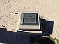
Adamsville Ghost Town Marker
|
|
| Country | United States |
| State | Arizona |
| County | Pinal |
| Elevation | 1,450 ft (442 m) |
| Population
(2010)
|
|
| • Total | N/A |
| Time zone | UTC-7 (Mountain (MST)) |
| • Summer (DST) | UTC-7 (MST) |
| ZIP codes |
85132
|
| Area code(s) | 520 |
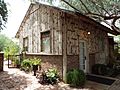
Adamsville was a populated place in Pinal County, Arizona. Once a thriving farm town, it became a ghost town by the 1920s. Adamsville is located at an elevation is 1,450 feet, on the south bank of the Gila River, west of Florence, Arizona.
History
Adamsville was one of the first two towns formed in Pinal County, Arizona. It was named for its original settler in 1866, Charles S. Adams. When a post office was established there in 1871, it was named Sanford, (for a Captain George B. Sanford of the First U.S. Cavalry), by a political enemy of Mr. Adams, Richard McCormick. Local residents continued to use the original name, causing confusion which existed until 1876, when the post office was discontinued. The entire settlement was gone by 1920.
Structures in Adamsville
- Adamsville, Arizona (Ghost Town)
(National Register of Historic Places)
-
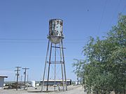
Adamsville Water Tower
-
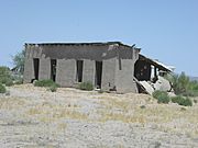
Adamsville store.
-
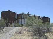
Adamsville Water Tanks.


Demographics
| Historical population | |||
|---|---|---|---|
| Census | Pop. | %± | |
| 1870 | 400 | — | |
| 1880 | 39 | −90.2% | |
| U.S. Decennial Census | |||
Adamsville first appeared on the 1870 U.S. Census as an unincorporated village. It was then located within Pima County. It became a part of Pinal County with its creation in 1875. It reported 400 residents in 1870, all White. It was tied with the village of Apache Pass as the then-second most populous locale in Pima County, behind Tucson, and was the 4th largest recorded community in the entire territory of Arizona. In 1880, it reported as the village of Sanford, with just 39 residents. It was the second-least recorded populated community, tied with the village of Plomosa, and just ahead of Casa Grande. It did not report again on the census.
Images for kids
-

Adamsville Water Tower
-

Adamsville store
-
Adamsville grain storage
-
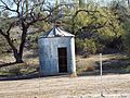
Windmill Farmhouse
-

Adamsville A.O.U.W. Cemetery
-
Grave of Fred A. Adams (1844–1910)


