
Albemarle County, Virginia facts for kids
Quick facts for kids
Albemarle County
|
||
|---|---|---|

The Albemarle County Office Building
|
||
|
||

Location within the U.S. state of Virginia
|
||
 Virginia's location within the U.S. |
||
| Country | ||
| State | ||
| Founded | 1744 | |
| Named for | Willem Anne van Keppel, 2nd Earl of Albemarle | |
| Seat | Charlottesville | |
| Largest community | Scottsville | |
| Area | ||
| • Total | 726 sq mi (1,880 km2) | |
| • Land | 721 sq mi (1,870 km2) | |
| • Water | 5 sq mi (10 km2) 0.7% | |
| Population
(2020)
|
||
| • Total | 112,395 | |
| • Density | 154.81/sq mi (59.77/km2) | |
| Time zone | UTC−5 (Eastern) | |
| • Summer (DST) | UTC−4 (EDT) | |
| Congressional district | 5th | |

Albemarle County is a county located in the Piedmont region of the Commonwealth of Virginia. Its county seat is Charlottesville, which is an independent city and enclave entirely surrounded by the county. Albemarle County is part of the Charlottesville Metropolitan Statistical Area. As of the 2020 census, the population was 112,395.
Albemarle County was created in 1744 from the western portion of Goochland County, though portions of Albemarle were later carved out to create other counties. Albemarle County was named in honor of Willem Anne van Keppel, 2nd Earl of Albemarle. Its most famous inhabitant was Thomas Jefferson, who built his estate home, Monticello, in the county.
Contents
History

At the time of European encounter, the inhabitants of the area that became Albemarle County were a Siouan-speaking tribe called the Saponi. In 1744, the Virginia General Assembly created Albemarle County from the western portion of Goochland County. The county was named in honor of Willem Anne van Keppel, 2nd Earl of Albemarle and titular Governor of Virginia at the time. The large county was partitioned in 1761, forming Buckingham and Amherst counties, at which time the county seat was moved from the formerly central Scottsville to a piece of newly central land, christened Charlottesville. In 1777, Albemarle County was divided and Fluvanna County established, finalizing the boundaries of modern Albemarle County.
Albemarle County is well known for its association with President and Founding Father Thomas Jefferson, who was born in the County at Shadwell, though it was then part of Goochland County. However, his home of Monticello is located in the County.
Geography
According to the U.S. Census Bureau, the county has a total area of 726 square miles (1,880 km2), of which 721 square miles (1,870 km2) is land and 5 square miles (13 km2) (0.7%) is water.
Waterways
The Rivanna River's south fork forms in Albemarle County and was historically important for transportation. The south fork flows in-between Darden Towe Park and Pen Park. Boat ramp access is available at Dardent Towe Park. The James River acts as a natural boarder between Albemarle and Buckingham Counties.
Major highways
- Interstate 64
- U.S. Route 29
- U.S. Route 250
- Virginia State Route 6
- Virginia State Route 20
- Virginia State Route 22
- Virginia State Route 53
- Virginia State Route 240
Protected areas
Albemarle's western border with Augusta and Rockingham Counties is located within the Shenandoah National Park.
Adjacent counties
Albemarle County borders 8 other counties, more than any other county in Virginia.
- Charlottesville, Virginia (surrounded by Albemarle County)
- Greene County, Virginia (north)
- Orange County, Virginia (northeast)
- Louisa County, Virginia (east)
- Fluvanna County, Virginia (southeast)
- Buckingham County, Virginia (south)
- Nelson County, Virginia (southwest)
- Augusta County, Virginia (west)
- Rockingham County, Virginia (northwest)
Parks and recreation
- Pen Park
- Walnut Creek Park
Demographics
| Historical population | |||
|---|---|---|---|
| Census | Pop. | %± | |
| 1790 | 12,585 | — | |
| 1800 | 16,439 | 30.6% | |
| 1810 | 18,268 | 11.1% | |
| 1820 | 19,750 | 8.1% | |
| 1830 | 22,618 | 14.5% | |
| 1840 | 22,294 | −1.4% | |
| 1850 | 25,800 | 15.7% | |
| 1860 | 26,625 | 3.2% | |
| 1870 | 27,544 | 3.5% | |
| 1880 | 32,618 | 18.4% | |
| 1890 | 32,379 | −0.7% | |
| 1900 | 28,473 | −12.1% | |
| 1910 | 29,871 | 4.9% | |
| 1920 | 26,005 | −12.9% | |
| 1930 | 26,981 | 3.8% | |
| 1940 | 24,652 | −8.6% | |
| 1950 | 26,662 | 8.2% | |
| 1960 | 30,969 | 16.2% | |
| 1970 | 37,780 | 22.0% | |
| 1980 | 55,783 | 47.7% | |
| 1990 | 68,040 | 22.0% | |
| 2000 | 79,236 | 16.5% | |
| 2010 | 98,970 | 24.9% | |
| 2020 | 112,395 | 13.6% | |
| U.S. Decennial Census 1790-1960 1900-1990 1990-2000 2010 2020 |
|||
2020 census
| Race / Ethnicity | Pop 2010 | Pop 2020 | % 2010 | % 2020 |
|---|---|---|---|---|
| White alone (NH) | 77,130 | 80,335 | 77.93% | 71.48% |
| Black or African American alone (NH) | 9,487 | 9,793 | 9.59% | 8.71% |
| Native American or Alaska Native alone (NH) | 150 | 96 | 0.15% | 0.09% |
| Asian alone (NH) | 4,597 | 8,186 | 4.64% | 7.28% |
| Pacific Islander alone (NH) | 42 | 44 | 0.04% | 0.04% |
| Some Other Race alone (NH) | 173 | 604 | 0.17% | 0.54% |
| Mixed Race/Multi-Racial (NH) | 1,974 | 4,884 | 1.99% | 4.35% |
| Hispanic or Latino (any race) | 5,417 | 8,453 | 5.47% | 7.52% |
| Total | 98,970 | 112,395 | 100.00% | 100.00% |
Note: the US Census treats Hispanic/Latino as an ethnic category. This table excludes Latinos from the racial categories and assigns them to a separate category. Hispanics/Latinos can be of any race.
2010 Census
The largest self-reported ancestry groups in Albemarle County are English 16.3%, German 16.0%, Irish 12.7%, "American" 11.4% and Italian 5.2%.
As of the census of 2010, there were 98,970 people, 38,157 households, and 24,578 families residing in the county. The population density was 137 people per square mile (52.8/km2). There were 42,122 housing units at an average density of 58 per square mile (22.4/km2). The racial makeup of the county was 80.6% White, 9.7% Black or African American, 0.3% Native American, 4.7% Asian, 0.1% Pacific Islander, 2.3% from other races, and 2.4% from two or more races. 5.5% of the population were Hispanic or Latino of any race.
There were 38,157 households, out of which 28.2% had children under the age of 18 living with them, 51.4% were married couples living together, 9.6% had a female householder with no husband present, and 35.6% were non-families. 28.0% of all households were made up of individuals, and 25.9% had someone living alone who was 65 years of age or older. The average household size was 2.41 and the average family size was 2.96.
In the county, the population was spread out, with 21.5% under the age of 18, 12.3% from 18 to 24, 24.7% from 25 to 44, 27.2% from 45 to 64, and 14.3% who were 65 years of age or older. The median age was 38.2 years. For every 100 females there were 92.69 males. For every 100 females age 18 and over, there were 89.59 males.
22% of Albemarle residents have a graduate or professional degree, compared with 10% nationwide.
The median income for a household in the county was $63,001, and the median income for a family was $98,934. Males had a median income of $55,530 versus $52,211 for females. The per capita income for the county was $36,718. About 3.8% of families and 10.4% of the population were below the poverty line, including 8.0% of those under age 18 and 2.4% of those age 65 or over.
Communities
The city of Charlottesville is enclaved within Albemarle County. Under Virginia law in effect since 1871, all municipalities in the state incorporated as cities are legally and politically independent of any county.
Town
There is only one incorporated town in Albemarle County:
- Scottsville, the original county seat
Census-designated places
- Crozet
- Esmont
- Free Union
- Hollymead
- Ivy
- Pantops
- Piney Mountain
- Rivanna (east county)
- University of Virginia
Other unincorporated communities
- Advance Mills
- Afton
- Alberene
- Ardwood
- Arrowhead
- Ashcroft
- Ashmere
- Ballard Woods
- Barboursville
- Barracks
- Barterbrook
- Batesville
- Bedford Hills
- Bell Haven
- Bellair
- Bentivar
- Berkeley
- Berkmar
- Birnam Wood
- Blenheim
- Boiling Spring
- Boonesville
- Branchland
- Briarwood
- Brinnington
- Brookwood
- Brownsville
- Browntown
- Buckingham Circle
- Bungletown
- Burnley
- Camellia Garden
- Camelot
- Campbell
- Candlewyck
- Canterbury Hills
- Carrsbrook
- Cash Corner
- Cedarmere
- Chapel Hills
- Chestnut Grove
- Cismont
- Clover Hill
- Cobham
- Colthurst
- Commonwealth
- Country Green
- The Country Store
- Country View
- Covesville
- Damon
- Davis Shop
- Deer Run
- Deerwood
- Doylesville
- Earlysville
- Earlysville Heights
- Eastham
- Ednam
- Ehart
- Everettsville
- Fairgrove
- Farmington
- Fieldbrook
- Flordon
- Foxwood
- Franklin
- Freetown
- Gilbert
- Glenaire
- Glendower
- Glenmore
- Glenorchy
- Greenfields
- Greenwood
- Hatton
- Heards
- Howardsville
- Hunters Hall
- Hydraulic
- Inglecress
- Keene
- Keswick
- Key West
- Knollwood
- Langford
- Lexington
- Liberty Hill
- Lindsay
- Little Clover Hill
- Loch Leigh
- Lochridge
- Mallard Lake
- McCullough
- The Meadows
- Meriwether Hill
- Midway
- Midway
- Mill Creek
- Mill Ridge
- Mill Run
- Millington
- Milton
- Milton Heights
- Milton Hills
- Miran Forest
- Montvue
- Mountain Laurel
- Mountfair
- Newtown
- Nob Hill
- Northfields
- North Garden
- Nortonsville
- Norwood
- Oak Hill
- Oak Terrace
- Old Dominion
- Overton
- Owensville
- Parkview
- Patterson Store
- Peacock Hill
- The Pines
- Porters
- Powell Corner
- Proffit
- Queen Charlotte
- Raintree
- Redland
- Rio
- Rio Heights
- Rivanna (north county)
- Riverrun
- Rockbrook
- Rose Hill
- Rosena
- Rugby
- Running Deer
- Shadwell
- Simeon
- Solaris
- Springfield
- Squire Hill
- Stillfield
- Stonehenge
- Stony Point
- Tapscott
- Terrybrook
- Thurston
- Tillmans
- Totier Hills
- Townwood
- Warren
- Watts
- Waverly
- West Leigh
- Westfield
- Westgate
- Westmoreland
- Westover Hills
- White Hall
- Wildwood
- Wilhait
- Willoughby
- Windrift
- Windsor
- Woodbrook
- Woodridge
- Wyngate
- Yancey Mills
Economy
35% of people working in Albemarle live in the county, while 65% commute in. 19% of those commuting in live in Charlottesville, while the remainder live in the surrounding counties. 26,800 people commute out of Albemarle for work. 48% of those commute to Charlottesville, making up 51% of Charlottesville's in-commuters. In 2018, Albemarle had a 2.7% unemployment rate, compared with a national rate of 3.9%.
The top 10 employers as of Q2 2019 were:
- University of Virginia
- County of Albemarle
- Sentara Healthcare
- U.S. Department of Defense
- State Farm Mutual Automobile Insurance
- Atlantic Coast Athletic Club
- Piedmont Virginia Community College
- Northrop Grumman Corporation
- Crutchfield Corporation
- Walmart
36% of workers in Albemarle are employed by the government, with 898 working for the federal government, 12,476 working for the state government (including the University of Virginia), and 4,127 working for the local government.
Education
The Albemarle County Public School System operates public education in the county. It provides education to nearly 14,000 students including preschool through high school. The Albemarle County Public School System's mission is to "establish a community of learners and learning, through relationships, relevance and rigor, one student at a time." ACPS provides 25 school facilities which include Community Lab School, a charter school that is located in the City of Charlottesville, Albemarle High School, Western Albemarle High School, and Monticello High School. The School Board and the Superintendent, Dr. Matthew Haas, work closely together in operating the Albemarle County Public School System.
Many private schools in Albemarle serve the county and students from surrounding areas. These include:
- The Covenant School (upper campus)
- Field School of Charlottesville
- Free Union Country School
- The Miller School of Albemarle
- Montessori Community School
- North Branch School
- Peabody School
- Charlottesville Catholic School
- St. Anne's-Belfield School
- Tandem Friends School
Some students attend several private schools in the City of Charlottesville.
Jefferson-Madison Regional Library is the regional library system that provides services to the citizens of Albemarle.
Notable residents


- Chilton Allan (1786–1858), born in Albemarle County, United States Congressman from Kentucky
- Rev Samuel Black, Albemarle County's first Presbyterian minister. Built Sam Black's Tavern
- Dabney Smith Carr (1802–1854), born in Albemarle County, founder of newspaper Baltimore Republican and Commercial Advertiser, United States minister to Turkey
- Christopher Henderson Clark (1767–1828), United States Congressman from Virginia
- George Rogers Clark (1752–1818), surveyor, soldier, and Revolutionary War hero and older brother of William Clark born in Albemarle County
- William Coleman, Olympic equestrian team member 2012
- Edward Coles (1786–1868), born in Albemarle County, Governor of Illinois
- Rita Dove (1952- ), former United States Poet Laureate and winner of the Pulitzer Prize for poetry, living in Albemarle County since 1989
- Greensville Dowell (1822–1876), born in Albemarle County, noted physician, professor, and author
- Kathryn Erskine, National Book Award-winning novelist
- James T. Farley (1829–1886), born in Albemarle County, United States Senator from California
- James Walker Gons (1812–1870), born in Albemarle County, Baptist church clergyman, later converting to Christian Church (Disciples of Christ), editor and publisher of church's Christian Intelligencer, educator.
- John Grisham, author of The Whistler and A Time to Kill
- Claude Hall, historian who wrote definitive biography of Abel Parker Upshur
- John Harvie (1742–1807), born in Albemarle County, member of the Continental Congress and mayor of Richmond, Virginia from 1785 to 1786
- Samuel Hopkins (1753–1819), born in Albemarle County, United States Army officer and United States Congressman from Kentucky
- Thomas Jefferson, third President of the United States and former Governor of Virginia
- Sarah Garland Boyd Jones (1866–1905), physician
- Jack Jouett (1754–1822), born in Albemarle County, known as the "Paul Revere of the South", influential in organizing Kentucky as a separate state, Virginia and Kentucky state legislator
- Fiske Kimball (1888–1955), architectural historian, founder of the University of Virginia School of Architecture
- Ben King (cyclist), professional cyclist
- Walter Leake (1769?-1825), born in Albemarle County, United States Senator from Mississippi and later governor of that state
- Meriwether Lewis (1774–1809), born in Albemarle County, explorer, governor of Louisiana, and one of the leaders of the Lewis and Clark Expedition
- Howie Long, former NFL player with the Oakland Raiders
- Joseph Martin (1740–1808), Revolutionary War general and explorer; namesake of Martinsville, Virginia
- Dave Matthews of the Dave Matthews Band
- David Meriwether, born in Albemarle County, Continental Army officer, member United States Congress, Speaker of the Georgia House of Representatives, Major General - Georgia Militia
- James Monroe, fifth President of the United States and former Governor of Virginia
- James Monroe (1799–1870), born in Albemarle County, United States Congressman from New York
- Lottie Moon (1840–1912), Southern Baptist missionary to China; Southern Baptists worldwide take up a Christmas offering every year for international missions in her name
- John Milbank, English Philosopher and Theologian
- Sissy Spacek, actress
- Peter Threewits (1725-1770), born in Sussex County, Virginia state legislator
- Bebe Williams, Xeric Award cartoonist/artist Art Comics Daily
Images for kids
-
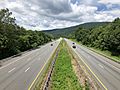
I-64 in Albemarle County
_in_Greenwood,_Albemarle_County,_Virginia.jpg)
See also
 In Spanish: Condado de Albemarle (Virginia) para niños
