
Albert County, New Brunswick facts for kids
Quick facts for kids
Albert
|
|
|---|---|

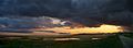
Farm landscape near Alma
|
|

Location within New Brunswick
|
|
| Country | |
| Province | |
| Established | 1845 |
| Area | |
| • Land | 1,807.88 km2 (698.03 sq mi) |
| Population
(2016)
|
|
| • Total | 29,158 |
| • Density | 16.1/km2 (42/sq mi) |
| • Pop 2011-2016 | |
| • Dwellings | 13,111 |
| Time zone | UTC-4 (AST) |
| • Summer (DST) | UTC-3 (ADT) |
| Area code(s) | 506 |
Albert County (2016 population 29,158) is a county in southeastern New Brunswick, Canada on Chignecto Bay in the Bay of Fundy. Prior to the ending of county government in 1967, the shire town was Hopewell Cape. The county was created in 1845 from parts of Westmorland County and Saint John County, and named after Prince Albert.
Contents
Census subdivisions
Communities
There are four municipalities within Albert County (listed by 2016 population):
| Official Name | Status | Area km2 | Population | Parish |
|---|---|---|---|---|
| Riverview | Town | 35.45 | 19,667 | Coverdale |
| Hillsborough | Village | 12.83 | 1,277 | Hillsborough |
| Riverside-Albert | Village | 3.35 | 350 | Hopewell |
| Alma | Village | 47.60 | 213 | Alma |
Parishes
The county is subdivided into six parishes (listed by 2016 population):
| Official Name | Area km2 | Population | municipalities | Unincorporated communities |
|---|---|---|---|---|
| Coverdale | 236.04 | 4,466 | Riverview (town) | Colpitts Settlement / Five Points / Grub Road / Lower Coverdale / Lower Turtle Creek / Middlesex / Middle Coverdale / Nixon / Pine Glen / Price / Salisbury Back Road / Stoney Creek / Synton / Turtle Creek / Upper Coverdale |
| Hillsborough | 304.05 | 1,308 | Hillsborough (village) | Albert Mines / Baltimore / Beech Hill / Berryton / Caledonia Mountain / Dawson Settlement / Edgetts Landing / Isaiah Corner / Osborne Corner / Rosevale / Salem / Shenstone / Steeves Mills / Steevescote / Weldon |
| Elgin | 519.59 | 892 | Church Hill / Churchs Corner / Elgin / Ferndale / Forest Hill / Goshen / Gowland Mountain / Harrison Settlement / Hillside / Little River / Mapleton / Meadow / Midland / Parkindale / Pleasant Vale / Prosser Brook / Ross Corner | |
| Hopewell | 149.08 | 647 | Riverside-Albert (village) | Cape Station / Chemical Road / Chester / Curryville / Demoiselle Creek / Hopewell Cape / Hopewell Hill / Lower Cape / McGinleys Corner / Memel Settlement / Mountville / Shepody |
| Harvey | 277.27 | 333 | Beaver Brook / Brookville / Cape Enrage / Derrys Corner / Germantown / Harvey / Harvey Bank / Little Ridge / Midway / New Horton / New Ireland / Upper New Horton / Waterside / West River | |
| Alma | 222.62 | 213note | Alma (village) | Mitchells Corner / Teahans Corner |
note 2016 population of the Village of Alma
Demographics
Population
| Canada census – Albert County, New Brunswick community profile | |||
|---|---|---|---|
| 2016 | 2011 | 2006 | |
| Population: | 29,158 (+1.1% from 2011) | 28,846 (+4.7% from 2006) | 27,562 (+3.0% from 2001) |
| Land area: | 1,807.88 km2 (698.03 sq mi) | 1,806.54 km2 (697.51 sq mi) | 1,806.12 km2 (697.35 sq mi) |
| Population density: | 16.1/km2 (42/sq mi) | 16.0/km2 (41/sq mi) | 15.3/km2 (40/sq mi) |
| Median age: | 45.0 (M: 44.0, F: 46.0) | 42.9 (M: 41.8, F: 43.9) | 41.0 (M: 40.2, F: 41.7) |
| Total private dwellings: | 13,111 | 12,573 | 11,503 |
| Median household income: | $66,521 | $60,952 | $54,297 |
| References: 2016 2011 2006 earlier | |||
| Historical Census Data - Albert County, New Brunswick | |||||||||||||||||||||||||||||||||||||||||||||||||||||||||||||||||||||||||||||||||||
|---|---|---|---|---|---|---|---|---|---|---|---|---|---|---|---|---|---|---|---|---|---|---|---|---|---|---|---|---|---|---|---|---|---|---|---|---|---|---|---|---|---|---|---|---|---|---|---|---|---|---|---|---|---|---|---|---|---|---|---|---|---|---|---|---|---|---|---|---|---|---|---|---|---|---|---|---|---|---|---|---|---|---|---|
|
|
|
|||||||||||||||||||||||||||||||||||||||||||||||||||||||||||||||||||||||||||||||||
Language
| Canada Census Mother Tongue - Albert County, New Brunswick | ||||||||||||||||||
|---|---|---|---|---|---|---|---|---|---|---|---|---|---|---|---|---|---|---|
| Census | Total |
|
|
|
|
|||||||||||||
| Year | Responses | Count | Trend | Pop % | Count | Trend | Pop % | Count | Trend | Pop % | Count | Trend | Pop % | |||||
|
|
|
26,135 | 91.41% | 1,845 | 6.45% | 200 | 0.70% | 410 | 1.43% | |||||||||
|
|
|
25,130 | 92.19% | 1,575 | 5.78% | 65 | 0.24% | 490 | 1.80% | |||||||||
|
|
|
24,640 | 93.09% | 1,440 | 5.44% | 115 | 0.43% | 275 | 1.04% | |||||||||
|
|
|
24,665 | n/a | 93.94% | 1,300 | n/a | 4.95% | 100 | n/a | 0.38% | 190 | n/a | 0.72% | |||||
Access Routes
Highways and numbered routes that run through the county, including external routes that start or finish at the county limits:
|
|
|
|
Images for kids
-
Sunset over the Bay of Fundy near Waterside
See also
 In Spanish: Condado de Albert para niños

All content from Kiddle encyclopedia articles (including the article images and facts) can be freely used under Attribution-ShareAlike license, unless stated otherwise. Cite this article:
Albert County, New Brunswick Facts for Kids. Kiddle Encyclopedia.