
Alexander County, Illinois facts for kids
Quick facts for kids
Alexander County
|
|
|---|---|

Alexander County Courthouse in Cairo
|
|

Location within the U.S. state of Illinois
|
|
 Illinois's location within the U.S. |
|
| Country | |
| State | |
| Founded | 1819 |
| Named for | William M. Alexander |
| Seat | Cairo |
| Largest city | Cairo |
| Area | |
| • Total | 253 sq mi (660 km2) |
| • Land | 236 sq mi (610 km2) |
| • Water | 17 sq mi (40 km2) 6.8% |
| Population
(2020)
|
|
| • Total | 5,240 |
| • Density | 20.71/sq mi (7.997/km2) |
| Time zone | UTC−6 (Central) |
| • Summer (DST) | UTC−5 (CDT) |
| Congressional district | 12th |
| Website | alexandercountyil.com |
Alexander County is the southernmost and southwesternmost county in the U.S. state of Illinois. As of the 2020 census, the population was 5,240. Its county seat is Cairo and its western boundary is formed by the Mississippi River.
Alexander County is part of the Cape Girardeau, MO-IL Metropolitan Statistical Area which is made up of jurisdictions on both sides of the Mississippi River.
Contents
History
Alexander County was organized out of Union County in 1819. It was named for William M. Alexander, a physician who practiced in the town of America (the first county seat). Alexander became Speaker of the Illinois House of Representatives in 1822. The county seat was moved to Unity in 1833, then to Thebes in 1843, and finally to Cairo in 1860. America, the first county seat, is now within Pulaski County, which was formed from Alexander and Johnson Counties in 1843.
-
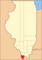
Alexander County between 1819 and 1843.
-
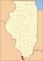
Alexander County reduced to its current borders in 1843 with the creation of Pulaski County.


Geography
According to the U.S. Census Bureau, the county has a total area of 253 square miles (660 km2), of which 236 square miles (610 km2) is land and 17 square miles (44 km2) (6.8%) is water. Its borders are partly defined by the Mississippi River and the Ohio River. The lowest point in the state of Illinois is located on the Mississippi River in Cairo in Alexander County, where it flows out of Illinois and into Kentucky.
Adjacent counties
- Union County - north
- Ballard County, Kentucky - southeast
- Pulaski County - east
- Mississippi County, Missouri - south
- Scott County, Missouri - west
- Cape Girardeau County, Missouri - northwest
National protected areas
- Cypress Creek National Wildlife Refuge (part)
- Shawnee National Forest (part)
Major highways
 Interstate 57
 U.S. Route 51
 U.S. Route 60
 U.S. Route 62
 Illinois Route 3
 Illinois Route 37
 Illinois Route 127
 Illinois Route 146
Climate and weather
| Weather chart for Cairo, Illinois | |||||||||||||||||||||||||||||||||||||||||||||||
|---|---|---|---|---|---|---|---|---|---|---|---|---|---|---|---|---|---|---|---|---|---|---|---|---|---|---|---|---|---|---|---|---|---|---|---|---|---|---|---|---|---|---|---|---|---|---|---|
| J | F | M | A | M | J | J | A | S | O | N | D | ||||||||||||||||||||||||||||||||||||
|
3.2
41
26
|
3.6
48
30
|
4.4
58
39
|
4.7
69
50
|
4.8
78
59
|
4.2
86
67
|
4.4
90
71
|
3.6
87
69
|
3
81
61
|
3.4
71
49
|
4.4
57
39
|
4.2
46
30
|
||||||||||||||||||||||||||||||||||||
| temperatures in °F precipitation totals in inches source: The Weather Channel |
|||||||||||||||||||||||||||||||||||||||||||||||
|
Metric conversion
|
|||||||||||||||||||||||||||||||||||||||||||||||
In recent years, average temperatures in the county seat of Cairo have ranged from a low of 26 °F (−3 °C) in January to a high of 90 °F (32 °C) in July, although a record low of −12 °F (−24 °C) was recorded in January 1985 and a record high of 104 °F (40 °C) was recorded in June 1954. Average monthly precipitation ranged from 3.04 inches (77 mm) in September to 4.76 inches (121 mm) in May.
Demographics
| Historical population | |||
|---|---|---|---|
| Census | Pop. | %± | |
| 1820 | 626 | — | |
| 1830 | 1,390 | 122.0% | |
| 1840 | 3,313 | 138.3% | |
| 1850 | 2,484 | −25.0% | |
| 1860 | 4,707 | 89.5% | |
| 1870 | 10,564 | 124.4% | |
| 1880 | 14,808 | 40.2% | |
| 1890 | 16,563 | 11.9% | |
| 1900 | 19,384 | 17.0% | |
| 1910 | 22,741 | 17.3% | |
| 1920 | 23,980 | 5.4% | |
| 1930 | 22,542 | −6.0% | |
| 1940 | 25,496 | 13.1% | |
| 1950 | 20,316 | −20.3% | |
| 1960 | 16,061 | −20.9% | |
| 1970 | 12,015 | −25.2% | |
| 1980 | 12,264 | 2.1% | |
| 1990 | 10,626 | −13.4% | |
| 2000 | 9,590 | −9.7% | |
| 2010 | 8,238 | −14.1% | |
| 2020 | 5,240 | −36.4% | |
| U.S. Decennial Census 1790-1960 1900-1990 1990-2000 2010-2020 2020 |
|||

As of the 2010 United States Census, there were 8,238 people, 3,329 households, and 2,093 families residing in the county. The population density was 35.0 inhabitants per square mile (13.5/km2). There were 4,006 housing units at an average density of 17.0 per square mile (6.6/km2). The racial makeup of the county was 60.9% white, 35.4% black or African American, 0.3% American Indian, 0.2% Asian, 0.1% Pacific islander, 1.4% from other races, and 1.7% from two or more races. Those of Hispanic or Latino origin made up 1.9% of the population. In terms of ancestry, 13.9% were German, 6.8% were Irish, 5.3% were English, and 4.7% were American.
Of the 3,329 households, 29.6% had children under the age of 18 living with them, 39.6% were married couples living together, 18.5% had a female householder with no husband present, 37.1% were non-families, and 33.6% of all households were made up of individuals. The average household size was 2.31 and the average family size was 2.94. The median age was 41.1 years.
The median income for a household in the county was $28,833 and the median income for a family was $44,699. Males had a median income of $35,880 versus $25,743 for females. The per capita income for the county was $15,858. About 11.8% of families and 20.1% of the population were below the poverty line, including 33.1% of those under age 18 and 14.7% of those age 65 or over.
2020 census
Between 2010 and 2020, the population of Alexander County decreased to 5,240. The 36.4 percent decline was the largest of any of the 3,138 U.S. counties. Although the population of the county had been decreasing for decades, the closure of the Tamms Correctional Center in 2013 probably caused an acceleration of the decline in the 2010s.
| Race | Pop 2010 | Pop 2020 | % 2010 | % 2020 |
|---|---|---|---|---|
| White (NH) | 4,983 | 3,274 | 60.49% | 62.48% |
| Black or African American (NH) | 2,908 | 1,612 | 35.3% | 30.76% |
| Native American or Alaska Native (NH) | 25 | 22 | 0.3% | 0.42% |
| Asian (NH) | 16 | 6 | 0.19% | 0.11% |
| Pacific Islander (NH) | 6 | 0 | 0.07% | 0.0% |
| Some Other Race (NH) | 5 | 8 | 0.06% | 0.15% |
| Mixed/Multi-Racial (NH) | 140 | 236 | 1.7% | 4.5% |
| Hispanic or Latino | 155 | 82 | 1.88% | 1.56% |
| Total | 8,238 | 5,240 |
As of the 2020 United States census, there were 5,240 people, 2,154 households, and 1,357 families residing in the county.
Communities
City
Villages
Census-designated place
Unincorporated communities
Education
- Cairo Unified School District 1
- Century Community Unit School District 100
- Egyptian Community Unit School District 5
- Meridian Community Unit School District 101
- Shawnee Community Unit School District 84
See also
 In Spanish: Condado de Alexander (Illinois) para niños
