
Alexandra, New Zealand facts for kids
Quick facts for kids
Alexandra
Manuherikia or Areketanara (Māori)
|
|
|---|---|
|
Minor urban area
|
|

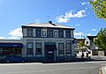
The new post office in 2013
|
|
| Country | New Zealand |
| Region | Otago |
| Territorial authority | Central Otago District |
| Ward | Vincent Ward |
| Area | |
| • Total | 9.76 km2 (3.77 sq mi) |
| Population
(June 2023)
|
|
| • Total | 6,120 |
| • Density | 627.0/km2 (1,624.0/sq mi) |
| Postcode |
9320
|
| Local iwi | Ngāi Tahu |
Alexandra (Māori: Manuherikia or Areketanara) is a town in the Central Otago district of the South Island of New Zealand. It is on the banks of the Clutha River (at the confluence of the Manuherikia River), on State Highway 8, 188 kilometres (117 mi) by road from Dunedin and 33 kilometres (21 mi) south of Cromwell. The nearest towns to Alexandra via state highway 8 are Clyde seven kilometers to the northwest and Roxburgh forty kilometers to the south. State highway 85 also connects Alexandra to Omakau, Lauder, Oturehua, Ranfurly and on to Palmerston on the East Otago coast.
The town of Alexandra is home to 6,120 people as of June 2023.
Contents
History
The town was founded during the Central Otago goldrush in the 1860s, and was named after Alexandra of Denmark by John Aitken Connell who surveyed the town. It was known to miners of the day by several names: the "Lower Township", the "Junction Township", and "Manuherikia". (The "Upper Township" was Dunstan, now Clyde.)
Many orchards were destroyed in the 1980s as a result of construction, 10 km upriver, of the Clyde High Dam, which is the country's third largest hydroelectric power station.
Geography

Alexandra is the service centre for a significant stone-fruit industry, which is celebrated by a blossom festival in the town each spring. Grape production is another major industry in the Central Otago Wine Region. Alexandra has the world's southernmost vineyard, Black Ridge.
The town is a popular holiday destination mainly due to the hot and sunny climate during summer.
Alexandra is perhaps best known for the Alexandra Blossom Festival, an annual event that began in 1957. The Festival celebrates the advent of Spring in the Central Otago District as evidenced by the blooming of the fruit trees.
Alexandra has had two bridges crossing the Clutha River, the current one opening in 1958.
The Alexandra Aerodrome is Alexandra's only airport. SPANZ, NAC and Mount Cook Airlines were main users of the airport till the 1980s. It is home to the Central Otago Flying Club, and gliding. It is reasonably quiet, and commercial passenger flights are no longer scheduled; Queenstown International Airport is the nearest facility for those.
A portion of the Central Otago Rail Trail runs through Alexandra.
Climate
Alexandra experiences a borderline oceanic/semi-arid climate (Köppen climate classification Cfb/BSk), The district is one of the farthest from a coastline in New Zealand and experiences cold winters and warm summers relative to the rest of the country. Temperatures regularly drop below zero in winter and will rise above thirty degrees Celsius in the summer months. In spite of its southerly latitude it is known to be one of the warmest areas in New Zealand during summer. The hottest and coldest temperatures recorded in Alexandra (between 1971 and 2000) are 37.2 °C (99 °F) and −11.2 °C (12 °F) respectively.
| Climate data for Alexandra (1981−2010) | |||||||||||||
|---|---|---|---|---|---|---|---|---|---|---|---|---|---|
| Month | Jan | Feb | Mar | Apr | May | Jun | Jul | Aug | Sep | Oct | Nov | Dec | Year |
| Average high °C (°F) | 25.1 (77.2) |
24.8 (76.6) |
22.3 (72.1) |
18.0 (64.4) |
13.6 (56.5) |
8.8 (47.8) |
8.1 (46.6) |
12.5 (54.5) |
16.4 (61.5) |
19.0 (66.2) |
21.1 (70.0) |
23.3 (73.9) |
17.7 (63.9) |
| Daily mean °C (°F) | 18.0 (64.4) |
17.4 (63.3) |
14.9 (58.8) |
10.9 (51.6) |
7.6 (45.7) |
3.6 (38.5) |
2.9 (37.2) |
6.0 (42.8) |
9.3 (48.7) |
11.7 (53.1) |
14.0 (57.2) |
16.3 (61.3) |
11.0 (51.8) |
| Average low °C (°F) | 10.8 (51.4) |
10.1 (50.2) |
7.3 (45.1) |
3.8 (38.8) |
1.5 (34.7) |
−1.5 (29.3) |
−2.4 (27.7) |
−0.5 (31.1) |
2.2 (36.0) |
4.4 (39.9) |
6.7 (44.1) |
9.3 (48.7) |
4.3 (39.7) |
| Average precipitation mm (inches) | 50.1 (1.97) |
32.8 (1.29) |
29.0 (1.14) |
22.0 (0.87) |
27.4 (1.08) |
31.6 (1.24) |
24.2 (0.95) |
17.6 (0.69) |
20.9 (0.82) |
28.7 (1.13) |
30.6 (1.20) |
44.5 (1.75) |
359.4 (14.15) |
| Average precipitation days (≥ 1.0 mm) | 6.7 | 5.2 | 4.9 | 4.0 | 6.9 | 5.8 | 4.3 | 4.4 | 5.4 | 5.5 | 4.8 | 7.7 | 65.7 |
| Average relative humidity (%) | 70.1 | 77.5 | 80.0 | 84.5 | 86.8 | 89.1 | 89.3 | 85.1 | 74.5 | 72.7 | 67.8 | 69.0 | 78.9 |
| Mean monthly sunshine hours | 231.4 | 199.8 | 193.7 | 158.2 | 121.2 | 87.1 | 90.7 | 135.9 | 164.7 | 193.9 | 214.1 | 215.0 | 2,005.8 |
| Source: NIWA Climate Data | |||||||||||||
Economy
Viticulture
Grape production is another major industry in the Central Otago Wine Region. The first plantings of grapes were in 1864. Pinot Noir and Pinot Gris are some of the varieties that are grown in the vicinity. Alexandra has a number of vineyards that potentially are the world's most southern. There are more than 25 vineyards in the vicinity of Alexandra. These include Three Miners Vineyard, Grasshopper Rock, Como Villa Estate, Rock'n'Pillar, Thyme Hill Vineyard, Leaning Rock Vineyard, Judge Rock, Immigrants Vineyard, Dunstan Road Wines, Alexandra Wine Company, Drumsara Wines, McArthur Ridge Vineyard and Perseverance Estate. A cycling trail called Pedal for Pinot gives visitors the opportunity to cycle around the cellar doors and sample a variety of local wines.
Horticulture
Alexandra is the service centre for a significant stone-fruit industry, which is celebrated by a blossom festival in the town each spring. The first orchards planted provide fruit for the mining community. Now, nectarines, apricots, cherries, peaches, plums and apples are grown and sold for both New Zealand and export markets. Seasonal work picking fruit is available during the summer and many tourists and Pacific Islanders come to New Zealand to work in Alexandra.
Pastoral farming
Sheep farming, particularly of merino sheep has occurred around Alexandra for many years. One of the original sheep runs was Galloway Station. This was established by Watson and Alexander Shennan in 1858.The brothers, from Scotland imported various breeds of sheep. In particular they acquired 15 merino rams and 27 merino ewes in 1861 from the King of Prussia's Potsdam Stud, which cost the massive sum at that time of £2000. The Galloway Station was sub-divided in 1916.
Airport
The Alexandra Aerodrome is Alexandra's only airport. SPANZ, NAC and Mount Cook Airlines were main users of the airport till the 1980s. It is home to the Central Otago Flying Club, and gliding. Commercial passenger flights are no longer scheduled; Queenstown International Airport is the nearest facility for those.
Demography

Alexandra's population was 1414 residents in 1951 and this had increased to 1823 residents in 1956 and then to 2292 residents in 1961.
Alexandra is described by Statistics New Zealand as a small urban area, and covers 9.76 km2 (3.77 sq mi). It had an estimated population of 6,120 as of June 2023, with a population density of 627 people per km2. It is the seventh-largest urban area in Otago, and the second-largest urban area in the Central Otago District behind Cromwell.
| Historical population | ||
|---|---|---|
| Year | Pop. | ±% p.a. |
| 2006 | 4,827 | — |
| 2013 | 4,803 | −0.07% |
| 2018 | 5,472 | +2.64% |
Alexandra had a population of 5,472 at the 2018 New Zealand census, an increase of 669 people (13.9%) since the 2013 census, and an increase of 645 people (13.4%) since the 2006 census. There were 2,331 households. There were 2,661 males and 2,811 females, giving a sex ratio of 0.95 males per female, with 909 people (16.6%) aged under 15 years, 729 (13.3%) aged 15 to 29, 2,247 (41.1%) aged 30 to 64, and 1,590 (29.1%) aged 65 or older.
Ethnicities were 93.1% European/Pākehā, 9.8% Māori, 1.5% Pacific peoples, 2.5% Asian, and 1.4% other ethnicities (totals add to more than 100% since people could identify with multiple ethnicities).
The proportion of people born overseas was 12.3%, compared with 27.1% nationally.
Although some people objected to giving their religion, 51.8% had no religion, 38.4% were Christian, 0.4% were Hindu, 0.2% were Muslim, 0.2% were Buddhist and 1.8% had other religions.
Of those at least 15 years old, 624 (13.7%) people had a bachelor or higher degree, and 1,083 (23.7%) people had no formal qualifications. 573 people (12.6%) earned over $70,000 compared to 17.2% nationally. The employment status of those at least 15 was that 2,076 (45.5%) people were employed full-time, 810 (17.8%) were part-time, and 81 (1.8%) were unemployed.
| Name | Area (km2) | Population | Density (per km2) | Households | Median age | Median income |
|---|---|---|---|---|---|---|
| Alexandra North | 4.60 | 2,856 | 621 | 1,173 | 45.8 years | $29,500 |
| Alexandra South | 5.16 | 2,616 | 507 | 1,158 | 52.7 years | $30,500 |
| New Zealand | 37.4 years | $31,800 |
Education
Primary schools
The Terrace School is a co-educational state primary school for Year 1 to 8 students, with a roll of 294 as of April 2023. It opened in 1965.
Alexandra School is a co-educational state primary school for Year 1 to 8 students, with a roll of 190. It opened in 1865, and became a district high school in 1912. After the opening of Dunstan High and The Terrace School, Alexandra School resumed its function solely as a primary school.
St Gerard's School is a co-educational state-integrated Catholic primary school for Year 1 to 8 students, with a roll of 129. The school first opened in 1912.
Secondary schools
Dunstan High School is a co-educational state secondary school for Year 9 to 13 students, with a roll of 568 as of April 2023. It opened in 1962.
Notable buildings
Shaky bridge
The Shaky bridge crosses the Manuherikia river and links Kerry Street and Graveyard Gully Road. It was completed in 1879. Leslie Duncan MacGeorge (1854–1939) designed the 60 metre long bridge. It was the only bridge crossing the Manuherikia river for twenty years. In 1906 a road and rail bridge was completed making the shaky bridge obsolete. It did not receive the required upkeep and earned its nickname of the "shaky bridge". The small suspension bridge with its stone towers was saved by the Pioneer Bridge Committee. The Committee raised funds to restore the bridge. Today it is promoted as a tourist attraction and is only open to pedestrians.
Simmond's boarding house
Simmond's boarding house was built in 1882 and provided accommodation for over ninety years until it was converted into an office building in the 1970s. It was built by James SImmonds who also served as mayor of Alexandra.

Bendigo hotel
The Bendigo Hotel was situated on the corner of Tabert & Rivers streets. The original Bendigo Hotel, was a wooden, single storied structure built in the 1860s. This original building was demolished in 1900. This was required by the Tuapeka Licensing Commission who stated that the building should be replaced, or the license revoked. The Bendigo Hotel was then rebuilt in 1900. The new hotel was a two storied brick structure. It contained 30 bedrooms and was of the standard of a first class city hotel at the time. Numerous alternations occurred to the building over the next 100 years. The Bendigo was flooded in December 1995 and again in November 1999. This led to the hotel being demolished and the construction of a floodbank in 2001 to protect Alexandra from flooding.
Alexandra courthouse

The old courthouse located in Alexandra's Centennial Avenue was opened on 16 June 1879, it housed both the Warden's and Magistrate's Courts. it was built of stone. As mining was the main industry at the time the Warden's Court was kept busy dealing with issues relating to mining. These included registration of claims and dealing with matters such as water races, business, licenses, roads, forgeries and other similar issues relating to mining. The Magistrate's Court dealt with general legal matters. It was used as a courthouse until 1972. It is a Category 2 Historic Building. In 2006 the chimneys were renovated and it was repainted. It now operates as a cafe.
Vallance cottage
Vallance Cottage is a mud brick house built in 1896. It was home to a family of eleven at one stage. It is a category 2 listed building with Heritage New Zealand. In the 1970s, Vallance Cottage still had no running water inside and only cold running water in the separate wash-house.
Images for kids
-
Alexandra Bank of New Zealand
-
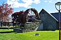
Waterwheel at the Central Otago Art Gallery and Museum


