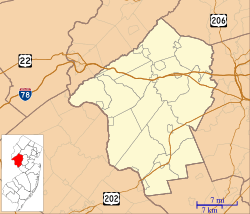
Alexandria Township, New Jersey facts for kids
Quick facts for kids
Alexandria Township, New Jersey
|
|
|---|---|
|
Township
|
|
| Township of Alexandria | |
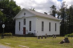
Alexandria Township Historical Museum
|
|
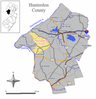
Map of Alexandria Township in Hunterdon County. Inset: Location of Hunterdon County in the State of New Jersey.
|
|
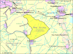
Census Bureau map of Alexandria Township, New Jersey
|
|
| Country | |
| State | |
| County | |
| Royal charter | March 5, 1765 |
| Incorporated | February 21, 1798 |
| Named for | James Alexander |
| Government | |
| • Type | Township |
| • Body | Township Committee |
| Area | |
| • Total | 27.75 sq mi (71.87 km2) |
| • Land | 27.53 sq mi (71.31 km2) |
| • Water | 0.22 sq mi (0.56 km2) 0.79% |
| Area rank | 98th of 565 in state 9th of 26 in county |
| Elevation | 404 ft (123 m) |
| Population | |
| • Total | 4,938 |
| • Estimate
(2019)
|
4,754 |
| • Rank | 380th of 566 in state 8th of 26 in county |
| • Density | 180.1/sq mi (69.5/km2) |
| • Density rank | 515th of 566 in state 21st of 26 in county |
| Time zone | UTC−05:00 (Eastern (EST)) |
| • Summer (DST) | UTC−04:00 (Eastern (EDT)) |
| ZIP Code | |
| Area code(s) | 908 |
| FIPS code | 3401900550 |
| GNIS feature ID | 0882186 |
Alexandria Township is a township in Hunterdon County, New Jersey, United States. As of the 2010 United States Census, the township's population was 4,938, reflecting an increase of 240 (+5.1%) from the 4,698 counted in the 2000 Census, which had in turn increased by 1,104 (+30.7%) from the 3,594 counted in the 1990 Census.
Alexandria was formed by Royal charter on March 5, 1765, from portions of Bethlehem Township, and was incorporated as one of New Jersey's initial 104 townships by an act of the New Jersey Legislature on February 21, 1798. Portions of the township were taken to form Frenchtown (April 4, 1867), Holland Township (April 13, 1874, restored to Alexandria on March 4, 1878, and recreated on March 11, 1879) and Milford (April 15, 1911). The township was named for James Alexander, a surveyor who served as New Jersey Attorney General and who had acquired 10,000 acres (4,000 ha) of land in the area in 1744.
Contents
Geography
According to the United States Census Bureau, the township had a total area of 27.640 square miles (71.587 km2), including 27.423 square miles (71.025 km2) of land and 0.217 square miles (0.562 km2) of water (0.79%).
Unincorporated communities, localities and place names located partially or completely within the township include Everittstown, Little York, Mechlings Corner, Mount Pleasant, Mount Salem, Palmyra and Swinesburg. Pittstown is an unincorporated community that is also spread across Franklin Township and Union Township.
The township borders the municipalities of Bethlehem Township, Franklin Township, Frenchtown, Holland Township, Kingwood Township, Milford and Union Township in Hunterdon County; and both Bridgeton Township and Tinicum Township in Bucks County across the Delaware River border with the Commonwealth of Pennsylvania.
Demographics
| Historical population | |||
|---|---|---|---|
| Census | Pop. | %± | |
| 1790 | 1,503 | — | |
| 1810 | 2,271 | — | |
| 1820 | 2,619 | 15.3% | |
| 1830 | 3,042 | 16.2% | |
| 1840 | 3,420 | 12.4% | |
| 1850 | 3,811 | 11.4% | |
| 1860 | 4,088 | 7.3% | |
| 1870 | 3,341 | −18.3% | |
| 1880 | 1,324 | −60.4% | |
| 1890 | 1,250 | −5.6% | |
| 1900 | 1,045 | −16.4% | |
| 1910 | 1,045 | 0.0% | |
| 1920 | 938 | −10.2% | |
| 1930 | 1,094 | 16.6% | |
| 1940 | 1,186 | 8.4% | |
| 1950 | 1,369 | 15.4% | |
| 1960 | 1,629 | 19.0% | |
| 1970 | 2,127 | 30.6% | |
| 1980 | 2,798 | 31.5% | |
| 1990 | 3,594 | 28.4% | |
| 2000 | 4,698 | 30.7% | |
| 2010 | 4,938 | 5.1% | |
| 2019 (est.) | 4,754 | −3.7% | |
| Population sources: 1790-1920 1840 1850-1870 1850 1870 1880-1890 1890-1910 1910-1930 1930-1990 2000 2010 * = Lost territory in previous decade. |
|||
Census 2010
As of the census of 2010, there were 4,938 people, 1,758 households, and 1,384 families residing in the township. The population density was 180.1 per square mile (69.5/km2). There were 1,865 housing units at an average density of 68.0 per square mile (26.3/km2)*. The racial makeup of the township was 94.80% (4,681) White, 2.00% (99) Black or African American, 0.04% (2) Native American, 1.82% (90) Asian, 0.02% (1) Pacific Islander, 0.63% (31) from other races, and 0.69% (34) from two or more races. [[Hispanic (U.S. Census)|Hispanic or Latino of any race were 3.22% (159) of the population.
There were 1,758 households out of which 35.7% had children under the age of 18 living with them, 71.4% were married couples living together, 5.3% had a female householder with no husband present, and 21.3% were non-families. 16.7% of all households were made up of individuals, and 7.5% had someone living alone who was 65 years of age or older. The average household size was 2.78 and the average family size was 3.16.
In the township, the population was spread out with 25.5% under the age of 18, 6.5% from 18 to 24, 16.8% from 25 to 44, 38.5% from 45 to 64, and 12.6% who were 65 years of age or older. The median age was 45.5 years. For every 100 females there were 99.7 males. For every 100 females ages 18 and old there were 95.9 males.
The Census Bureau's 2006-2010 American Community Survey showed that (in 2010 inflation-adjusted dollars) median household income was $117,404 (with a margin of error of +/- $11,426) and the median family income was $137,821 (+/- $24,473). Males had a median income of $101,927 (+/- $22,844) versus $60,875 (+/- $7,233) for females. The per capita income for the borough was $47,777 (+/- $5,059). About 3.0% of families and 3.3% of the population were below the poverty line, including 2.9% of those under age 18 and 3.1% of those age 65 or over.
Census 2000
As of the 2000 United States Census there were 4,698 people, 1,535 households, and 1,290 families residing in the township. The population density was 170.6 people per square mile (65.9/km2). There were 1,598 housing units at an average density of 58.0 per square mile (22.4/km2). The racial makeup of the township was 97.02% White, 0.79% African American, 0.11% Native American, 0.72% Asian, 0.04% Pacific Islander, 0.45% from other races, and 0.87% from two or more races. Hispanic or Latino of any race were 1.72% of the population.
There were 1,535 households, out of which 42.9% had children under the age of 18 living with them, 77.9% were married couples living together, 4.4% had a female householder with no husband present, and 15.9% were non-families. 13.5% of all households were made up of individuals, and 5.2% had someone living alone who was 65 years of age or older. The average household size was 2.95 and the average family size was 3.25.
In the township the population was spread out, with 28.1% under the age of 18, 4.9% from 18 to 24, 27.1% from 25 to 44, 27.8% from 45 to 64, and 12.1% who were 65 years of age or older. The median age was 40 years. For every 100 females, there were 100.3 males. For every 100 females age 18 and over, there were 95.0 males.
The median income for a household in the township was $92,730, and the median income for a family was $93,619. Males had a median income of $70,996 versus $39,904 for females. The per capita income for the township was $34,622. About 4.3% of families and 5.0% of the population were below the poverty line, including 7.7% of those under age 18 and 2.7% of those age 65 or over.
Transportation
Alexandria Field Airport is a privately owned public-use general aviation airport located in the geographic center of the township.
As of May 2010[update], the township had a total of 71.43 miles (114.96 km) of roadways, of which 48.77 miles (78.49 km) were maintained by the municipality and 22.66 miles (36.47 km) by Hunterdon County.
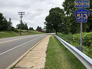
No Interstate, U.S. or State routes pass through. The most significant roads to pass through Alexandria are CR 513, CR 519 and CR 579 (which only runs along the northeast border).
Interstate 78 is the closest limited access road which is accessible outside the municipality in bordering Union and Franklin Townships.
Surrounding communities
 |
Bethlehem Township | Union Township |  |
|
| Holland Township | Franklin Township | |||
| Milford Tinicum Township, PA |
Frenchtown | Kingwood Township |
- Alexandria Township School District's 2014–15 School Report Card from the New Jersey Department of Education
Education
The Alexandria Township School District serves students in pre-kindergarten through eighth grade. As of the 2017–18 school year, the district, comprised of two schools, had an enrollment of 493 students and 52.5 classroom teachers (on an FTE basis), for a student–teacher ratio of 9.4:1. The two schools in the district (with 2017-18 enrollment data from the National Center for Education Statistics) are Lester D. Wilson School with 207 students in pre-kindergarten through third grade and Alexandria Middle School with 285 students in grades four through eight.
Students in public school for ninth through twelfth grades attend Delaware Valley Regional High School, together with students from Frenchtown, Holland Township, Kingwood Township and Milford. The school is part of the Delaware Valley Regional High School District. As of the 2017–18 school year, the high school had an enrollment of 728 students and 68.8 classroom teachers (on an FTE basis), for a student–teacher ratio of 10.6:1. Seats on the high school district's nine-member board of education are allocated based on the populationof the constituent municipalities, with two seats assigned to Alexandria Township.
The Alexandria Township Education Foundation, is a non-profit organization established in 1997, whose mission is to help achieve and maintain an extra margin of excellence by employing private resources to supplement traditional school district funding.
Eighth grade students from all of Hunterdon County are eligible to apply to attend the high school programs offered by the Hunterdon County Vocational School District, a county-wide vocational school district that offers career and technical education at its campuses in Raritan Township and at programs sited at local high schools, with no tuition charged to students for attendance.
Notable people
People who were born in, residents of, or otherwise closely associated with Alexandria Township include:
- Carla Katz (born 1959), union leader.
- Frank Muehlheuser (1926–2006), American football fullback and linebacker who played in the NFL for the Boston Yanks and the New York Bulldogs.
- Jayson Williams (born 1968), former NBA player with the New Jersey Nets and Philadelphia 76ers, who owned an estate that featured a private basketball court, a personalized movie theatre and many other features.
See also
 In Spanish: Municipio de Alexandria (Nueva Jersey) para niños


