
Alger County, Michigan facts for kids
Quick facts for kids
Alger County
|
||
|---|---|---|

Alger County Courthouse Complex, Munising (2009)
|
||
|
||

Location within the U.S. state of Michigan
|
||
 Michigan's location within the U.S. |
||
| Country | ||
| State | ||
| Founded | March 17, 1885 | |
| Named for | Russell A. Alger | |
| Seat | Munising | |
| Largest city | Munising | |
| Area | ||
| • Total | 5,048 sq mi (13,070 km2) | |
| • Land | 915 sq mi (2,370 km2) | |
| • Water | 4,133 sq mi (10,700 km2) 82%% | |
| Population
(2020)
|
||
| • Total | 8,842 | |
| • Density | 10/sq mi (4/km2) | |
| Time zone | UTC−5 (Eastern) | |
| • Summer (DST) | UTC−4 (EDT) | |
| Congressional district | 1st | |
| Website | https://www.algercounty.gov/ | |

Alger County is a county in the Upper Peninsula of the U.S. state of Michigan. As of the 2020 Census, the population was 8,842. Its county seat is Munising. The Pictured Rocks National Lakeshore is located within the county.
Contents
History
Alger County was detached from Schoolcraft County, set off and organized in 1885. The county was named for lumber baron Russell Alexander Alger, who was elected as a Michigan Governor, and U.S. Senator, and appointed as U.S. Secretary of War during the William McKinley Presidential administration. See also, List of Michigan county name etymologies, List of Michigan counties, and List of abolished U.S. counties.
Geography

According to the U.S. Census Bureau, the county has a total area of 5,048 square miles (13,070 km2), of which 915 square miles (2,370 km2) is land and 4,133 square miles (10,700 km2) (82%) is water. It is the second-largest county in Michigan by total area, mainly because of Lake Superior on the north side of the county.
Highways
 US 41
US 41 M-28
M-28 M-67
M-67 M-77
M-77 M-94
M-94 H-01
H-01 H-03
H-03 H-05
H-05 H-11
H-11 H-13
H-13 H-15
H-15 H-44
H-44 H-52
H-52 H-58, passes through Pictured Rocks National Lakeshore.
 FFH 13
Adjacent counties
- Luce County (east)
- Schoolcraft County (southeast)
- Delta County (south)
- Marquette County (west)
- Thunder Bay District, Ontario (north)
National protected areas

- Grand Island National Recreation Area
- Hiawatha National Forest (part)
- Pictured Rocks National Lakeshore
Demographics
| Historical population | |||
|---|---|---|---|
| Census | Pop. | %± | |
| 1890 | 1,238 | — | |
| 1900 | 5,868 | 374.0% | |
| 1910 | 7,675 | 30.8% | |
| 1920 | 9,983 | 30.1% | |
| 1930 | 9,327 | −6.6% | |
| 1940 | 10,167 | 9.0% | |
| 1950 | 10,007 | −1.6% | |
| 1960 | 9,250 | −7.6% | |
| 1970 | 8,568 | −7.4% | |
| 1980 | 9,225 | 7.7% | |
| 1990 | 8,972 | −2.7% | |
| 2000 | 9,862 | 9.9% | |
| 2010 | 9,601 | −2.6% | |
| 2020 | 8,842 | −7.9% | |
| US Decennial Census 1790-1960 1900-1990 1990-2000 2010-2018 |
|||
The 2010 United States Census indicates Alger County had a population of 9,601. This decrease of 261 people from the 2000 United States Census represents a 2.6% population decrease. In 2010 there were 3,898 households and 2,479 families residing in the county. The population density was 11 inhabitants per square mile (4.2/km2). There were 6,554 housing units at an average density of 7 per square mile (3/km2). The racial makeup of the county was 86.3% White, 6.4% Black or African American, 4.1% Native American, 0.3% Asian, 0.1% of some other race and 2.7% of two or more races. 1.2% were Hispanic or Latino (of any race).
Regarding specific ethnicities, 15.7% of the population was of German heritage, 13.5% Finnish, 12.6% French, French Canadian or Cajun, 9.3% English, 7.3% Polish, 6.9% Irish and 5.3% American ancestry.
There were 3,898 households, out of which 20.1% had children under the age of 18 living with them, 52.2% were married couples living together, 7.1% had a female householder with no husband present, and 36.4% were non-families. 31.6% of all households were made up of individuals, and 15.2% had someone living alone who was 65 years of age or older. The average household size was 2.2 and the average family size was 2.74.
In the county, the population was spread out, with 17.1% under the age of 18, 6.6% from 18 to 24, 22.8% from 25 to 44, 32.8% from 45 to 64, and 20.7% who were 65 years of age or older. The median age was 47.3 years. The population was 54.4% male and 45.6% female.
The median income for a household in the county was $38,231, and the median income for a family was $46,154. The per capita income for the county was $19,858. About 9.3% of people in families and 14.0% of the population were below the poverty line, including 19.3% of those under age 18 and 8.2% of those age 65 or over.
Communities
City
- Munising (county seat)
Village
Unincorporated communities
- Au Train
- Christmas
- Coalwood
- Deerton
- Diffin
- Dixon
- Dorsey
- Doty
- Eben Junction
- Evelyn
- Forest Lake
- Grand Marais
- Green Haven
- Indian Town
- Juniper
- Kentucky
- Kiva
- Ladoga
- Limestone
- Mantila Camp
- Melstrand
- Munising Junction
- Myren
- Onota
- Rock River
- Rumely
- Sand River
- Shingleton
- Slapneck
- Star
- Stillman
- Sullivans Landing
- Sundell
- Sunrise Landing
- Traunik
- Trenary
- Vail
- Van Meer
- Wetmore
- Williams Crossing
- Williams Landing
Townships
Images for kids
-
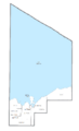
U.S. Census data map showing local municipal boundaries within Alger County. Shaded areas represent incorporated cities.

See also
 In Spanish: Condado de Alger para niños
