Amesbury facts for kids
Quick facts for kids Amesbury |
|
|---|---|
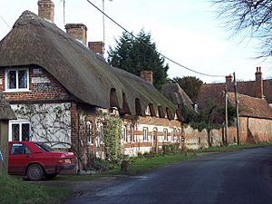 Cottages in Amesbury |
|
| Population | 10,724 (in 2011) |
| OS grid reference | SU1642 |
| Civil parish |
|
| Unitary authority |
|
| Ceremonial county | |
| Region | |
| Country | England |
| Sovereign state | United Kingdom |
| Post town | SALISBURY |
| Postcode district | SP4 |
| Dialling code | 01980 |
| Police | Wiltshire |
| Fire | Wiltshire |
| Ambulance | Great Western |
| EU Parliament | South West England |
| UK Parliament |
|
| Website | Town Council |
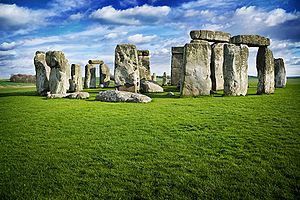
Amesbury is a town and civil parish in Wiltshire, England. It is known for the prehistoric monument of Stonehenge which is within the parish. The town is claimed to be the oldest occupied settlement in Great Britain, having been first settled around 8820 BC. The parish includes the hamlets of Ratfyn and West Amesbury, and part of Boscombe Down military airfield.
Contents
Geography
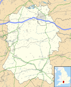
Amesbury is located in southern Wiltshire, 7 miles (11 km) north of Salisbury on the A345. It sits in the River Avon valley on the southern fringes of Salisbury Plain and has historically been considered an important river crossing area on the road from London to Warminster and Exeter. This has continued into the present with the building of the A303 across the Avon next to the town. Originally the town developed around the water meadows next to several bends in the river, but in time has spread onto the valley hillsides and absorbed part of the military airfield at Boscombe Down.
The nearest railway station is located at nearby Grateley, on the London to Salisbury line.
History
Ancient and medieval history
The land around Amesbury has been settled since prehistoric times, evidenced by the monument of Stonehenge. Other finds in the parish point to large scale prehistoric structures and settlements in the whole area, including Bluestonehenge at West Amesbury, the numerous other monuments around Stonehenge, the discovery of a Neolithic village in the neighbouring parish of Durrington by the Stonehenge Riverside Project, and continuing excavations at Boscombe Down where Wessex Archaeology found the Amesbury Archer and Boscombe Bowmen. They are now on display at Salisbury and South Wiltshire Museum. Amesbury is recognized as the oldest continuously occupied UK settlement.
During the Iron Age a large hill fort now known as Vespasian's Camp was built alongside the Avenue and overlooking the River Avon. The fort could easily have catered for up to 1000 people, and was probably surrounded by smaller settlements and farming communities.
Roman remains are poorly documented at Amesbury, but excavations have revealed Roman structures in the Stonehenge landscape, and Wessex Archaeology have discovered a large Roman graveyard in the area of the Amesbury Archer burial. It is likely that there was a large Romano-British settlement overlooking the River Avon at this point.
It has been suggested that the name of Amesbury is derived from Ambrosius Aurelianus, leader of Romano-British resistance to Saxon invasions in the 5th century. If this is the case he is likely to have used the hill fort as a stronghold. It is possible that an order of monks established a monastery in the area that was destroyed by the Saxons before they settled the area in the 7th century. Amesbury is also associated with the Arthurian legend: the convent to which Guinevere retired was said to have been the one at Amesbury.
In 979 AD a Benedictine abbey, the Abbey of St Mary and St Melor, was founded on what may have been the site of a previous monastery by Dowager Queen Ælfthryth. In 1177 the abbey was dissolved by Henry II and replaced with a double priory of the Fontevrault order. Eleanor of Provence was buried in the abbey on 11 September 1291. At some point in time it seems likely that the church became the parish church, and it is possible that this is why it was spared destruction in 1540 when, as part of the reformation, the priory and all other associated buildings were destroyed. Amesbury became an estate and was given to Edward Seymour, 1st Earl of Hertford by the crown.
On John Speed's map of Wiltshire (1611), the town's name is spelt both Amesbury (for the hundred) and Ambersbury (for the town itself).
Modern history
The Seymour family held Amesbury estate until 1675 and had several grand homes built, including Kent and Diana houses, and a new mansion in 1660. The estate subsequently passed to the Bruce family, and then to Lord Carleton, who bequeathed it to his nephew Charles Douglas, 3rd Duke of Queensberry. It remained in the Queensberry family until 1824. It is believed that at some point in the early 19th century, William Douglas, 4th Duke of Queensberry planted the Nile Clumps to commemorate Admiral Nelson and had the hill fort landscaped as part of the grounds around the mansion. In 1824 the Antrobus family acquired the estate and it remained in their hands until 1915 when, after the last heir was killed in France, Lord Antrobus sold the grounds–-including Stonehenge-–to private bidders. The mansion remained in their hands until 1979.
In 1677, John Rose, gentleman, founded two schools at Amesbury, a grammar school for teaching grammar, writing, and ciphering to twenty children born in the parish, and an "English school" to prepare twenty children of poor parents for the grammar school. By a decree in Chancery of 1831, the freedom of the grammar school was extended to children of "mechanics, artisans, and small tradesmen". The grammar school was closed in 1899, and the children were transferred to a National School.
Recent history
With the establishment of the military Aeroplane and Armament Experimental Establishment at Boscombe Down in 1939, Amesbury began to expand. As it sits on the A303 commuter belt, Amesbury has seen substantial developments on the land between the old town centre and Boscombe Down. Several new housing estates have been completed, and the most recent one – Archers Gate – has taken its name from the discovery of the Amesbury Archer. At the Boscombe Down junction of the A303 a new mixed business development known as Solstice Park has been built and plans have been submitted for a Regional Distribution Centre for a major retailer.
Population
At the 2011 Census the population of the civil parish was 10,724. For the Amesbury Community Area the mid-2011 population was estimated to be 33,660 (this is a wide area stretching to Tilshead, Larkhill and Figheldean in the north; Cholderton in the east; the Winterbournes, the Woodfords and Great Wishford in the south; and Wylye in the west).
Religious sites
The Church of England parish church of St Mary and St Melor is Grade I listed. It dates from the 12th century but was restored by William Butterfield in 1852-3.
Amesbury Methodist Church was built in 1900, replacing an 1816 chapel. Christ the King Catholic church opened in 1985, replacing a 1933 building on a different site. Amesbury Baptist Church was built in 1997.
Notable buildings
The mansion known as Amesbury Abbey, standing in parkland close to the site of the former abbey, is Grade I listed. It was built in 1834–1840 by architect Thomas Hopper for Sir Edmund Antrobus, and replaced a similar house built in 1661 by John Webb for the 2nd Duke of Somerset. Features in the grounds include an ornamental bridge rebuilt in 1755. The house is now operated as a nursing home. Diana's House and Kent House are flint and stone gatehouses to the property from the early 17th century; both are Grade II* listed and are irregular in plan with a high stair-tower, leading Pevsner to call them "curious".
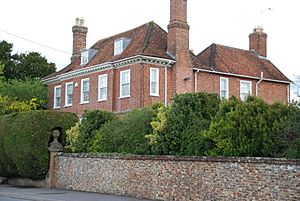
The Red House on Salisbury Road is a five-bay former farmhouse, rebuilt in red brick c.1700 and described by Pevsner as "the best older house ... with a pretty early-19th-century cast-iron porch". This is the former home of Francis Stephen Long, Esquire, whose wife, Ann, remained at the Red House until her death in 1856. Nearby on Salisbury Road, Antrobus House was built in 1924–5 under a bequest of Lady Florence Antrobus (1856–1923) as a memorial to her son Edmund, who died at war in Belgium in 1914. Although intended as a village hall, Historic England state it is "built to a high standard". In handmade brick, the tall five-bay central block contains the hall and has substantial wings on both sides. The low roadside wall in flint and stone has an overall length of 43m and a central iron gate set back from the road; the tall brick gate piers have stone vases.
West Amesbury House is from the 15th century and is Grade I listed; in flint and stone chequer, it was remodelled in the early 20th century by Detmar Blow.
Sport and leisure
Amesbury has a Non-League football club, Amesbury Town F.C., which plays at Bonnymead Park.
In popular culture
Although Stonehenge falls within the parish of Amesbury, the town does not directly benefit from the monument's fame. However, Amesbury has appeared in the public eye on its own merits in the past.
In 2002, the discovery of the richest Bronze Age burial site yet found in Britain was made at Amesbury. The remains of two men of apparently aristocratic rank were accompanied by over 100 objects including arrowheads, copper knives and the earliest worked gold in the country. The occupant of the more richly furnished grave has become known as the "Amesbury Archer".
The town is linked to the Arthurian legend as it is popularly believed that Guinevere retired to the original convent at Amesbury after leaving Arthur. Legend holds that she is buried in the grounds of the former Abbey.
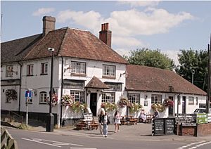
From 3–5 May 1965, The Beatles stayed at The Antrobus Hotel during the filming of Help! on Salisbury Plain. The Antrobus Hotel and the former Plaza Cinema were both used as locations for the filming of a BBC Miss Marple mystery.
Education
Amesbury has a secondary school – The Stonehenge School – and four primary schools:
- Amesbury Archer Primary School
- Amesbury Church of England Voluntary Controlled Primary School
- Christ The King Catholic Primary School
- King's Gate Primary School
Transport
Amesbury is 6 miles (10 km) from the nearest station at Grateley on the London to Salisbury line. The town's own station, Amesbury railway station, was closed in 1963 along with the rest of the Bulford Camp Railway.
Amesbury Bus Station closed in January 2014 along with the bus station in nearby Salisbury as a cost-cutting measure, but Salisbury Reds services still stop in the town. Stagecoach and Salisbury Reds jointly operate a frequent Salisbury-Amesbury-Tidworth-Andover service, and National Express provide a service to London. Salisbury Reds also operate the X4 Salisbury-Amesbury-Larkhill and the X5 Salisbury-Amesbury-Swindon.
See also
 In Spanish: Amesbury para niños


