
Anderson County, Texas facts for kids
Quick facts for kids
Anderson County
|
|
|---|---|

The Anderson County Courthouse in Palestine
|
|

Location within the U.S. state of Texas
|
|
 Texas's location within the U.S. |
|
| Country | |
| State | |
| Founded | March 24, 1846 |
| Named for | Kenneth L. Anderson |
| Seat | Palestine |
| Largest city | Palestine |
| Area | |
| • Total | 1,078 sq mi (2,790 km2) |
| • Land | 1,063 sq mi (2,750 km2) |
| • Water | 15 sq mi (40 km2) 1.4% |
| Population
(2020)
|
|
| • Total | 57,922 |
| • Density | 53.731/sq mi (20.746/km2) |
| Time zone | UTC−6 (Central) |
| • Summer (DST) | UTC−5 (CDT) |
| Congressional district | 5th |
Anderson County is a county in the U.S. state of Texas. Located within East Texas, its county seat is Palestine. As of the 2020 United States census, the population of Anderson County was 57,922. Anderson County comprises the Palestine micropolitan statistical area. Anderson County was organized in 1846, and was named for Kenneth Lewis Anderson (1805-1845), the last vice president of the Republic of Texas.
Contents
History
Native Americans
Indians friendly to the settlers resided in east Texas before the Kiowa, Kickapoo, Kichai, Apache and Comanche intruded upon their territory. These tribes hunted, farmed the land, and were adept traders. By 1772 they had settled on the Brazos at Waco and on the Trinity upstream from the site of present Palestine. The Tawakoni branch of Wichita Indians originated north of Texas, but migrated south into east Texas. From 1843 onward, the Tawakoni were part of treaties made by both the Republic of Texas and the United States.
On May 19, 1836 an alliance of Comanche, Kiowa, Caddo and Wichita attacked Fort Parker, killing or kidnapping all but about 18 settlers who managed to escape to Fort Houston, which had been erected in Anderson County in 1835 as protection against Indians. Among the captured was Cynthia Ann Parker, who later became mother of Comanche Chief Quanah Parker. Some residents of Anderson County are related to Cynthia Ann Parker.
In October 1838, Gen. Thomas Jefferson Rusk conducted a raid against hostile Indians at Kickapoo, near Frankston, ending the engagements with the Indians in eastern Texas for that year.
Settlers
In 1826, empresario David G. Burnet received a grant from the Coahuila y Tejas legislature to settle 300 families in what is now Anderson County. Most of the settlers in the county came from the southern states and from Missouri.
Baptist spiritual leader Daniel Parker and eight other men organized the Pilgrim Predestinarian Regular Baptist Church in Lamotte, Illinois. The fellowship in its entirety migrated in 1833 to the new frontier of Texas. Among this group of settlers were Silas M. Parker, Moses Herrin, Elisha Anglin, Luther T. M. Plummer, David Faulkenberry, Joshua Hadley, and Samuel Frost. Fort Parker was the earliest actual settlement in the vicinity. After the fort was attacked, some of the survivors moved to Anderson County.
County established
The First Legislature of the state of Texas formed Anderson County from Houston County on March 24, 1846. The county was named after Kenneth Lewis Anderson. Palestine was named county seat.
Anderson County voted in favor of secession from the Union. When the Civil War broke out, former Palestine district judge Judge John H. Reagan served in the cabinet of the Confederate government as postmaster general, being captured at the end of the war and spending twenty-two months in solitary confinement. During Reconstruction, District Nine Court Judge Reuben A. Reeves, a resident of Palestine, was removed from office as "an obstruction to Reconstruction" in part because of his refusal to allow blacks to participate as jurors in the judicial process.
In 1875, the International – Great Northern Railroad placed its machine and repair shops and general offices in Palestine, causing the community to double in size over the next five years.
In January 1928 the first successful oil producer in Anderson County, known as the Humble-Lizzie Smith No. 1, was brought in. By the year 2000 - 295,904,540 barrels (47,045,062 m3) of oil had been taken from county lands since 1929.
The Gus Engeling Wildlife Management Area was purchased by the state between 1950 and 1960, much of it. Milze L. Derden. The area was renamed in 1952 after Gus A. Engeling, the first biologist assigned to the area, was shot and killed by a poacher on December 13, 1951.
Geography
According to the U.S. Census Bureau, the county has a total area of 1,078 square miles (2,790 km2), of which 1,063 square miles (2,750 km2) is land and 15 square miles (39 km2) (1.4%) is water.
Major highways
 U.S. Highway 79
 U.S. Highway 84
 U.S. Highway 175
 U.S. Highway 287
 State Highway 19
 State Highway 155
 State Highway 294
Adjacent counties
- Henderson County (north)
- Cherokee County (east)
- Houston County (south)
- Leon County (southwest)
- Freestone County (west)
National protected area
- Neches River National Wildlife Refuge (part)
Demographics
| Historical population | |||
|---|---|---|---|
| Census | Pop. | %± | |
| 1850 | 2,684 | — | |
| 1860 | 10,398 | 287.4% | |
| 1870 | 9,229 | −11.2% | |
| 1880 | 17,395 | 88.5% | |
| 1890 | 20,923 | 20.3% | |
| 1900 | 28,015 | 33.9% | |
| 1910 | 29,650 | 5.8% | |
| 1920 | 34,318 | 15.7% | |
| 1930 | 34,643 | 0.9% | |
| 1940 | 37,092 | 7.1% | |
| 1950 | 31,875 | −14.1% | |
| 1960 | 28,162 | −11.6% | |
| 1970 | 27,789 | −1.3% | |
| 1980 | 38,381 | 38.1% | |
| 1990 | 48,024 | 25.1% | |
| 2000 | 55,109 | 14.8% | |
| 2010 | 58,458 | 6.1% | |
| 2020 | 57,922 | −0.9% | |
| U.S. Decennial Census 1850–2010 2010-2020 |
|||
| Race and ethnicity | Pop 2010 | Pop 2020 | % 2010 | % 2020 |
|---|---|---|---|---|
| White alone (NH) | 35,792 | 33,098 | 61.23% | 57.14% |
| Black or African American alone (NH) | 12,222 | 11,430 | 20.91% | 19.73% |
| Native American or Alaska Native alone (NH) | 192 | 193 | 0.33% | 0.33% |
| Asian alone (NH) | 283 | 381 | 0.48% | 0.66% |
| Pacific Islander alone (NH) | 16 | 13 | 0.03% | 0.02% |
| Some Other Race alone (NH) | 37 | 113 | 0.06% | 0.20% |
| Mixed Race/Multi-Racial (NH) | 629 | 1,583 | 1.08% | 2.73% |
| Hispanic or Latino (any race) | 9,287 | 11,111 | 15.89% | 19.18% |
| Total | 58,458 | 57,922 | 100.00% | 100.00% |
Note: the US Census treats Hispanic/Latino as an ethnic category. This table excludes Latinos from the racial categories and assigns them to a separate category. Hispanics/Latinos can be of any race.
From its initial population of 2,684 in 1850, Anderson County's population increased to 55,109 people at the 2000 U.S. census. By the publication of the 2020 United States census, its population further grew to 57,922, though the 2020 tabulation is a decline of negative 0.9% from 2010's 58,458 residents at the 2010 U.S. census.
Among the growing population of Anderson county, its racial and ethnic makeup has remained predominantly non-Hispanic or non-Latino white, although its Hispanic and Latino American population of any race increased to consist of more than 11,000 residents as of 2020; the increase in Hispanic and Latino American residency reflected nationwide trends of diversification since the 2020 census. Of note, its African American communities have remained relatively the same, though experiencing a slight decline; multiracial Americans have increased to forming 2.73% of the population, however.
Consisting of 16,555 households according to the 2020 American Community Survey's 5-year estimates, there was a homeownership rate of 71.5%. Among the population, the median gross rent was $829 against the statewide median of $1,082. The median value of an owner-occupied housing unit was $110,000, and the median mortgage was $1,102; housing units without a mortgage had a median monthly cost of $441. In 2000, there were 15,678 households, 34.10% had children under the age of 18 living with them, 55.50% were married couples living together, 13.20% had a female householder with no husband present, and 27.70% were not families. About 24.80% of all households were made up of individuals, and 11.80% had someone living alone who was 65 years of age or older.
In 2000, the median income for a household in the county was $31,957, and for a family was $37,513. Males had a median income of $27,070 versus $21,577 for females. The per capita income for the county was $13,838. About 12.70% of families and 16.50% of the population were below the poverty line, including 21.60% of those under age 18 and 16.60% of those age 65 or over. In 2020, its median household income grew to $45,847 and 14.1% of the population lived at or below the poverty line. The impoverished communities in Anderson County consisted of 21.5% of residents under the age of 18, and 9.9% were aged 65 and older.
Communities
City
- Palestine (county seat)
Towns
Unincorporated areas
- Alderbranch
- Bethel
- Blackfoot
- Bois d'Arc
- Bradford
- Brushy Creek
- Cayuga
- Cronin
- Crystal Lake
- Deanwright
- Elmtown
- Elmwood
- Fosterville
- Greens Bluff
- Long Lake
- Montalba
- Mound City (partly in Houston County)
- Neches
- Pert
- Salmon
- Slocum
- Tennessee Colony
Ghost Town
Education
These school districts serve areas in Anderson County:
- Athens Independent School District (partial)
- Cayuga Independent School District
- Elkhart Independent School District (partial)
- Frankston Independent School District (partial)
- La Poynor Independent School District (partial)
- Neches Independent School District
- Palestine Independent School District
- Slocum Independent School District
- Westwood Independent School District
Images for kids
-
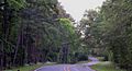
Farm to Market Road 315 north of Palestine, Anderson County, Texas, USA (April 2017)
.jpg)
See also
 In Spanish: Condado de Anderson (Texas) para niños
