
Angoulême facts for kids
Quick facts for kids
Angoulême
|
||
|---|---|---|
|
Prefecture and commune
|
||

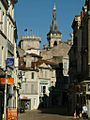
Angoulême, a view from Hirondelle golf course
|
||
|
||

Angoulême
Location in France

Angoulême
Location in Nouvelle-Aquitaine
|
||
| Country | France | |
| Region | Nouvelle-Aquitaine | |
| Department | Charente | |
| Arrondissement | Angoulême | |
| Canton | Angoulême-1, 2 and 3 | |
| Intercommunality | Grand Angoulême | |
| Area
1
|
21.85 km2 (8.44 sq mi) | |
| Population
(2014)
|
41,955 | |
| • Density | 1,920.1/km2 (4,973.1/sq mi) | |
| Demonym(s) | Angoumoisin (m) Angoumoisine (f) |
|
| Time zone | UTC+01:00 (CET) | |
| • Summer (DST) | UTC+02:00 (CEST) | |
| INSEE/Postal code |
16015 /16000
|
|
| Elevation | 27–130 m (89–427 ft) (avg. 100 m or 330 ft) |
|
| Website | Mairie de Angoulême | |
| 1 French Land Register data, which excludes lakes, ponds, glaciers > 1 km2 (0.386 sq mi or 247 acres) and river estuaries. | ||
.svg)
Angoulême (Occitan: Engoleime) is a commune in southwestern France in the Charente department, Nouvelle-Aquitaine region, of which it is its prefecture.
It was the capital of the old province of Angoumois.
Contents
Geography
The city of Angoulême is in the centre of the Charente department, on a plateau overlooking a meander of the Charente river.
It has an area of 21.9 km2 (8.5 sq mi). Its average altitude is 78 m (256 ft); at the city hall, the altitude is 86 m (282 ft).
| Bordeaux | Toulouse | Montpellier | Lyon | Nantes | Paris | Marseille |
|---|---|---|---|---|---|---|
| 121 km (75 mi) | 357 km (222 mi) | 596 km (370 mi) | 520 km (320 mi) | 276 km (171 mi) | 450 km (280 mi) | 761 km (473 mi) |
 |
The city of Angoulême is surrounded by the communes:
 |
Saint-Yrieix | Gond-Pontouvre | L'Isle-d'Espagnac | |
| Fléac Saint-Michel |
Soyaux | |||
| La Couronne | Puymoyen | Dirac |
Climate
The climate of Angoulême, in the Köppen climate classification, is Cfb - Oceanic climate with template summers.
Population
The inhabitants of this city are known, in French, as Angoumoisins (women: Angoumoisines).
With a population of 41,955, Angoulême has a population density of 1,920 inhabitants/km2.
Evolution of the population in Angoulême
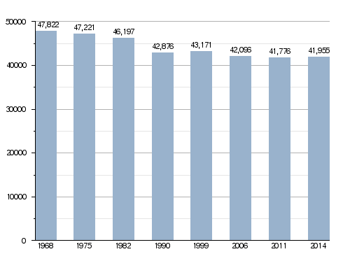
Angoulême forms, together with other 17 communes, the urban area of Angoulême with a population of 108,624 inhabitants (2013) and an area of 202.4 km2 (78.1 sq mi). This urban area is the centre of the metropolitan area of Angoulême, formed by 106 communes, with a population of 180,820 inhabitants (2013) and an area of 1,597.8 km2 (616.9 sq mi).
Administration
Angoulême is the prefecture of the Charente department, the capital of the arrondissement of Angoulême and the administrative centre (French: chef-lieu) of three cantons:
- Angoulême-1 formed by the commune Fléac and part of Angoulême, with 18,498 inhabitants (2014).
- Angoulême-2 formed by the commune L'Isle-d'Espagnac and part of Angoulême, with 18,990 inhabitants (2014).
- Angoulême-3 formed by the commune Soyaux and part of Angoulême, with 22,883 inhabitants (2014).
It is part of the intercommunality Grand Angoulême (French: Communauté d'agglomération Grand Angoulême).
Twinned and partner towns
Angoulême is twinned with:
|
|
Gallery


Related pages
Images for kids
-
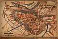
Map of Angoulême in 1914.
-
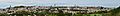
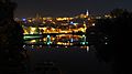
Panorama of Angoulême from Saint-Martin (South). The church of Saint-Ausone, the cathedral of Saint-Pierre, and the city hall can all be seen.
-
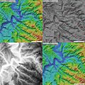
Topography of Angoulême city
-
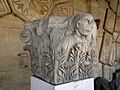
A Capital from the 2nd century discovered in 1888 on the Rue des Halles
-
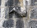
The Leg of Clovis
-
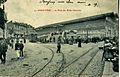
The network of Tramway of Angoulême served the city from 1900 to 1935.Seen here is a carriage at the Place des Halles before the First World War.
-
The city was also the terminus of a metre-gauge light railway called the Chemins de fer économiques des Charentes to Chalais which ran from 1910 to 1948.
-
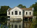
Former pumping station to bring up water from the Touvre.
-
Angoulême in 1914.
-
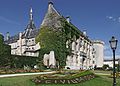
the approaches to the city hall with elegant green spaces
-
The Place du Palet
-
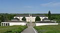
The Faculty of Law at La Couronne
-
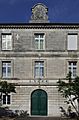
Angoulême City Hall
-
Column of the Duchess of Angoulême (1815), sister of Louis XVI
-
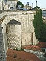
North Rampart
-
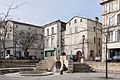
Near the covered market
-
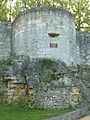
The Léchelle Tower
-
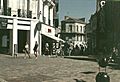
Pedestrian shopping area in the centre
-
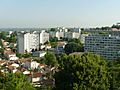
The port of l'Houmeau and, in the background, the town centre of Angoulême.
-
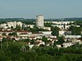
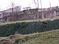
District of Grande-Garenne
-
District of Grand-Font
-
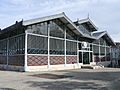
Les Halles
-
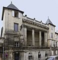
The Bardines Hotel
-
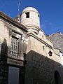
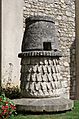
Watchtower in the old Épernon wall
-
The Pedestrian shopping area in 1992
-

The 19th-century gate on the Hotel Montalembert
-

The Palace of Justice
-
Entrance to the Guez de Balzac school
-
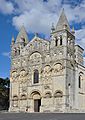
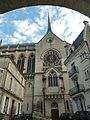
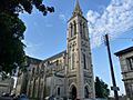
Angoulême Cathedral
-

An Aureola on the Cathedral
-
Church of Obézine
-
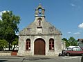
Chapel Saint-Roch
-
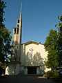
Church of the Sacred Heart
-

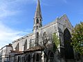
Church of Saint-Jacques de l'Houmeau
-
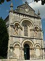
Church Saint-Ausone
-
Chapel Saint-Cybard
-
Chapel of Cordeliers
-
"Lantern of the dead" near the Church of Saint-André


See also
 In Spanish: Angulema para niños
