
Antares, Arizona facts for kids
Quick facts for kids
Antares
|
|
|---|---|
|
Village
|
|
.jpg)
Tourist attractions in 2011
|
|

Location of Antares in Arizona
|
|

Antares
Location in the United States

Antares
Location in Arizona
|
|
| Country | United States |
| Area | |
| • Land | 0.65 sq mi (1.7 km2) |
| • Water | 0 sq mi (0 km2) |
| Elevation | 3,556 ft (1,084 m) |
| Population
(2010)
|
|
| • Total | 126 |
| Time zone | UTC−07:00 (Mountain Standard Time) |
Antares is a village and census designated place (CDP) in Mohave County, Arizona, United States. The CDP encompasses 0.65 square mile of land, and is at 3,556 feet elevation above sea level. It exists on part of U.S. Route 66.
Demographics
| Historical population | |||
|---|---|---|---|
| Census | Pop. | %± | |
| 2010 | 126 | — | |
| U.S. Decennial Census | |||
Antares first appeared on the 2010 U.S. Census as a census-designated place (CDP). Of the 126 Antares residents as of 2010[update], 64 (50.8%) were male and 62 (49.2%) were female. The median age of its citizens was of 64.1 years at that time. The majority of the population is White American, with a small number of Native Americans and no others. The town's population density rated at 194.81 per square mile, ranking the town as #217 in population density. The city experienced a 17.6% decrease in population from 2006 to 2010.
Transportation
Road and rail
.jpg)
Antares is along Route 66, which is the main road of the village. The BNSF Railway runs parallel to Route 66.
An unpaved side road called Antares Road and described as "fine for all vehicles" also runs through the Hualapai Valley. Antares Road is a county road. It runs from Route 66 heading roughly northwest until it meets Pierce Ferry Road, giving access to Meadview, Arizona and the Colorado River at Lake Mead. The U.S. Geological Survey says that "Antares Road is unpaved for 31 of the 32 miles; however, Mohave County does maintain the road to a native material standard." Antares Road is designated County Highway 149, and after the intersection at Pierce Ferry Road it continues as County Highway 139/Gregg's Hideout Road.
The part of Route 66 that runs through the village is a long curve. This curve, known as Antares Point, is the longest continuous curve on any United States Highway, running for about 2 mi (3.2 km).
Air

The local airport, Music Mountain Air Ranch, operates two dirt runways, both of which had become overgrown by 2004. Formerly Kingman Number 3 Army Airfield and also known as Hackberry Airfield, the airport is located off Antares Road just to the north of the village—the western runway intersects the road. Kingman Airport is the closest commercial airport, 15 miles west of Antares. The Kingman Army Airfield had opened during World War II. Bullhead City International Airport in Bullhead City is the closest international airport, having formerly had charter flights to Canada, and is also relatively close. Phoenix Sky Harbor International Airport in Phoenix and McCarran International Airport in Las Vegas, Nevada are the closest large international airports to Antares.
Images for kids
-
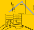
The road layout in and around Antares
-
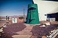
The Giant Head

.jpg)
See also
 In Spanish: Antares (Arizona) para niños
