
Arctic Cordillera facts for kids
Quick facts for kids Arctic Cordillera |
|
|---|---|

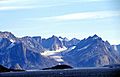
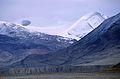
The Baffin Mountains at the northern end of Auyuittuq National Park
|
|
| Highest point | |
| Peak | Barbeau Peak |
| Elevation | 2,616 m (8,583 ft) |
| Geography | |
 |
|
| Country | Canada |
| Territories and Provinces | Nunavut, Quebec and Labrador |
| Regions | Arctic Archipelago and Ungava Peninsula |
| Geology | |
| Type of rock | Igneous, Metamorphic and Sedimentary |
The Arctic Cordillera is a mountain range running along the northeastern coast of North America from Ellesmere Island to the northernmost tip of Labrador. It is the only major mountain range in Canada east of the Rocky Mountains. The range has a surface area of 218,225 km2 (84,257 sq mi). Its highest point is 2,616 metres (8,583 ft) at Barbeau Peak.
- Chernoff, M. N., H. R. Hovdebo, and J. Stuart-Smith. Eastern Canadian Cordillera and Arctic Islands An Aerial Reconnaissance. Ottawa: 24th International Geological Congress, 1972.
- Geological Survey of Canada. Cordillera and Pacific Margin Interior Plains and Arctic Canada. Geological Survey of Canada Current Research, 1998-A. 1998.
- Hall, John K. Arctic Ocean Geophysical Studies The Alpha Cordillera and Mendeleyev Ridge. Palisades, N.Y.: Lamont-Doherty Geological Observatory, Columbia University, 1970.
- Walker, Edward R. A Synoptic Climatology for Parts of the Western Cordillera. Montreal: McGill University, 1961.
Images for kids
-
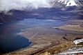
Tanquary Fiord, showing confluence of Air Force River, Rollrock River and Macdonald River
-
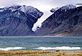
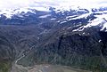
Gull Glacier in Tanquary Fjord
-
Folded rock in the Torngat Mountains
-
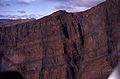
Dragon Cliff, including the flood basalt lava layers
-
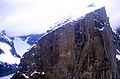
Mount Asgard in July 2001
-
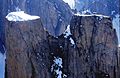
Mount Thor in 1997
-
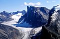
Characteristic rock formations and glaciers. Turnweather Peak in the middle.
-
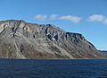
Nedlukseak Fiord (Davis Strait) and view to the mountains
-
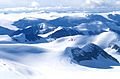
The Conger Range and Ad Astra Icecap
-
The Osborn Range seen from a Twin Otter
-
Qijuttaaqanngittuq Valley in the southern Baffin Mountains
-
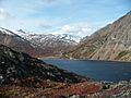
Nachvak Fjord, Torngat Mountains


.jpg)


See also
 In Spanish: Cordillera Ártica para niños
