
Armagh facts for kids
Quick facts for kids Armagh
|
|
|---|---|
 St. Patrick's Cathedral, Armagh (Roman Catholic) |
|
 |
|

|
|
| Population | 14,777 (2011 Census) |
| Irish grid reference | H876455 |
| • Belfast | 33 mi (53 km) |
| District |
|
| County | |
| Country | Northern Ireland |
| Sovereign state | United Kingdom |
| Post town | ARMAGH |
| Postcode district | BT60, BT61 |
| Dialling code | 028 |
| EU Parliament | Northern Ireland |
| UK Parliament |
|
| NI Assembly |
|
| Website | armagh.gov.uk |
Armagh ( ar-MAH; Irish: Ard Mhacha "Macha's height") is the county town of County Armagh and a city in Northern Ireland, as well as a civil parish. It is the ecclesiastical capital of Ireland – the seat of the Archbishops of Armagh, the Primates of All Ireland for both the Roman Catholic Church and the Church of Ireland. In ancient times, nearby Navan Fort (Eamhain Mhacha) was a pagan ceremonial site and one of the great royal capitals of Gaelic Ireland. Today, Armagh is home to two cathedrals (both named after Saint Patrick) and the Armagh Observatory, and is known for its Georgian architecture.
Although classed as a medium-sized town, Armagh was given city status in 1994 and Lord Mayoralty status in 2012, both by Queen Elizabeth II. It had a population of 14,777 people in the 2011 Census.
Contents
History

.jpg)

Foundation
Eamhain Mhacha (or Navan Fort), at the western edge of Armagh, is believed to have been an ancient pagan ritual or ceremonial site. According to Irish mythology it was one of the great royal sites of Gaelic Ireland and the capital of Ulster. It appears to have been largely abandoned after the 1st century. In the 3rd century, a ditch and bank was dug around the top of Cathedral Hill, the heart of what is now Armagh. Its circular shape matches the modern street layout. Evidence suggests that it was a pagan sanctuary and the successor to Navan. Like Navan, it too was named after the goddess Macha – Ard Mhacha means "Macha's height". This name was later anglicised as Ardmagh, which eventually became Armagh.
After Christianity spread to Ireland, the pagan sanctuary was converted into a Christian one, and Armagh became the site of an important church and monastery. According to tradition, Saint Patrick founded his main church there in the year 457, and it eventually became the "ecclesiastical capital" of Ireland. Saint Patrick was said to have decreed that only those educated in Armagh could spread the gospel. According to the Annals of the Four Masters:
Ard Mhacha was founded by Saint Patrick, it having been granted to him by Daire, son of Finnchadh, son of Eoghan, son of Niallan. Twelve men were appointed by him for building the town. He ordered them, in the first place, to erect an archbishop's city there, and a church for monks, for nuns, and for the other orders in general, for he perceived that it would be the head and chief of the churches of Ireland in general.
Medieval era
In 839 and 869, the monastery in Armagh was raided by Vikings. As with similar raids, their goal was to acquire valuables such as silver, which could often be found in churches and monasteries.
The Book of Armagh came from the monastery. It is a 9th-century Irish manuscript now held by Trinity College Library in Dublin (ms 52). It contains some of the oldest surviving specimens of Old Irish.
Brian Boru is believed to be buried in the graveyard of the St. Patrick's Church of Ireland cathedral. After having conquered the island during the 990s, he became High King of Ireland in 1002, until his death in 1014.
In 1189, John de Courcy, a Norman knight who had invaded Ulster in 1177, plundered Armagh.
Modern era
Armagh has been an educational centre since the time of Saint Patrick, and thus it has been referred to as "the city of saints and scholars". The educational tradition continued with the foundation of the Royal School in 1608, St Patrick's College in 1834 and the Armagh Observatory in 1790. The Observatory was part of Archbishop Robinson's plan to have a university in the city. This ambition was finally fulfilled, albeit briefly, in the 1990s when Queen's University of Belfast opened an outreach centre in the former hospital building.
Three brothers from Armagh died at the Battle of the Somme during World War I. None of the three has a known grave and all are commemorated on the Thiepval Memorial to the Missing of the Somme. A fourth brother was wounded in the same attack.
On 14 January 1921, during the Irish War of Independence, a Royal Irish Constabulary (RIC) sergeant was assassinated by the Irish Republican Army (IRA) in Armagh. He was attacked with a grenade as he walked along Market Street and later died of his wounds. On 4 September 1921, republican leaders Michael Collins and Eoin O'Duffy addressed a large meeting in Armagh, which was attended by up to 10,000 people.
Demography
On Census day (27 March 2011) there were 14,777 people living in Armagh (5871 households), accounting for 0.82% of the NI total, representing an increase of 1.3% on the Census 2001 population of 14,590. Of these:
- 20.90% were aged under 16 years and 15.44% were aged 65 and over;
- 52.52% of the usually resident population were female and 47.48% were male;
- 68.85% belong to or were brought up in the Catholic religion and 26.95% belong to or were brought up in a 'Protestant and Other Christian (including Christian related)' religion;
- 44.39% had an Irish national identity, 27.18% indicated that they had a British national identity and 26.43% had a Northern Irish national identity (respondents could indicate more than one national identity);
- 37 years was the average (median) age of the population;
- 18.76% had some knowledge of Irish (Gaelic) and 4.08% had some knowledge of Ulster-Scots.
Climate
Armagh, like most of Ireland, has a temperate maritime climate (Cfb) according to the Köppen climate classification system. The nearest Met Office standard weather station, at Armagh Observatory, provides long term weather data back to 1844. During that time, the highest temperature to be recorded was 30.3 °C (86.5 °F) on 10 July 1934. The lowest temperature was −15.1 °C (4.8 °F) on 7 February 1895.
Typically, the warmest day of the year will reach 26.1 °C (79.0 °F), and 3.7 days a year should attain a maximum temperature of 25.1 °C (77.2 °F) or above.
Typically the coldest night of the year should fall to −6.8 °C (19.8 °F) and 40.4 nights should register an air frost. All averages refer to the 1981–2010 observation period.
| Climate data for Armagh Weather Observing Station 1981–2010, extremes 1844– | |||||||||||||
|---|---|---|---|---|---|---|---|---|---|---|---|---|---|
| Month | Jan | Feb | Mar | Apr | May | Jun | Jul | Aug | Sep | Oct | Nov | Dec | Year |
| Record high °C (°F) | 14.7 (58.5) |
15.9 (60.6) |
21.7 (71.1) |
22.6 (72.7) |
26.2 (79.2) |
30.0 (86.0) |
30.3 (86.5) |
29.4 (84.9) |
26.7 (80.1) |
21.7 (71.1) |
16.8 (62.2) |
15.0 (59.0) |
30.3 (86.5) |
| Average high °C (°F) | 7.4 (45.3) |
8.1 (46.6) |
10.2 (50.4) |
12.6 (54.7) |
15.6 (60.1) |
18 (64) |
19.7 (67.5) |
19.3 (66.7) |
16.9 (62.4) |
13.4 (56.1) |
10 (50) |
7.7 (45.9) |
13.3 (55.9) |
| Average low °C (°F) | 1.9 (35.4) |
1.6 (34.9) |
3.1 (37.6) |
4.3 (39.7) |
6.7 (44.1) |
9.6 (49.3) |
11.7 (53.1) |
11.4 (52.5) |
9.5 (49.1) |
6.8 (44.2) |
3.9 (39.0) |
2.1 (35.8) |
6.1 (43.0) |
| Record low °C (°F) | −14.3 (6.3) |
−15.1 (4.8) |
−12.4 (9.7) |
−7.1 (19.2) |
−2.3 (27.9) |
0.8 (33.4) |
1.7 (35.1) |
2.3 (36.1) |
−0.6 (30.9) |
−5.6 (21.9) |
−8.3 (17.1) |
−14.6 (5.7) |
−15.1 (4.8) |
| Average rainfall mm (inches) | 74.5 (2.93) |
54 (2.1) |
65.6 (2.58) |
57.6 (2.27) |
57.8 (2.28) |
58.4 (2.30) |
62.7 (2.47) |
76.3 (3.00) |
68.1 (2.68) |
85.5 (3.37) |
74.6 (2.94) |
77.1 (3.04) |
812.2 (31.96) |
| Mean monthly sunshine hours | 46.4 | 69 | 96.6 | 142.6 | 173.5 | 144.2 | 137.0 | 133.3 | 113.9 | 90.2 | 58.5 | 40.3 | 1,245.5 |
Notable people
Only people who are sufficiently notable to have individual entries on Wikipedia have been included in the list and, in each instance, their birth or residence has been verified by citations.
- Tom Boyd, Irish professional golfer, was born in Armagh in 1888
- Daragh Carville, playwright and screenwriter, whose works include Cherrybomb, was born in Armagh in 1969
- David Cunningham (born 1954), musician
- Moses Harvey, clergyman and naturalist, famous for studies of the giant squid, was born in Armagh in 1820
- John Lennox (born 1943), mathematician who grew up in Armagh and attended the Royal School. He specialises in group theory, is a philosopher of science and a Christian apologist
- Patrick Magee, actor and director known for his collaborations with Samuel Beckett and Harold Pinter, was born in Armagh in 1922
- Saint Malachy of Armagh was born there in 1094
- Seamus McGarvey, Academy Award-nominated cinematographer (Atonement, Anna Karenina), was born in Armagh in 1967
- Colin Morgan, actor, known for playing the lead role in Merlin, was born in Armagh in 1986
- Ian Paisley, politician, founder of the Democratic Unionist Party and First Minister of Northern Ireland, was born in Armagh in 1926
- Thomas Romney Robinson (1792–1882), astronomer, lived in Armagh
- Christopher Vokes, Major General, was born in Armagh in 1904
- Charles Wood, composer, was born in Armagh in 1866
City centre regeneration
,_November_2009.JPG)
To combat the problem of a diminishing city centre and to address the concerns of local people, Armagh City and District Council decided to upgrade the surfaces and general appearance of the main shopping areas.
The scheme aims to deal with the many issues raised by the public and businesses over recent years. It will regenerate the centre of Armagh, transforming it into a high-quality pedestrian-friendly environment. The ineffective pedestrian area in Market Street will be opened officially to vehicles. The scheme will provide wider footpaths, pedestrian crossings and disabled parking throughout the city centre to improve safety and accessibility.
As well as these new street layouts the appearance of the city centre will be enhanced by new lighting, paving, seating, bins and greenery. The use of quality stone materials, public art projects and feature lighting will contribute to the overall effect and present the city's famous architecture at its best. A shop frontage scheme will be launched toward the end of the street development project.
The scheme includes eleven streets: Market Street, Thomas Street, Ogle Street, Scotch Street, Dobbin Street, Dobbin Street Lane, Barrack Street, McCrum's Court, Upper English Street, Russell Street, Ogle Street and Linenhall Street.
The £5m Armagh City Centre Regeneration Scheme is funded by Armagh City and District Council, the Department for Social Development, Transport NI and the Arts Council of Northern Ireland.
Transport
The Ulster Railway linked Armagh with Belfast in 1848 and Monaghan in 1858. The Newry and Armagh Railway (N&A) opened in 1864 and the Castleblayney, Keady and Armagh Railway (CK&A) was completed in 1910. In 1876 the Ulster Railway became part of the new Great Northern Railway (GNR), which took over the N&A in 1879 and the CK&A in 1911.
The partition of Ireland in 1922 hastened the railways' decline, and the GNR closed the Keady – Castleblayney section of the CKA in 1923. The GNR withdrew passenger trains from the Armagh – Keady section of the CKA in 1922 and closed the Armagh – Markethill section of the N&A in 1933. The Government of Northern Ireland forced the GNR Board to close all remaining lines serving Armagh railway station on 1 October 1957: the goods branch from Armagh to Keady and the main line through Armagh from Portadown as far as the border at Glaslough on the way to Monaghan.
Northern Ireland Railways train services run from Portadown to Belfast Great Victoria Street and the cross-border Enterprise service runs via Newry to Dublin Connolly. Poyntzpass also has a limited service.
When he was Minister for the Department for Regional Development, then MLA Danny Kennedy had indicated plans to restore the railway from Armagh station to Portadown.
Townlands
Armagh is within the civil parish of Armagh. Like the rest of Ireland, this parish has long been divided into townlands, whose names mostly come from the Irish language. Over time, more townlands have been built upon and they have lent their names to many streets, roads and housing estates.
In 1830, most of Armagh's urban townlands were amalgamated (for administration) and became known as Corporation Lands or simply Corporation. However, the surrounding townlands remained as separate units and they were eventually built upon too. They are listed below alongside their likely etymologies.
- Aghamoat (from Irish Achadh Mochta, meaning 'Mochta's field')
- Ballynahone Beg (from Baile [Beag] na hAbhann meaning "[small] townland of the river") – part of Lisnadill parish
- Ballynahone More (from Baile [Mór] na hAbhann meaning "[large] townland of the river")
- Cargagh (from Cairgeach meaning "rocky land")
- Cavanacaw (from Cabhán na Cáithe meaning "hollow of the chaff")
- Drumadd (from Druim-fhad meaning "long ridge")
- Drumarg (from Druim Arg meaning "ridge of the chests" or Druim Fhairig meaning "ridge of the feasting/hospitality")
- Drumman More (from an Drumainn meaning "the ridge")
- Killuney (from Cill Lughna meaning "Lughna's church")
- Legarhill or Mullaghcreevie (from Mullach Craoibhe meaning "hilltop of the branch")
- Lurgyvallen (from Lorg Uí Mhealláin meaning "Ó Mhealláin's track")
- Mullynure (from Mullach an Iubhair meaning "hilltop of the yew") – part of Grange parish
- Parkmore (from Páirc Mhór meaning "great field")
- Tullyelmer (from Tulaigh Giolla Mura meaning "Giolla Mura's mound")
- Umgola (origin uncertain but probably includes the element -gabhla meaning "forks")
Sport

Armagh City Football Club, which plays in the NIFL Championship is the main association football club, and the City of Armagh Rugby Club is the local rugby club. Lisanally Rangers F.C. is another football team, playing in the Mid-Ulster Football League. Gaelic football is represented by Armagh Harps and Pearse Ógs. The local GAA handball club is Eugene Quinn's, named after a player from the Armagh area who died on an attempted swim from Tory Island to the coast of Donegal. The local hurling club is Armagh Cúchulainns.
In 2004 the Royal School, Armagh became only the second team in history to win both the schools' rugby and hockey cups in the same year.
The Mall in Armagh has a long association with cricket, and is the location of the Armagh Cricket Club clubhouse.
Armagh Athletics Club was founded in 1969. The club organises the Armagh International 5k Road Race annually. The race was first organised in 1980 and takes place every February with athletes coming from England, Scotland, Wales, continental Europe and the United States.
Education
Primary
- Armstrong Primary School
- Christian Brothers Primary School Armagh
- The Drelincourt Primary School
- Dromintee Primary School
- Drumhillery Primary School
- Mount St Catherine's Primary School
- The Royal School Preparatory School
- Saints and Scholars Integrated Primary School
- St. Malachy's Primary School
- St. Patrick's Primary School
Post-primary
- City of Armagh High School
- St. Brigid's High School
- St. Catherine's College, Armagh
- St. Patrick's Grammar School, Armagh
- The Royal School, Armagh
- Southern Regional College
Images for kids
-
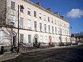
Former houses on Charlemont Place, beside The Mall, now occupied by Education Authority (Southern)


.jpg)
See also
 In Spanish: Armagh para niños
