
Arroux facts for kids
Quick facts for kids Arroux |
|
| River | |
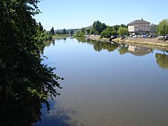
 The Arroux near the Porte d'Arroux in Autun.
|
|
| Country | |
|---|---|
| Regions | Bourgogne-Franche-Comté, Auvergne-Rhône-Alpes |
| Departments | Côte-d'Or, Saône-et-Loire, Allier |
| Tributaries | |
| - left | Drée, Mesvrin, Bourbince |
| - right | Ternin, Méchet |
| Cities | Autun, Gueugnon, Digoin |
| Source | |
| - location | Culètre, Côte-d'Or, France |
| - elevation | 430 m (1,411 ft) |
| - coordinates | 47°8′54″N 4°33′22″E / 47.14833°N 4.55611°E |
| Confluence | Loire River |
| - location | Digoin, Saône-et-Loire, France |
| - elevation | 224 m (735 ft) |
| - coordinates | 46°29′24″N 3°57′33″E / 46.49000°N 3.95917°E |
| Length | 129.4 km (80 mi) |
| Basin | 3,166 km² (1,222 sq mi) |
| Discharge | for Digoin |
| - average | 34.20 m³/s (1,208 cu ft/s) |
The Arroux is a river in central France. It is a right tributary of the Loire river.
Geography
The Arroux river has a length of 129.4 km (80.4 mi), and a drainage basin with an area of 3,166 km2 (1,222 sq mi).
Course
The Arroux river starts in Culètre commune in the south of the Côte-d'Or) department, at an altitude of about 430 m (1,411 ft). From here, the Arroux flows first to the west and then to the southwest.
The Arroux river flows through 2 regions and 3 departments. It flows through the following communes, among others:
- Bourgogne-Franche-Comté region
- Côte-d'Or: Arnay-le-Duc
- Saône-et-Loire: Autun, Étang-sur-Arroux, Toulon-sur-Arroux, Gueugnon, Digoin
- Auvergne-Rhône-Alpes region
- Allier: (only a short distance)
Finally, it flows into the Loire river near the town of Digoin.
Main tributaries
The main tributaries of the Arroux river are:
|
Left tributaries:
|
Right tributaries:
|
Hydrology
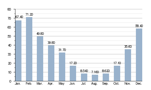
Its average yearly discharge (volume of water which passes through a section of the river per unit of time) is 34.20 m3/s (1,208 cu ft/s) at Digoin in the Saône-et-Loire department.
Average monthly discharge (m3/s) at Digoin (1958 - 2017)
Gallery
-
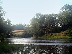
The Arroux.
-
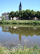
The Arroux in Vendenesse-sur-Arroux.
-
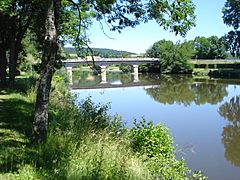
Vendenesse-sur-Arroux, bridger over the Arroux.
-
The Arroux in Gueugnon.
-
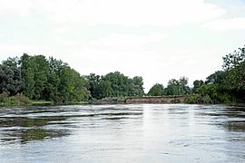
Confluence of the Arroux in the Loire.


Related pages
