
Ashville, Ohio facts for kids
Quick facts for kids
Ashville, Ohio
|
|
|---|---|
|
Village
|
|

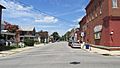
Looking North on Long Street
|
|

Location of Ashville, Ohio
|
|

Location of Ashville in Pickaway County
|
|

Ashville, Ohio
Location in Ohio

Ashville, Ohio
Location in the United States

Ashville, Ohio
Location in North America
|
|
| Country | United States |
| State | Ohio |
| County | Pickaway |
| Township | Harrison |
| Area | |
| • Total | 2.51 sq mi (6.50 km2) |
| • Land | 2.51 sq mi (6.50 km2) |
| • Water | 0.00 sq mi (0.00 km2) |
| Elevation | 715 ft (238 m) |
| Population
(2010)
|
|
| • Total | 4,097 |
| • Estimate
(2022)
|
4,643 |
| • Density | 1,967.25/sq mi (759.60/km2) |
| Time zone | UTC-5 (Eastern (EST)) |
| • Summer (DST) | UTC-4 (EDT) |
| ZIP code |
43103
|
| Area code(s) | 740, 220 |
| FIPS code | 39-02680 |
| GNIS feature ID | 1064348 |
| Website | http://ashvilleohio.gov |
Ashville is a village in Pickaway County, Ohio, United States. The population was 4,097 at the 2010 census. Ashville is located five miles south of Columbus and six miles north of Circleville.
Contents
History
In 1812 two distilleries were built near Ashville and were owned by William and Richard Staige (Stage). The land that is now Ashville was at that time primarily the property of Richard Staige. After many years he sold his distillery to Mahlon Ashbrook, who did a large business with his brother Absolom. He also built a grist mill on Walnut Creek about 1845 and owned a large store that was run by his sister Iva "Ivy" and her husband Daniel Kellerman. Kellerman was the first postmaster in Ashbrook (later Ashville). The Ashbrook's enterprises failed in 1855. From that time, until the construction of the Scioto Valley Railroad through Ashville and the advent of a depot in 1876, business was slow. Ashville was incorporated in 1882, with the first mayor being W. R. Julian.
A historical museum, Ohio's Small Town Museum, is operated in the community. The museum, established in 1975, claims to be home to America's oldest working traffic light, which directed traffic in downtown Ashville until 1982. This signal was designed by local resident Teddy Boor.
Ashville is featured in the Together Concepts video production "We Are..Teays Valley". The video depicts a surprising number of achievements and innovations, as well as connections to American and world history.
The Puppeteers of America organization was first incorporated in Ashville in 1961 and the Puppetry Journal was published by the Pickaway Publishing Company in Ashville.
Ohio's oldest surviving 17-star U.S. flag representing Ohio's entry into the Union of States was found in an attic in a house on Long Street in Ashville.
Places of Interest
Slate Run Living Historical Farm is a working farm circa 1880. The farm belonged to the Oman family and is where patented gyroplane inventor John Oman was raised.
Snake Den Mounds are an upland mound grouping that is located 5 miles east of Ashville, noted as much as a hibernation spot for blue racer snakes as for the curious collection of silver nuggets found in hollow concretions.
Gallery
-
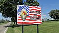
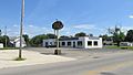
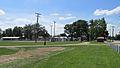
Ashville corporation limit sign on Lockbourne-Eastern Road
-
Looking north on Long Street
-
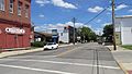
Looking east on East Main Street
-
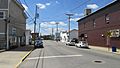
Looking west on West Main Street
-
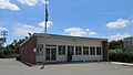
Ashville Post Office
-
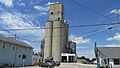
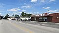
Ashville Grain LLC
-
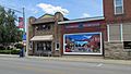
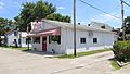
Papa Joe's Pizza
-
The Village Curiosity Shoppe
-
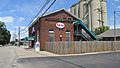
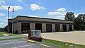
Ashville Police Department
-
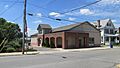
Ohio's Small Town Museum
-
Floyd E. Younkin Library
-
Former Ashville High School, now Hinkle/Cookson Apartments
-
Ashville Cleaning Center
-
IGA Food Market and Valero gas station
-
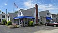
Cherry Street Diner
-
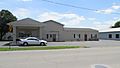
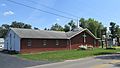
Harrison Township Fire Department
-
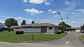
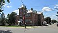
Village of Ashville Administrative Building
-
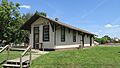
Ashville Depot
-
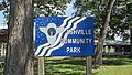
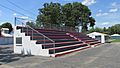
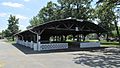
Ashville Community Park
-
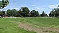
Ashville Community Park
-
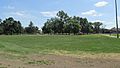
Ashville Community Park
-
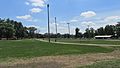
Ashville Community Park
-
Ashville Community Park
-
Ashville Community Park
-
Ashville Community Park
-
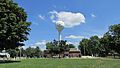
World's Oldest Traffic Light water tower
-
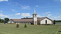
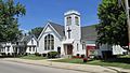
Village Chapel United Methodist Church
-
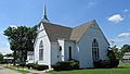
New Hope Free Will Baptist Church
-
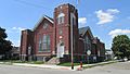
Zion United Methodist Church
-
Ashville Church of Christ in Christian Union
-
First English Lutheran Church


Festivals
Ashville's Fourth of July Celebration has been featured in articles by the New York Times and the Philadelphia Enquirer. The celebration was captured by famous social realist artist and photographer, Ben Shahn, in 1938 for the Farm Security Administration. Thousands of people come from all over the state to enjoy the parades, fish sandwiches, musical entertainment, games, rides, small town atmosphere, concessions, and fireworks.
The Ashville Viking Festival has been drawing crowds since 2003. The focus is on fun and the 10th Century.
Geography
Ashville is located at 39°43′03″N 82°57′10″W / 39.717550°N 82.952850°W.
According to the United States Census Bureau, the village has a total area of 2.51 square miles (6.50 km2), all of it land.
Demographics
| Historical population | |||
|---|---|---|---|
| Census | Pop. | %± | |
| 1890 | 430 | — | |
| 1900 | 654 | 52.1% | |
| 1910 | 972 | 48.6% | |
| 1920 | 1,032 | 6.2% | |
| 1930 | 1,085 | 5.1% | |
| 1940 | 1,101 | 1.5% | |
| 1950 | 1,303 | 18.3% | |
| 1960 | 1,639 | 25.8% | |
| 1970 | 1,772 | 8.1% | |
| 1980 | 2,046 | 15.5% | |
| 1990 | 2,254 | 10.2% | |
| 2000 | 3,174 | 40.8% | |
| 2010 | 4,097 | 29.1% | |
| 2019 (est.) | 4,385 | 7.0% | |
| U.S. Decennial Census | |||
2010 census
As of the census of 2010, there were 4,097 people, 1,598 households, and 1,100 families living in the village. The population density was 1,632.3 inhabitants per square mile (630.2/km2). There were 1,731 housing units at an average density of 689.6 per square mile (266.3/km2). The racial makeup of the village was 96.7% White, 1.0% African American, 0.4% Native American, 0.3% Asian, 0.1% from other races, and 1.4% from two or more races. Hispanic or Latino people of any race were 1.4% of the population.
There were 1,598 households, of which 41.6% had children under the age of 18 living with them, 45.7% were married couples living together, 15.6% had a female householder with no husband present, 7.6% had a male householder with no wife present, and 31.2% were non-families. 25.5% of all households were made up of individuals, and 8.8% had someone living alone who was 65 years of age or older. The average household size was 2.56 and the average family size was 3.05.
The median age in the village was 32.8 years. 29.3% of residents were under the age of 18; 9.8% were between the ages of 18 and 24; 29.6% were from 25 to 44; 21.9% were from 45 to 64; and 9.5% were 65 years of age or older. The gender makeup of the village was 48.5% male and 51.5% female.
Education
Schools
Teays Valley Local Schools
Prior to 1963, Harrison Township and the village had operated Ashville Harrison School which graduated its last class in 1962, which had 44 students. The district combined with two neighboring districts in the Fall of 1962 to form Teays Valley. The district currently operates three schools within the village's boundaries, which include Teays Valley High School, East Middle School, and Ashville Elementary.
Brooks-Yates School
Brooks-Yates was a school operated by Pickaway County Board of Developmental Disabilities that provided services to Pickaway County students with developmental disabilities. The school was moved to Teays Valley's main campus in Ashville from Circleville in 2016. The school ultimately closed in 2021, following a decline in enrollment.
CSCC – Pickaway County Center
A regional campus of Columbus State Community College was once located at Teays Valley High School. As of 2022, the campus is no longer active.
Library
Ashville has a public library, located on Long Street. The Floyd E. Younkin Branch is part of the Pickaway County Library system and was opened in 1999 after local business owners, the Younkin family, donated funds to open the location.
Notable residents
- Harley H. Christy, World War I hero and Vice Admiral
- Champ Henson, former Cincinnati Bengals player
- Ron Hood, politician and 2022 Ohio gubernatorial candidate
- William Ashbrook Kellerman, mycologist, journal founder, explorer and photographer
- Isham Randolph, Chicago and Panama Canal civil engineer
- Brian Stewart, politician
- Seth Mosley, Christian music singer and producer
Images for kids
-
Patent of Richard Stage, Jr. for ownership of land in modern day Ashville, Ohio.
-
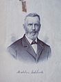
Mahlon Ashbrook
-
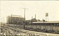
Scioto Valley (Sciola) Canning Company
-

An unusual traffic light on display at the Ashville Museum
-
Village Chapel Church
-
Ashville Community Park
-
Ashville Depot
-
Ohio's Small Town Museum


.jpg)

See also
 In Spanish: Ashville (Ohio) para niños
