
Aspley, Queensland facts for kids
Quick facts for kids AspleyBrisbane, Queensland |
|||||||||||||||
|---|---|---|---|---|---|---|---|---|---|---|---|---|---|---|---|

Marchant Park Memorial Gates
|
|||||||||||||||

Aspley
Location in Queensland
|
|||||||||||||||
| Population | 12,108 (2016 census) | ||||||||||||||
| • Density | 1,863/km2 (4,830/sq mi) | ||||||||||||||
| Postcode(s) | 4034 | ||||||||||||||
| Area | 6.5 km2 (2.5 sq mi) | ||||||||||||||
| Time zone | AEST (UTC+10:00) | ||||||||||||||
| Location | 13.4 km (8 mi) N of Brisbane GPO | ||||||||||||||
| LGA(s) | City of Brisbane (Bracken Ridge Ward; Marchant Ward; McDowall Ward) |
||||||||||||||
| State electorate(s) | Aspley | ||||||||||||||
| Federal Division(s) | |||||||||||||||
|
|||||||||||||||
Aspley is a suburb in the City of Brisbane, Queensland, Australia. In the 2016 census, Aspley had a population of 12,108 people.
History
Soon after Brisbane was declared a free settlement in 1842, people began exploring the lands north of Brisbane City. A northern route followed aboriginal tracks through what is now Kelvin Grove, Enoggera, Everton Hills, Albany Creek onto North Pine. This route is still known as "'Old Northern Road'" and "'Old North Road'" in places.
Another aboriginal track branching eastward from the Old Northern Road at the South Pine River crossed towards Little Cabbage Tree Creek and continued towards Downfall Creek. This track is now known as "Albany Creek Road" and "Gympie Road". Albany Creek Road was known as "Chinaman Creek Road" before 1888.
In 1857 the first land sales in the area east of the Old Northern Road and South Pine River begin under the control of New South Wales. Initially, the land was sold for farming and comprised the land around Cabbage Tree Creek, bordered by what is now Zillmere Road, Roghan Road, Bridgeman Road and the northerly continuation of Kirby Road, covering mostly what is now Aspley, Carseldine and Fitzgibbon. The land parcels east of what is now Hawbridge Street and Lacey Road were purchased by William John Ward.
The western land parcels were not sold. These land parcels were bordered by what is now Graham Road, Roghan Road, Hawbridge Street/Lacey Road and Bridgeman Road, and were subsequently subdivided into smaller land parcels and sold. This area is now known as Carseldine.
After the separation of Queensland from New South Wales in 1859, subsequent subdivisions were much smaller. In the following 5 years, land parcels south of Zillmere Road/Graham Road in what is now recognised as Aspley began. In 1865, subdivisions west of what is now Maundrell Terrace were sold at the Brisbane Land Sales. In 1866, subdivisions between what is now Gympie Road, Maundrell Terrace and Webster Road were auctioned. The subdivisions were named "Soldier's Flat". Initially, the area was known as "Little Cabbage Tree Creek District". The immigrants were primarily of English and German ancestry.
During the 1860s James and John Castledean, who owned land and a general store in the Bald Hills District, pushed a direct track from Bald Hills through to what is now the intersection of Gympie Road and Albany Creek Road.
In late October 1867 gold was discovered in Gympie, Queensland. By this time, a road from Brisbane City to Kedron Brook had been completed with the Bowen Bridge opened in 1860, permitting the northern track along Gympie Road and Albany Creek Road to be used as an alternate route to the Old Northern Road. However, neither road was of good quality. On 8 May 1868 the Government announced that it had allocated 2700 pounds to construct a trafficable, more direct, road to the Gympie goldfields. The new road came through Kedron Brook, Downfall Creek, Little Cabbage Tree Creek before heading to Bald Hills and North Pine. This road is now known as Gympie Road and travels a route very different from the original aboriginal track.

With increased traffic on Gympie Road, the Royal Exchange Hotel was established in 1875 opposite the intersection of Gympie Road and Albany Creek Road. It also operated as a general store for a while with Cobb and Co coaches passing on their way to the Gympie goldfields. In 1934, a second building was built south of the original hotel. The new building was called the "Aspley Hotel".
In the early 1870s, a vineyard was established by the Morris family on their property bounded by Maundrell Terrace, Gympie Road and Terrence Street. It was named the "Aspley Vineyard", after "Aspley Hall" in Nottingham, England. The vineyard operated for over twenty years. In 1897, Little Cabbage Tree Creek District was renamed Aspley.
In the latter part of the 19th century, Aspley was essentially a farming district. Additional industries were established to support the farming industry. In the 1880s, John Smith Booth established a bone mill and sawmill on Little Cabbage Tree Creek and Albany Creek Road. It later relocated to the current location of the former Aspley Acres Caravan Park and finally closed in 1932. In 1888, Huttons Pty Ltd established a meat processing plant in nearby suburb Zillmere. It contributed greatly to the local economy of Aspley, providing an alternative employment for farmers during poor seasons. A blacksmith operated on the northern corner of Gympie Road and Albany Creek Road until the 1920s. Several slaughter houses operated along Little Cabbage Tree Creek.
After World War I and into the 1920s, Aspley experienced some growth in the number of businesses present in the district. Griffiths Sweet Factory operated on Gympie Road between 1930 and 1950 after shifting from Windsor. Hedges Dripping Factory operated near the reservoir on Lawrence Road. A brickworks was established by the Granville family on Brickfield Road during the 1930s.

In 1912 the Kedron Omnibus company was formed by locals and ran local services to Wooloowin Station after previous services were cancelled as an aftermath of the 1912 transport strike.
In 1918 the local community hall was built on Gympie Road. A year later, movies were presented inside the hall. In 1950 the hall was sold to become St Pauls Church.
Transport
Aspley is primarily accessed by Gympie Road, the primary artery in Brisbane's northern suburbs. Other primary roads are Albany Creek Road to the west and Robinson Road to the east.
Public transport is provided by buses operated by Brisbane Transport, Translink, Hornibrook Bus Lines. Brisbane's tram network originally terminated just south of Aspley on Gympie Road at Chermside. The closest railway stations are Geebung and Zillmere.
In the 1961 Brisbane City Council Town Plan, the concept of a northern suburbs' expressway between Bowen Hills and Aspley was first proposed. The expressway would travel along the eastern side of Lutwyche Road to Park Road at Kedron, take a northerly route to Chermside and through the eastern side of Aspley, before heading north-westerly through Carseldine to connect with the Bruce Highway north of Bald Hills. The 1965 Wilbur Smith and Associates Brisbane Transportation Study recommended the additional construction of a Northwest Freeway between the Brisbane CBD and Aspley via the Grange and Everton Park.

The freeway system was to be constructed between 1965 and 1985 in four five-year stages. However, by 1972, opposition was voicing concerns about inadequate compensation for resumed properties, the housing crisis at the time, and neglected public transport. By 1975 the freeway plan had been abandoned due to community opposition and funding issues.
Land planning in the 1980s has protected the land corridor of the original Northwest Freeway between Alderley and Carseldine. The corridor is most obvious in the suburb running parallel to Trouts Road in the suburb's west. It is referred to as the Northwest Transport Corridor and remains in current planning standards as a four-lane median-divided road [1]. There is speculation that the corridor may form part of a western bypass road which will link the Western Freeway with the Bruce Highway. Another proposal has been for a light-rail system to connect Caboolture and Ferny Grove lines.
Demographics
In the 2011 census, Aspley recorded a population of 12,594 people and comprises 52.4% females and 47.6% males.
The median age of the Aspley population was 40 years of age, 3 years above the Australian median.
74% of people living in Aspley were born in Australia, compared to the national average of 69.8%; the next most common countries of birth were New Zealand 4.4%, England 3.5%, India 1.4%, Italy 1.1%, Philippines 1%.
84.1% of people spoke only English at home; the next most popular languages were 1.9% Italian, 1.1% Cantonese, 1% Mandarin, 0.6% Hindi, 0.5% Greek.
Spirituality
Aspley is home to many denominations and other religious activities. Some of which are Aspley Uniting Church and a chaplaincy at Aspley State High and Aspley East State Schools.
Amenities
Aspley is serviced by a fortnightly visit by the Brisbane City Council's mobile library service at the corner of Gayford and Albany Creek Roads.
- The history of Aspley by D.R. Teague. Colonial Press, 1990. Edition: 3rd ed. (ISBN 0-909139-08-3)
Sport
Aspley is home to the Australian Football Club the Aspley Hornets (situated on Graham Road) and the Aspley Devils Rugby League club (located on Kirby Road).
Education

Aspley State School is a government primary (Early Childhood-6) school for boys and girls at Maundrell Terrace (27°22′11″S 153°00′52″E / 27.3698°S 153.0145°E). In 2018, the school had an enrolment of 718 students with 50 teachers (45 full-time equivalent) and 26 non-teaching staff (19 full-time equivalent). It includes a special education program.
Aspley East State School is a government primary (Prep-6) school for boys and girls at 31 Helena Street (27°21′44″S 153°01′26″E / 27.3623°S 153.0239°E). In 2018, the school had an enrolment of 880 students with 64 teachers (56 full-time equivalent) and 42 non-teaching staff (25 full-time equivalent). It includes a special education program.
St Dympna's Catholic Primary School is a Catholic primary (Prep-6) school for boys and girls at 491 Robinson Road (27°21′58″S 153°01′58″E / 27.3660°S 153.0327°E). In 2018, the school had an enrolment of 693 students with 44 teachers (37 full-time equivalent) and 34 non-teaching staff (20 full-time equivalent).
Aspley State High School is a government secondary (7-12) school for boys and girls at 651 Zillmere Road (27°21′26″S 153°01′27″E / 27.3571°S 153.0242°E). In 2018, the school had an enrolment of 867 students with 81 teachers (78 full-time equivalent) and 52 non-teaching staff (35 full-time equivalent). It includes a special education program and an intensive English language program.
Aspley Special School is a special secondary (7-12) school for boys and girls at 751 Zillmere Road (27°21′24″S 153°01′16″E / 27.3567°S 153.0211°E). In 2018, the school had an enrolment of 87 students with 29 teachers (27 full-time equivalent) and 38 non-teaching staff (24 full-time equivalent).
Images for kids
-
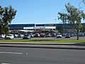
Pick 'n Pay Hypermarket, Aspley
-
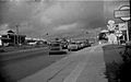
Shops on Gympie Road Aspley c.1972


