
Atglen, Pennsylvania facts for kids
Quick facts for kids
Atglen, Pennsylvania
|
|
|---|---|

Atglen Municipal Building
|
|

Location in Chester County and the U.S. state of Pennsylvania.
|
|

Atglen, Pennsylvania
Location in Pennsylvania

Atglen, Pennsylvania
Location in the United States
|
|
| Country | United States |
| State | Pennsylvania |
| County | Chester |
| Area | |
| • Total | 0.88 sq mi (2.28 km2) |
| • Land | 0.88 sq mi (2.27 km2) |
| • Water | 0.01 sq mi (0.02 km2) |
| Elevation | 489 ft (149 m) |
| Population
(2010)
|
|
| • Total | 1,406 |
| • Estimate
(2019)
|
1,409 |
| • Density | 1,610.29/sq mi (622.03/km2) |
| Time zone | UTC-5 (EST) |
| • Summer (DST) | UTC-4 (EDT) |
| ZIP code |
19310
|
| Area code(s) | 610 Exchange: 593 |
| FIPS code | 42-03384 |
| Website | http://www.atglen.org |

Atglen is a borough in Chester County, Pennsylvania, United States. According to the 2010 Census, its population is 1,406.
Contents
History
The land upon which Atglen now stands was once a wilderness. Cutting through it were paths made by Indians who traveled from Paxtang (present day Harrisburg) to present day New Castle, Delaware to trade with the Swedes and later, the English. The Great Minquas Path was one of these trails.
In 1717, Sadsbury township was organized. It included all of present-day Sadsbury Township as well as Fallowfield, Highland, and Valley townships. In August 1728, several inhabitants petitioned the court to separate Sadsbury from Fallowfield because of the former's size. In November of that year, the township was subdivided into East and West Sadsbury, and in 1729, upon the division of Chester County into Lancaster and Chester counties, the line between the two divisions of the township was made to conform to the county line.
During the mid 18th century more settlers arrived, drawn by the township's rich farming land. The Indian trails became horse tracks and later wagon tracks as farmers shipped their goods to market in Philadelphia, Newport, Delaware, and New Castle, Delaware. The old Provincial Highway as authorized by the government was laid out in 1730 and the Newport Road to the ore mines at Conwall in Lebanon County, was laid out in 1796.
The earliest organized religious group in the area were the Presbyterians, who in 1720 formed what is known today as the Upper Octorara Presbyterian Church. They were followed by the Quakers who in 1724 founded the Sadsbury Meeting House. A year later, the English settlers formed St. John's Church.
Andrew Moore (1688–1753), who had been influential with Samuel Miller in founding Sadsbury Meeting House, built a tub mill on his property.
Geography
Atglen is located at 39°56′53″N 75°58′26″W / 39.94806°N 75.97389°W (39.948106, -75.973887).
According to the United States Census Bureau, the borough has a total area of 0.9 square miles (2.3 km2), all of it land.
Demographics
| Historical population | |||
|---|---|---|---|
| Census | Pop. | %± | |
| 1880 | 347 | — | |
| 1890 | 397 | 14.4% | |
| 1900 | 404 | 1.8% | |
| 1910 | 546 | 35.1% | |
| 1920 | 650 | 19.0% | |
| 1930 | 620 | −4.6% | |
| 1940 | 588 | −5.2% | |
| 1950 | 668 | 13.6% | |
| 1960 | 721 | 7.9% | |
| 1970 | 740 | 2.6% | |
| 1980 | 669 | −9.6% | |
| 1990 | 825 | 23.3% | |
| 2000 | 1,217 | 47.5% | |
| 2010 | 1,406 | 15.5% | |
| 2020 | 1,313 | −6.6% | |
At the 2010 census, the borough was 85.6% White, 7.4% Black or African American, 0.1% Native American, 0.2% Asian, and 1.5% were two or more races. 5.8% of the population were of Hispanic or Latino ancestry.[1]
As of the census of 2000, there were 1,217 people, 413 households, and 317 families residing in the borough. The population density was 1,377.2 people per square mile (534.0/km2). There were 429 housing units at an average density of 485.5 per square mile (188.2/km2). The racial makeup of the borough was 88.17% White, 8.38% African American, 0.16% Asian, 2.30% from other races, and 0.99% from two or more races. Hispanic or Latino of any race were 4.93% of the population.
There were 413 households, out of which 46.2% had children under the age of 18 living with them, 55.9% were married couples living together, 16.7% had a female householder with no husband present, and 23.2% were non-families. 17.9% of all households were made up of individuals, and 5.3% had someone living alone who was 65 years of age or older. The average household size was 2.95 and the average family size was 3.33.
In the borough the population was spread out, with 34.2% under the age of 18, 9.0% from 18 to 24, 32.4% from 25 to 44, 16.6% from 45 to 64, and 7.9% who were 65 years of age or older. The median age was 30 years. For every 100 females there were 94.7 males. For every 100 females age 18 and over, there were 89.8 males.
The median income for a household in the borough was $59,167 according to 2016 Census figures. Males had a median income of $38,553 versus $25,125 for females. The per capita income for the borough was $17,732. About 11.9% of families and 16.8% of the population were below the poverty line, including 27.5% of those under age 18 and 6.1% of those age 65 or over.
-
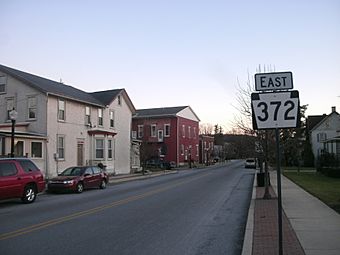
Rt 372
-
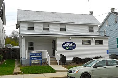
Atglen library
-
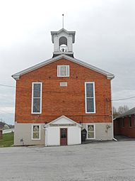
Methodist Episcopal Church
-
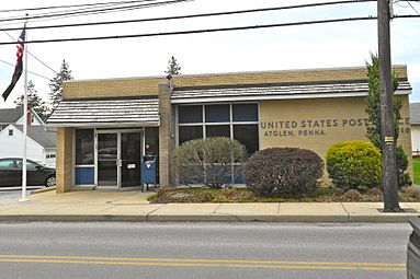
Post Office
-
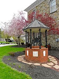
Bell from the original Municipal Building


See also
 In Spanish: Atglen para niños
