
Aurelia, Iowa facts for kids
Quick facts for kids
Aurelia, Iowa
|
|
|---|---|
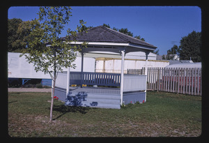
Bandstand in Aurelia
|
|

Location of Aurelia, Iowa
|
|
| Country | |
| State | |
| County | Cherokee |
| Area | |
| • Total | 1.01 sq mi (2.63 km2) |
| • Land | 1.01 sq mi (2.63 km2) |
| • Water | 0.00 sq mi (0.00 km2) |
| Elevation | 1,391 ft (424 m) |
| Population
(2020)
|
|
| • Total | 968 |
| • Density | 954.64/sq mi (368.44/km2) |
| Time zone | UTC-6 (Central (CST)) |
| • Summer (DST) | UTC-5 (CDT) |
| ZIP code |
51005
|
| Area code(s) | 712 |
| FIPS code | 19-03745 |
| GNIS feature ID | 0454283 |
Aurelia is a city in Cherokee County, Iowa, United States. The population was 968 at the 2020 census.
Contents
History
Aurelia was founded in 1873 as a stop along the Illinois Central Railroad branch connecting Sioux City, Iowa to Chicago, Illinois. This was the only railroad connecting the two Midwestern hubs and so gave birth to many Railroad towns. Aurelia was named for the youngest daughter of the owner of the raildroad, John Insley Blair, who died in 1866. The location of Aurelia was only set after a last minute change in the railroad design that saw it redirect to go through LeMars and Cherokee, rather than connect Sioux City directly to Storm Lake.
Geography
Aurelia is located at 42°42′51″N 95°26′05″W / 42.714055°N 95.434696°W.
According to the United States Census Bureau, the city has a total area of 1.04 square miles (2.69 km2), all of it land.
Demographics
| Historical population | |||
|---|---|---|---|
| Census | Pop. | %± | |
| 1880 | 225 | — | |
| 1890 | 663 | 194.7% | |
| 1900 | 621 | −6.3% | |
| 1910 | 625 | 0.6% | |
| 1920 | 708 | 13.3% | |
| 1930 | 723 | 2.1% | |
| 1940 | 752 | 4.0% | |
| 1950 | 807 | 7.3% | |
| 1960 | 904 | 12.0% | |
| 1970 | 1,065 | 17.8% | |
| 1980 | 1,143 | 7.3% | |
| 1990 | 1,034 | −9.5% | |
| 2000 | 1,062 | 2.7% | |
| 2010 | 1,036 | −2.4% | |
| 2020 | 968 | −6.6% | |
| U.S. Decennial Census | |||

2010 census
As of the census of 2010, there were 1,036 people, 426 households, and 299 families living in the city. The population density was 996.2 inhabitants per square mile (384.6/km2). There were 447 housing units at an average density of 429.8 per square mile (165.9/km2). The racial makeup of the city was 96.3% White, 0.3% African American, 0.2% Native American, 0.6% Asian, 1.6% from other races, and 1.0% from two or more races. Hispanic or Latino of any race were 2.6% of the population.
There were 426 households, of which 27.7% had children under the age of 18 living with them, 59.9% were married couples living together, 7.5% had a female householder with no husband present, 2.8% had a male householder with no wife present, and 29.8% were non-families. 26.8% of all households were made up of individuals, and 13.6% had someone living alone who was 65 years of age or older. The average household size was 2.35 and the average family size was 2.84.
The median age in the city was 45.2 years. 22.6% of residents were under the age of 18; 6.6% were between the ages of 18 and 24; 20.4% were from 25 to 44; 26.4% were from 45 to 64; and 23.8% were 65 years of age or older. The gender makeup of the city was 49.5% male and 50.5% female.
Education
It is within the Alta–Aurelia Community School District. It was in the Aurelia Community School District until it merged into Alta–Aurelia on July 1, 2018.
Aurelia houses one of the two K–4 elementary schools in the district and the sole middle school, which serves grades 5–8. The high school is in Alta.
See also
 In Spanish: Aurelia (Iowa) para niños
