
Badulla District facts for kids
Quick facts for kids
Badulla District
|
|
|---|---|

Map of Sri Lanka with Badulla District highlighted
|
|

Map of Badulla district showing its administrative areas
|
|
| Country | |
| Province | Uva Province |
| Largest city | Badulla |
| Area | |
| • Total | 2,861 km2 (1,105 sq mi) |
| Population
(2006)
|
|
| • Total | 837,000 |
| • Density | 292.56/km2 (757.7/sq mi) |
| Time zone | UTC+05:30 (Sri Lanka) |
| ISO 3166 code | LK-81 |
| Website | ds.gov.lk/dist_badulla |
Badulla is a district in the Uva Province of Sri Lanka. The entire land area of the Badulla district is 2,861 square kilometres. A total of 837,000 people live there. The district borders the districts of Monaragala and Rathnapura on the east and south, Ampara and Kandy districts on the north and Nuwara Eliya and Rathnapura on the west.
The economy of the district mostly depends on farming and livestock. Tea and vegetables are grown in the upper, hilly areas of the district. Paddy fields cover much of the lower parts.
Contents
Places
Towns
- Badulla, largest city
- Bandarawela
Major villages
- Haputale
- Mahiyanganaya
- Diyatalawa
- Hali-Ela
- Ella
- Haldummulla
- Beragala
- Welimada
- Kandaketiya
- Meegahakivula
- Passara
- Lunugala
- Pangaragammana
Images for kids
-
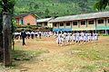
A school in Badulla district
-
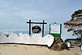
Lipton's seat
-
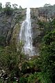
Diyaluma Falls


.jpg)
See also
 In Spanish: Distrito de Badulla para niños

All content from Kiddle encyclopedia articles (including the article images and facts) can be freely used under Attribution-ShareAlike license, unless stated otherwise. Cite this article:
Badulla District Facts for Kids. Kiddle Encyclopedia.