
Bagh District facts for kids
Quick facts for kids
Bagh
|
|
|---|---|

Map of Azad Kashmir with Bagh highlighted
|
|
| Country | Pakistan |
| Established | 1988 |
| Area | |
| • Total | 1,368 km2 (528 sq mi) |
| Population
(2009)
|
|
| • Total | 503,000 |
| • Density | 424/km2 (1,100/sq mi) |
| Time zone | UTC+5 (PST) |
| Number of Tehsils | 3 |
| Website | http://www.apnabagh.com |
Bagh District (Urdu: ضلع باغ) is one of the eight districts of Azad Kashmir, Pakistan. The district, which had been part of Poonch District, was created in 1988. The district is bordered by Muzaffarabad District to the north, by Punjab in the east. It also borders the divided district of Poonch, to the south is the Poonch District of Azad Kashmir and to the east is the Poonch District of India's Jammu and Kashmir state. The total area of the district is 1,368 square kilometers. Bagh District is linked to Muzaffarabad by two roads, one via Sudhan Gali (80 km) and the other through Kohala (97 km). It is 46 km from Rawalakot. The district is well known for its confectionery and bakery products.
People
The total population of the district according to the 1998 census was 395,000 which is estimated to have increased to 434,000 in 2003, with an annual growth rate of 2%.
Administration
The district is divided into 3 tehsils:
Images for kids
-
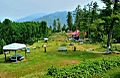
Dhirkot Park, Bagh District, Azad Kashmir

