
Baker Island facts for kids

Baker Island
|
|

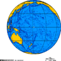
Map of the central Pacific Ocean showing Baker Island and nearby Howland Island just north of the equator and east of Tarawa.
|
|
| Geography | |
|---|---|
| Coordinates | 0°11′41″N 176°28′46″W / 0.19472°N 176.47944°W |
| Area | 1.64 km2 (0.63 sq mi) |
| Highest elevation | 8 m (26 ft) |
| Administration | |
| Demographics | |
| Population | 0 |
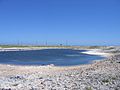
Baker Island is a small coral island, or atoll, in the North Pacific Ocean. It is just above the equator. It belongs to the United States. The United States Department of the Interior is in charge of the island. It is called the Baker Island National Wildlife Refuge.
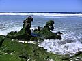
The island has no trees. The island is surrounded by a coral reef. This makes the atoll hard to approach in a boat.
Contents
Gallery
-
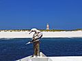
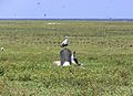
Baker Island coastline with red-footed booby
-
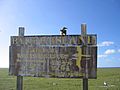
Fish and wildlife sign
-
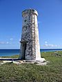
Baker Island day beacon
-
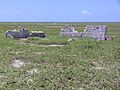
Settlement remains, radio tower in background
-
Brown noddies with radio towers in background


Related pages
Images for kids
-
Orthographic projection over Baker Island.
-
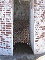
Hermit crabs taking shade in day beacon
-
Masked booby on gravestone
-
Landing craft wreckage on Baker Island coast
-
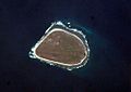
Baker Island satellite image


See also
 In Spanish: Isla Baker para niños
