
Barney View, Queensland facts for kids
Quick facts for kids Barney ViewQueensland |
|||||||||||||||
|---|---|---|---|---|---|---|---|---|---|---|---|---|---|---|---|
_Church,_Barney_View,_2006.JPG)
Barney View Community Church (formerly Methodist/Uniting), 2006
|
|||||||||||||||

Barney View
Location in Queensland
|
|||||||||||||||
| Population | 64 (2016 census) | ||||||||||||||
| • Density | 1.744/km2 (4.52/sq mi) | ||||||||||||||
| Postcode(s) | 4287 | ||||||||||||||
| Area | 36.7 km2 (14.2 sq mi) | ||||||||||||||
| Time zone | AEST (UTC+10:00) | ||||||||||||||
| Location |
|
||||||||||||||
| LGA(s) | Scenic Rim Region | ||||||||||||||
| State electorate(s) | Scenic Rim | ||||||||||||||
| Federal Division(s) | Wright | ||||||||||||||
|
|||||||||||||||
Barney View is a rural locality in the Scenic Rim Region, Queensland, Australia. In the 2016 census, Barney View had a population of 64 people.
History
A Methodist church was opened in 1908.
Barney View was originally known as Thulimbah, which was frequently confused with another Queensland district of the same name, Thulimbah near Stanthorpe. The problem was resolved in 1916 by changing the name to Barney View (due to its location beside Mount Barney).
Barney View State School closed in 1961.
Heritage listings
Heritage-listed sites at Barney View include:
- 101 Mount Barney Road: Barney View Church and Cemetery
Images for kids
-
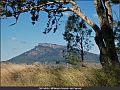
Mount Maroon, 2020


All content from Kiddle encyclopedia articles (including the article images and facts) can be freely used under Attribution-ShareAlike license, unless stated otherwise. Cite this article:
Barney View, Queensland Facts for Kids. Kiddle Encyclopedia.