
Barnum Island, New York facts for kids
Quick facts for kids
Barnum Island, New York
|
|
|---|---|
 |
|

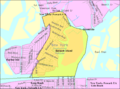
Location in Nassau County and the state of New York.
|
|

Barnum Island, New York
Location in New York
|
|
| Country | |
| State | |
| County | |
| Town | Hempstead |
| Area | |
| • Total | 1.3 sq mi (3.4 km2) |
| • Land | 0.9 sq mi (2.4 km2) |
| • Water | 0.4 sq mi (1.0 km2) |
| Elevation | 0 ft (0 m) |
| Population
(2020)
|
|
| • Total | 2,590 |
| Time zone | UTC-5 (EST) |
| • Summer (DST) | UTC-4 (EDT) |
| ZIP code |
11558
|
| Area code(s) | 516 |
| FIPS code | 36-04550 |
| GNIS feature ID | 1867393 |
.jpg)
Barnum Island is a hamlet and census-designated place (CDP) in Nassau County, New York, United States. The population was 2,590 at the 2020 census. It occupies the eastern portion of an island situated between Long Island and Long Beach. That island, previously known in its entirety as Hog Island, consists entirely of the communities of Barnum Island, Island Park, and Harbor Island.
Barnum Island is an unincorporated area of the Town of Hempstead. Most of Barnum Island is separated from the Village of Island Park by the LIRR's Long Beach Branch rail line to Long Beach.
Barnum Island has its own fire district and school district, but is under contract with the Village of Island Park for fire and education services for its residents. Barnum Island is included in the Island Park School District and ZIP code (11558).
The E.F. Barrett Power Station is located within the hamlet.
Geography

Barnum Island is located at 40°36′19″N 73°38′51″W / 40.60528°N 73.64750°W (40.605203, -73.647403).
According to the United States Census Bureau, the CDP has a total area of 1.3 square miles (3.4 km2), of which 0.9 square miles (2.3 km2) is land and 0.4 square miles (1.0 km2) (28.24%) is water.
Naming
Previously called Hog Island, after the feral pigs introduced by early European explorers to the Native Americans, it was later renamed for Sarah Ann Baldwin Barnum. Between 1851 and 1870, her husband Peter owned large parcels of land on Long Island, though his primary business was a Manhattan clothier. Sarah Ann arranged the purchase of Hog Island for use as a "poor farm" – a self-supporting almshouse, a social innovation for that period, and the island was renamed in her honor.
Local lore connects the island's name to P.T. Barnum, the circus impresario, but this is incorrect, and likely due to confusion between "PT" and "PC" (Peter C.).
The county discontinued the almshouse and sold the island to developers in 1898 for $40,000.
The center part of the island was incorporated as the village of Island Park in 1926. The rest of the island remains unincorporated, with the western portion known as Harbor Island, and the northeastern portion retaining the name Barnum Island. However, all three make up the original Hog Island/Barnum Island, and are part of the Town of Hempstead.
Demographics
As of the census of 2020, there were 2,590 people, 1,062 housing units, and 958 households residing in the CDP. The population density was 2,877.7 per square mile (1,111.1/km2). There were 1,062 housing units at an average density of 1,180/sq mi (455.7/km2). The racial makeup of the CDP was 68.03% White, 2.97% African American, 0.73% Native American, 6.06% Asian, 0.00% Pacific Islander, 9.22% from other races, and 9.53% from two or more races. Hispanic or Latino of any race were 19.45% of the population.
There were 958 households, out of which 58.9% were married couples living together, 11.1% had a female householder with no spouse present, and 28.0% had a male householder with no spouse present.
In the CDP, the population was spread out, with 6.2% under the age of 5, 18.0% under the age of 18, 82.0% was 18 years or older and 19.9% who were 65 years of age or older. The median age was 47 years. For every 100 females, there were 148.2 males.
The median income for a household in the CDP was $102,955. About 7.9% of the population were below the poverty line, including 19.9% of those under age 18 and 3.9% of those age 65 or over.
Nunley's Ferris wheel
Nunley's Ferris wheel, formerly located at Nunley's Carousel and Amusement Park on the Baldwin-Freeport, New York border, is now located in Barnum Island, in Baldwin, New York. Nassau County purchased Nunley's Carousel in 1995, restored it, and reopened it in 2009 at the Cradle of Aviation Museum in Garden City, New York. Other Nunley's rides and games were sold at auction after the park closed in 1995 and are now scattered all over the country.
Images for kids
-
U.S. Census Map

See also
 In Spanish: Barnum Island para niños
