
Barre (city), Vermont facts for kids
Quick facts for kids
Barre, Vermont
|
|||
|---|---|---|---|

"Youth Triumphant" welcomes visitors to Barre
|
|||
|
|||
| Nickname(s):
Granite Center of the World
|
|||
_highlighted.svg)
Location in Washington County and the state of Vermont
|
|||

Barre (city), Vermont
Location in the United States
|
|||
| Country | United States | ||
| State | |||
| County | Washington | ||
| Incorporated | 1895 | ||
| Area | |||
| • City | 3.98 sq mi (10.31 km2) | ||
| • Land | 3.95 sq mi (10.22 km2) | ||
| • Water | 0.03 sq mi (0.08 km2) | ||
| Elevation | 609 ft (186 m) | ||
| Population
(2020)
|
|||
| • City | 8,491 | ||
| • Density | 2,160.63/sq mi (834.29/km2) | ||
| • Metro | 59,626 | ||
| Time zone | UTC−5 (Eastern (EST)) | ||
| • Summer (DST) | UTC−4 (EDT) | ||
| ZIP code |
05641
|
||
| Area code(s) | 802 | ||
| FIPS code | 50-03175 | ||
| GNIS feature ID | 1462035 | ||


Barre ( BARE-ee) is the most populous city in Washington County, Vermont, United States. As of the 2020 census, the municipal population was 8,491. Popularly referred to as "Barre City", it is almost completely surrounded by "Barre Town", which is a separate municipality.
Barre is often twinned with the nearby Vermont state capital of Montpelier in local media and businesses. It is the main city in the Barre-Montpelier micropolitan area, which has nearly 60,000 residents and is Vermont's third largest metropolitan area after those of Burlington and Rutland. Barre is also Vermont's fourth largest city.
Contents
History

On November 6, 1780, the land was granted to William Williams and 64 others. Originally called Wildersburgh, it included what is today both the town and city of Barre. It was first settled in 1788 by John Goldsbury and Samuel Rodgers, together with their families. But dissatisfied with the name Wildersburgh, citizens renamed the town after Isaac Barré, a champion of the American Colonies. In 1895, 4.0 square miles (10.4 km2) within the town was set off and incorporated as the separate city.
Granite industry

Barre is the self-proclaimed "Granite Center of the World". Initially established with the discovery of vast granite deposits at Millstone Hill soon after the War of 1812, the granite industry and the city itself saw a boom with the arrival of the railroad. The fame of this vast deposit of granite, which some geologists say is 4 miles (6.4 km) long, 2 miles (3.2 km) wide and 10 miles (16 km) deep, soon spread to Europe and Canada. Large numbers of people migrated to Barre from Italy, Scotland, Spain, Scandinavia, Greece, Lebanon, Canada, and a number of other countries. The population increased from 2,060 in 1880, to 6,790 in 1890, to 10,000 in 1894. By the turn of the century, Barre was noted as the state's most diverse municipality.
The Italian immigrants in particular brought a radical, largely anarchist labor movement to Barre. They were originally affiliated with the Socialist Labor Party before affiliating with the Industrial Workers of the World, and in 1916 and in 1929 the city elected a Socialist Party candidate as mayor of Barre. The old Socialist Labor Party Hall is still standing, and was listed on the National Register of Historic Places in 2000.
"Barre Gray" granite is sought after worldwide for its fine grain, even texture, and superior weather resistance. Many sculpture artists prefer it for outdoor sculpture. In 1936 the granite quarry in Barre carved out a 35-ton cross from one section of stone in the quarry.
Hope Cemetery in Barre displays extensive examples of the sculptors' art.
Geography and climate
According to the United States Census Bureau, the city has a total area of 4.0 square miles (10.4 km2), all land. Barre is drained by the Stevens Branch River and Jail Branch River, tributaries of the Winooski River.
The city is served by Interstate 89, U.S. Route 302, Vermont Route 14 and Vermont Route 62. It is bordered by the town of Berlin to the west, but is otherwise surrounded by the separate town of Barre.
| Climate data for Barre Montpelier Airport (1981–2010) | |||||||||||||
|---|---|---|---|---|---|---|---|---|---|---|---|---|---|
| Month | Jan | Feb | Mar | Apr | May | Jun | Jul | Aug | Sep | Oct | Nov | Dec | Year |
| Average high °F (°C) | 25.7 (−3.5) |
29.7 (−1.3) |
38.3 (3.5) |
52.6 (11.4) |
65.1 (18.4) |
73.8 (23.2) |
78.0 (25.6) |
76.1 (24.5) |
68.1 (20.1) |
55.6 (13.1) |
43.1 (6.2) |
31.0 (−0.6) |
53.1 (11.7) |
| Average low °F (°C) | 7.4 (−13.7) |
9.9 (−12.3) |
19.3 (−7.1) |
32.0 (0.0) |
42.3 (5.7) |
51.7 (10.9) |
56.0 (13.3) |
54.3 (12.4) |
46.5 (8.1) |
35.6 (2.0) |
27.3 (−2.6) |
14.8 (−9.6) |
33.1 (0.6) |
| Average precipitation inches (mm) | 2.17 (55) |
2.03 (52) |
2.38 (60) |
2.65 (67) |
3.37 (86) |
3.68 (93) |
3.80 (97) |
4.02 (102) |
3.26 (83) |
3.46 (88) |
3.12 (79) |
2.67 (68) |
36.61 (930) |
| Average snowfall inches (cm) | 20.4 (52) |
15.9 (40) |
14.2 (36) |
4.6 (12) |
0 (0) |
0 (0) |
0 (0) |
0 (0) |
0 (0) |
.8 (2.0) |
8.0 (20) |
18.1 (46) |
82 (208) |
| Average precipitation days (≥ .01 in) | 12.8 | 11.3 | 11.5 | 12.5 | 12.8 | 12.7 | 12.1 | 12.1 | 10.6 | 11.9 | 14.0 | 14.3 | 148.6 |
| Average snowy days (≥ .1 in) | 10.8 | 8.4 | 6.6 | 3.1 | 0 | 0 | 0 | 0 | 0 | .8 | 5.1 | 10.4 | 45.2 |
| Source: NOAA | |||||||||||||
Demographics
| Historical population | |||
|---|---|---|---|
| Census | Pop. | %± | |
| 1850 | 1,845 | — | |
| 1860 | 1,839 | −0.3% | |
| 1870 | 1,882 | 2.3% | |
| 1880 | 2,060 | 9.5% | |
| 1890 | 6,812 | 230.7% | |
| 1900 | 8,448 | 24.0% | |
| 1910 | 10,734 | 27.1% | |
| 1920 | 10,008 | −6.8% | |
| 1930 | 11,307 | 13.0% | |
| 1940 | 10,909 | −3.5% | |
| 1950 | 10,922 | 0.1% | |
| 1960 | 10,387 | −4.9% | |
| 1970 | 10,209 | −1.7% | |
| 1980 | 9,824 | −3.8% | |
| 1990 | 9,482 | −3.5% | |
| 2000 | 9,291 | −2.0% | |
| 2010 | 9,052 | −2.6% | |
| 2020 | 8,491 | −6.2% | |
| U.S. Decennial Census | |||
As of the census of 2000, there were 9,291 people, 4,220 households, and 2,253 families residing in the city. The population density was 2,309.4 people per square mile (892.4/km2). There were 4,477 housing units at an average density of 1,112.8 per square mile (430.0/km2). The racial makeup of the city was 97.40% White, 0.48% Black or African American, 0.38% Native American, 0.52% Asian, 0.01% Pacific Islander, 0.32% from other races, and 0.89% from two or more races. Hispanic or Latino of any race were 1.68% of the population.
There were 4,220 households, out of which 26.3% had children under the age of 18 living with them, 37.0% were couples living together and joined in either marriage or civil union, 12.3% had a female householder with no husband present, and 46.6% were non-families. Of all households, 39.2% were made up of individuals, and 16.0% had someone living alone who was 65 years of age or older. The average household size was 2.14 and the average family size was 2.86.
In the city, the population was spread out, with 22.4% under the age of 18, 7.9% from 18 to 24, 29.5% from 25 to 44, 27.0% from 45 to 69, and 13.2% who were 65 years of age or older. The median age was 38 years. For every 100 females, there were 86.5 males. For every 100 females age 18 and over, there were 82.6 males.
The median income for a household in the city was $30,393, and the median income for a family was $42,660. Males had a median income of $33,175 versus $20,319 for females. The per capita income for the city was $18,724. About 9.9% of families and 13.0% of the population were below the poverty line, including 16.2% of those under age 18 and 12.6% of those age 65 or over.
Sports
A Premier Basketball League (PBL) team, the Vermont Frost Heaves, played its games in Barre at the Barre Auditorium and at the Memorial Auditorium in Burlington, Vermont. The team was originally owned by Sports Illustrated writer Alexander Wolff. A local group later assumed ownership and operated the Heaves until the team ceased operations in late 2010 and subjected its players to a dispersal draft.
The Vermont Mountaineers, a collegiate summer baseball team which belongs to the New England Collegiate Baseball League, plays its home games at nearby Montpelier Recreation Field.
| Team | Founded | Sport | League | Stadium |
|---|---|---|---|---|
| Vermont Frost Heaves | 2005 | Basketball | Premier Basketball League | Barre Auditorium
Memorial Auditorium (Burlington) |
| Vermont Mountaineers | 2003 | Baseball | New England Collegiate Baseball League | Montpelier Recreational Field (Montpelier) |
The quarter-mile, high-banked Thunder Road International Speedbowl is the premier motorsports venue in the state, and associated with notable NASCAR figures Ken Squier and Dave Moody. Vermont Governor Phil Scott often participates in the track's "Governor's Cup 150" among other events. Thunder Road is also frequented by the American Canadian Tour late-model series of New England, New York, and southeastern Canada. The track, which is located in Barre Town, was built in 1958 and has been in operation since 1960.
Notable people

- Gayleen Aiken, artist
- Norman Anderson, athlete
- David Ball, NFL player
- Thomas H. Cave, Vermont State Treasurer
- Deane C. Davis, 74th Governor of Vermont
- Ira Hobart Evans, Civil War era Medal of Honor recipient
- Young Firpo, boxer
- James Fisk, United States Senator and Congressman from Vermont
- Luigi Galleani, Italian anarchist
- Hollister Jackson, 54th lieutenant governor of Vermont
- Jennifer McMahon, novelist
- James F. Milne, Secretary of State of Vermont
- Dave Moody, sportscaster
- Katherine Paterson, author
- Charles Poletti, 46th Governor of New York
- Paul N. Poirier, member Vermont House of Representatives and Barre City Council
- Richard Romanus, actor
- Phil Scott, 82nd Governor of Vermont
- Socrates N. Sherman, member of the United States House of Representatives from New York
- Fred Swan, artist
Images for kids
-
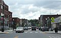
Downtown Barre

See also
 In Spanish: Barre (Vermont) para niños
