
Bellevue, Western Australia facts for kids
Quick facts for kids BellevuePerth, Western Australia |
|||||||||||||||
|---|---|---|---|---|---|---|---|---|---|---|---|---|---|---|---|

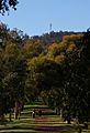
Old housing near Military Road, Bellevue
|
|||||||||||||||
| Population | 1,668 (2006 census) | ||||||||||||||
| Established | 1880s | ||||||||||||||
| Postcode(s) | 6056 | ||||||||||||||
| Location | |||||||||||||||
| LGA(s) |
|
||||||||||||||
| State electorate(s) | Midland | ||||||||||||||
| Federal Division(s) | Hasluck, Pearce | ||||||||||||||
|
|||||||||||||||
Bellevue is an eastern suburb of Perth, Western Australia in the local government areas of the City of Swan and the Shire of Mundaring. It is at the foot of the slopes of Greenmount, a landmark on the Darling Scarp that is noted in the earliest of travel journals of the early Swan River Colony.
Contents
Community
Bellevue has been dissected by the Roe Highway, railway, and substantial changes in the eastern parts of Midland. The Bellevue Primary School was closed and amalgamated with the Koongamia Primary School to form the new Clayton View Primary School slightly up the hill towards Greenmount.
It was the location of the original offices of what became the Mundaring Shire Council. It was also the location of the Catholic Church that preceded the St Anthony's church in Greenmount.
A significant point of contact in the twentieth century for the local community was the Darling Range Hotel.
Geography
Bellevue is bounded by the Helena River to the south, Great Eastern Highway to the north and Military Road and Cowie Close to the west. The suburb is an even mix of residential, industrial and parkland (mainly along the Helena River).
Being at the eastern part of the Swan Coastal Plain, Bellevue is also at the foot of the Darling Scarp with Greenmount Hill as the point of access to the region to the east.
Change
Bellevue has changed over the duration of its existence due to a number of factors - the extensive claypits of the early twentieth century (most having been since filled in),and the industrial locations adjacent to the railway lines.
The creation of the standard gauge railway and the removal of the railway station in the mid-1960s removed it from the railway map. Construction of the Roe Highway embankment in the western part removed a section of the suburb. The Midland Military Markets were located in the west of the suburb, but were destroyed by a fire in April 2007.
Images for kids
-
Eastern Rail reserve (first line) in Bellevue. Looking east from near the site of the Bellevue station, behind is Greenmount.

