
Belmont, California facts for kids
Quick facts for kids
Belmont, California
|
||
|---|---|---|
| City of Belmont | ||
 |
||
|
||

Location of Belmont in San Mateo County, California
|
||

Belmont, California
Location in the United States
|
||
| Country | United States | |
| State | California | |
| County | San Mateo | |
| Incorporated | October 29, 1926 | |
| Area | ||
| • Total | 4.64 sq mi (12.01 km2) | |
| • Land | 4.63 sq mi (11.99 km2) | |
| • Water | 0.01 sq mi (0.02 km2) 0.19% | |
| Elevation | 43 ft (13 m) | |
| Population
(2020)
|
||
| • Total | 28,335 | |
| • Density | 6,119.87/sq mi (2,363.11/km2) | |
| Time zone | UTC-8 (Pacific) | |
| • Summer (DST) | UTC-7 (PDT) | |
| ZIP code |
94002
|
|
| Area code | 650 | |
| FIPS code | 06-05108 | |
| GNIS feature IDs | 1658029, 2409826 | |


Belmont is an affluent city in San Mateo County in the U.S. state of California. It is in the San Francisco Bay Area, on the San Francisco Peninsula about halfway between San Francisco and San Jose. Known for its wooded hills, views of the San Francisco Bay and stretches of open space, Belmont is a quiet residential community in the midst of the culturally and technologically rich Bay Area. It was originally part of Rancho de las Pulgas, for which one of its main roads, the Alameda de las Pulgas, is named. The city was incorporated in 1926. Its population was 28,335 at the 2020 census.
Ralston Hall is a historic landmark built by Bank of California founder William Chapman Ralston on the campus of Notre Dame de Namur University, and is also home to Notre Dame High School. It was built around a villa formerly owned by Count Leonetto Cipriani, an Italian aristocrat. The locally famous "Waterdog Lake" is also located in the foothills and highlands of Belmont. A surviving structure from the Panama-Pacific International Exposition is on Belmont Avenue (another is the Palace of Fine Arts in San Francisco). The building was brought to Belmont by E.D. Swift shortly after the exposition closed in 1915.
The city is bordered by San Mateo to the north, Half Moon Bay to the west, Redwood Shores to the east, and San Carlos to the south.
Belmont has a smoking ordinance, passed in January 2009, which bans smoking in all businesses and multi-story apartments and condominiums; the ordinance has been described as one of the strictest in the nation.
Contents
Etymology
The name seems to derive from the Italian "bel monte," which means "beautiful mountain." It was allegedly named such because of its "symmetrically rounded eminence" nearby.
Geography

Belmont is located at 37°31′5″N 122°17′30″W / 37.51806°N 122.29167°W (37.518087, -122.291673).
According to the United States Census Bureau, the city has a total area of 4.6 square miles (12 km2) of which 4.6 square miles (12 km2) is land and 0.19% is water.
Demographics
| Historical population | |||
|---|---|---|---|
| Census | Pop. | %± | |
| 1880 | 202 | — | |
| 1930 | 984 | — | |
| 1940 | 1,229 | 24.9% | |
| 1950 | 5,567 | 353.0% | |
| 1960 | 15,996 | 187.3% | |
| 1970 | 23,538 | 47.1% | |
| 1980 | 24,505 | 4.1% | |
| 1990 | 24,127 | −1.5% | |
| 2000 | 25,123 | 4.1% | |
| 2010 | 25,835 | 2.8% | |
| 2020 | 28,335 | 9.7% | |
| U.S. Decennial Census | |||
2010
At the 2010 census Belmont had a population of 25,835. The population density was 5,579.8 people per square mile (2,154.4/km2). The racial makeup of Belmont was 17,455 (67.6%) White, 420 (1.6%) African American, 72 (0.3%) Native American, 5,151 (19.9%) Asian, 198 (0.8%) Pacific Islander, 964 (3.7%) from other races, and 1,572 (6.1%) from two or more races. Hispanic or Latino of any race were 2,977 persons (11.5%).
The census reported that 25,321 people (98.0% of the population) lived in households, 394 (1.5%) lived in non-institutionalized group quarters, and 120 (0.5%) were institutionalized.
There were 10,575 households, 3,251 (30.7%) had children under the age of 18 living in them, 5,630 (53.2%) were opposite-sex married couples living together, 830 (7.8%) had a female householder with no husband or wife present, 391 (3.7%) had a male householder with no wife or husband present. There were 510 (4.8%) unmarried opposite-sex partnerships, and 96 (0.9%) same-sex married couples or partnerships. 2,904 households (27.5%) were one person and 997 (9.4%) had someone living alone who was 65 or older. The average household size was 2.39. There were 6,851 families (64.8% of households); the average family size was 2.95.
The age distribution was 5,395 people (20.9%) under the age of 18, 1,668 people (6.5%) aged 18 to 24, 7,645 people (29.6%) aged 25 to 44, 7,284 people (28.2%) aged 45 to 64, and 3,843 people (14.9%) who were 65 or older. The median age was 40.9 years. For every 100 females, there were 95.4 males. For every 100 females age 18 and over, there were 92.5 males.
There were 11,028 housing units at an average density of 2,381.8 per square mile, of the occupied units 6,280 (59.4%) were owner-occupied and 4,295 (42.0%) were rented. The homeowner vacancy rate was 0.7%; the rental vacancy rate was 5.2%. 16,473 people (63.8% of the population) lived in owner-occupied housing units and 8,848 people (34.2%) lived in rental housing units.
2000
At the 2000 census there were 25,123 people in 10,418 households, including 6,542 families, in the city. The population density was 5,551.1 people per square mile (2,141.3/km2). There were 10,577 housing units at an average density of 2,337.1 per square mile (901.5/km2). Of the 10,418 households 26.4% had children under the age of 18 living with them, 52.6% were married couples living together, 7.1% had a female householder with no husband present, and 37.2% were non-families. 27.2% of households were one person and 7.3% were one person aged 65 or older. The average household size was 2.35 and the average family size was 2.89.
The age distribution was 19.3% under the age of 18, 6.5% from 18 to 24, 35.9% from 25 to 44, 25.1% from 45 to 64, and 13.2% 65 or older. The median age was 39 years. For every 100 females, there were 96.7 males. For every 100 females age 18 and over, there were 94.6 males.
According to a 2007 estimate, the median income for a household in the city was $99,739, and the median family income was $122,515. Males had a median income of $63,281 versus $46,957 for females. The per capita income for the city was $42,812. About 1.7% of families and 4.0% of the population were below the poverty line, including 3.2% of those under age 18 and 4.8% of those age 65 and over.
In May 2009, Belmont was ranked 11th on Forbes list of "America's Top 25 Towns to Live Well."
Sister cities
Economy
Top employers
According to the city's 2021 Comprehensive Annual Financial Report, the top employers in 2021 were:
| # | Employer | # of Employees |
|---|---|---|
| 1 | RingCentral, Inc. | 693 |
| 2 | Autobahn Motors | 129 |
| 3 | Safeway Store #1138 | 112 |
| 4 | Volkswagen Group of America | 109 |
| 5 | Nikon Precision, Inc. | 95 |
| 6 | Silverado Senior Living | 95 |
| 7 | Lunardi's Market | 82 |
| 8 | James Electronics Ltd. | 62 |
| 9 | Woodmont Real Estate Services | 57 |
| 10 | Merry Moppet Preschool, Inc. | 55 |
Education
Public schools
The public schools in Belmont are highly rated. The public schools in Belmont are run by the Belmont-Redwood Shores School District (BRSSD). The public high school in Belmont, Carlmont High School, however, is in Sequoia Union High School District.
Elementary schools
- Central
- Cipriani
- Fox
- Nesbit
Middle school
- Ralston Middle School, California Distinguished School
High school
- Carlmont High School, California Distinguished School
Private schools
- Immaculate Heart of Mary School (Preschool through 8th Grade)
- Notre Dame High School
- Charles Armstrong School specializing in language-based learning differences, such as dyslexia
Colleges
- Notre Dame de Namur University
Images for kids
-
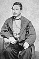
Belmont was originally part of Rancho de las Pulgas, granted to Californio politician José Darío Argüello in 1795.

See also
 In Spanish: Belmont (California) para niños
