
Benewah County, Idaho facts for kids
Quick facts for kids
Benewah County
|
||
|---|---|---|

Benewah County Courthouse
|
||
|
||

Location within the U.S. state of Idaho
|
||
 Idaho's location within the U.S. |
||
| Country | ||
| State | ||
| Founded | January 23, 1915 | |
| Seat | St. Maries | |
| Largest city | St. Maries | |
| Area | ||
| • Total | 784 sq mi (2,030 km2) | |
| • Land | 777 sq mi (2,010 km2) | |
| • Water | 7.3 sq mi (19 km2) 0.9% | |
| Population
(2010)
|
||
| • Total | 9,285 | |
| • Estimate
(2020)
|
9,430 | |
| • Density | 11.843/sq mi (4.573/km2) | |
| Time zone | UTC−8 (Pacific) | |
| • Summer (DST) | UTC−7 (PDT) | |
| Congressional district | 1st | |

Benewah County is a county located in the northwest part of the U.S. state of Idaho. As of the 2010 United States Census the county had a population of 9,285. The county seat and largest city is St. Maries, which has some area inside the Coeur d'Alene Reservation.
The county was established on January 23, 1915, of land partitioned from Kootenai County. It was named for a chief of the Coeur d'Alene Tribe. The federally recognized Coeur d'Alene Tribe is based on the Coeur d'Alene Reservation in this and neighboring Kootenai County.
Contents
Geography
According to the U.S. Census Bureau, the county has a total area of 784 square miles (2,030 km2), of which 777 square miles (2,010 km2) is land and 7.3 square miles (19 km2) (0.9%) is water. It is the northern part of the Palouse, a wide and rolling prairie-like region of the middle Columbia basin.
Adjacent counties
- Kootenai County – north
- Shoshone County – east
- Latah County – south
- Whitman County, Washington – southwest
- Spokane County, Washington – northwest
Major highways
 – US 95
 – SH-3
 – SH-5
 – SH-6
 – SH-58
 – SH-60
National protected area
- St. Joe National Forest (part)
State protected areas
Demographics
| Historical population | |||
|---|---|---|---|
| Census | Pop. | %± | |
| 1920 | 6,997 | — | |
| 1930 | 6,371 | −8.9% | |
| 1940 | 7,332 | 15.1% | |
| 1950 | 6,173 | −15.8% | |
| 1960 | 6,036 | −2.2% | |
| 1970 | 6,230 | 3.2% | |
| 1980 | 8,292 | 33.1% | |
| 1990 | 7,937 | −4.3% | |
| 2000 | 9,171 | 15.5% | |
| 2010 | 9,285 | 1.2% | |
| 2020 (est.) | 9,430 | 1.6% | |
| US Decennial Census 1790–1960 1900–1990 1990–2000 2010–2020 |
|||
2010 census
As of the 2010 United States Census, there were 9,285 people, 3,837 households, and 2,571 families in the county. The population density was 12.0 inhabitants per square mile (4.6/km2). There were 4,629 housing units at an average density of 6.0 per square mile (2.3/km2). The racial makeup of the county was 86.6% white, 8.7% Native American, 0.3% black or African American, 0.3% Asian, 0.1% Pacific islander, 0.5% from other races, and 3.6% from two or more races. Those of Hispanic or Latino origin made up 2.5% of the population. In terms of European ancestry, 23.7% were German, 17.5% were Irish, 14.6% were English, 7.1% were Norwegian, and 3.4% were American.
Of the 3,837 households, 29.0% had children under the age of 18 living with them, 52.8% were married couples living together, 9.3% had a female householder with no husband present, 33.0% were non-families, and 27.3% of all households were made up of individuals. The average household size was 2.40 and the average family size was 2.90. The median age was 44.8 years.
The median income for a household in the county was $37,500 and the median income for a family was $41,759. Males had a median income of $37,214 versus $22,348 for females. The per capita income for the county was $18,312. About 11.2% of families and 15.2% of the population were below the poverty line, including 21.6% of those under age 18 and 5.6% of those age 65 or over.
Communities
| Year | Democrat | Republican |
|---|---|---|
| 2012 | 29.96% 1,164 | 66.82% 2,596 |
| 2008 | 33.79% 1,407 | 63.54% 2,646 |
| 2004 | 28.35% 1,148 | 69.70% 2,823 |
| 2000 | 24.27% 895 | 70.68% 2,606 |
Cities
Census-designated places
Unincorporated communities
Images for kids
-
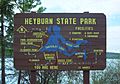
Heyburn State Park information sign
-
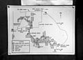
Map of McCroskey State Park


See also
 In Spanish: Condado de Benewah para niños
