Berkeley Heights, New Jersey facts for kids
Quick facts for kids
Berkeley Heights, New Jersey
|
||
|---|---|---|
|
Township
|
||
| Township of Berkeley Heights | ||
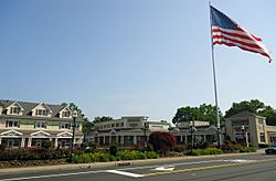
Heritage Square Shopping Center
|
||
|
||
| Motto(s):
"Where Tradition Meets Tomorrow."
|
||
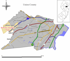
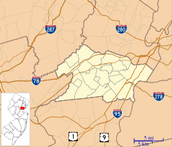
Map of Berkeley Heights in Union County. Inset: Location of Union County highlighted in the State of New Jersey.
|
||
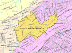
Census Bureau map of Berkeley Heights, New Jersey
|
||
| Country | ||
| State | ||
| County | ||
| Incorporated | November 8, 1809 (as New Providence Township) | |
| Renamed | November 6, 1951 (as Berkeley Heights Township) | |
| Named for | John Berkeley, 1st Baron Berkeley of Stratton | |
| Government | ||
| • Type | Faulkner Act (mayor–council–administrator) | |
| • Body | Township Council | |
| Area | ||
| • Total | 6.26 sq mi (16.21 km2) | |
| • Land | 6.22 sq mi (16.11 km2) | |
| • Water | 0.04 sq mi (0.10 km2) 0.59% | |
| Area rank | 251st of 565 in state 6th of 21 in county |
|
| Elevation | 394 ft (120 m) | |
| Population | ||
| • Total | 13,183 | |
| • Estimate
(2019)
|
13,363 | |
| • Rank | 189th of 566 in state 15th of 21 in county |
|
| • Density | 2,122.4/sq mi (819.5/km2) | |
| • Density rank | 283rd of 566 in state 20th of 21 in county |
|
| Time zone | UTC−05:00 (Eastern (EST)) | |
| • Summer (DST) | UTC−04:00 (Eastern (EDT)) | |
| ZIP Code |
07922
|
|
| Area code(s) | 908 | |
| FIPS code | 3403905320 | |
| GNIS feature ID | 0882218 | |
| Website | ||
Berkeley Heights is a township in Union County, New Jersey, United States. A bedroom community in northern-central New Jersey, the township is nestled within the Raritan Valley region in the New York metropolitan area. As of the 2010 United States Census, the township's population was 13,183, reflecting a decline of 224 (-1.7%) from the 13,407 counted in the 2000 Census, which had in turn increased by 1,427 (+11.9%) from the 11,980 counted in the 1990 Census.
Berkeley Heights was originally incorporated as New Providence Township by the New Jersey Legislature on November 8, 1809, from portions of Springfield Township, while the area was still part of Essex County. New Providence Township became part of the newly formed Union County at its creation on March 19, 1857. Portions of the township were taken on March 23, 1869, to create Summit, and on March 14, 1899, to form the borough of New Providence. On November 6, 1951, the name of the township was changed to Berkeley Heights, based on the results of a referendum held that day. The township was named for John Berkeley, 1st Baron Berkeley of Stratton, one of the founders of the Province of New Jersey.
The township has been ranked as one of the state's highest-income communities. Based on data from the American Community Survey for 2013–2017, township residents had a median household income of $147,614, ranked 15th in the state among municipalities with more than 10,000 residents, almost double the statewide median of $76,475.
In Money magazine's 2013 Best Places to Live rankings, Berkeley Heights was ranked 6th in the nation, the highest among the three places in New Jersey included in the top 50 list. The magazine's 2007 list had the township ranked 45th out of a potential 2,800 places in the United States with populations above 7,500 and under 50,000.
In its 2010 rankings of the "Best Places to Live", New Jersey Monthly magazine ranked Berkeley Heights as the 19th best place to live in New Jersey. In its 2008 rankings of the "Best Places To Live" New Jersey Monthly magazine ranked Berkeley Heights as the 59th best place to live in New Jersey.
Contents
History
The Lenape Native Americans were known to inhabit the region, including the area now known as Berkeley Heights, dating back to the 1524 voyage of Giovanni da Verrazzano to what is now the lower New York Bay.
The earliest construction in Berkeley Heights began in an area that is now part of the 1,960 acres (7.9 km2) Watchung Reservation, a Union County park that includes 305 acres (1.23 km2) of the township.
The first European settler was Peter Willcox, who received a 424 acres (1.72 km2) land grant in 1720 from the Elizabethtown Associates. This group bought much of northern New Jersey from the Lenape in the late 17th century. Willcox built a grist and lumber mill across Green Brook.
In 1793, a regional government was formed. It encompassed the area from present-day Springfield Township, Summit, New Providence, and Berkeley Heights, and was called Springfield Township. Growth continued in the area, and by 1809, Springfield Township divided into Springfield Township and New Providence Township, which included present day Summit, New Providence, and Berkeley Heights.
In 1845, Willcox's heirs sold the mill to David Felt, a paper manufacturer from New York. Felt built a small village around the mill aptly named Feltville. It included homes for workers and their families, dormitories, orchards, a post office and a general store with a second floor church.
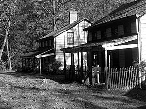
In 1860, Feltville was sold to sarsaparilla makers. Other manufacturing operations continued until Feltville went into bankruptcy in 1882. When residents moved away, the area became known as Deserted Village. Village remains consist of seven houses, a store, the mill and a barn. Deserted Village is listed on the National Register of Historic Places and is undergoing restoration by the Union County Parks Department. Restoration grants of almost $2 million were received from various state agencies. Deserted Village, in the Watchung Reservation, is open daily for unguided walking tours during daylight hours.
On March 23, 1869, Summit Township (now the City of Summit) seceded from New Providence Township. On March 14, 1899, the Borough of New Providence seceded from New Providence Township. Present day Berkeley Heights remained as New Providence Township. Many of the townships and regional areas in New Jersey were separating into small, locally governed communities at that time due to acts of the New Jersey Legislature that made it economically advantageous for the communities to due so.
Due to confusion between the adjacent municipalities of the Borough of New Providence and the Township of New Providence, the township conducted a referendum in 1952 and voted to change the name to Berkeley Heights Township. The origin of the township's name has never been fully established, but is believed to have been taken from an area of town that was referred to by this moniker, which itself was assumed to be derived from Lord John Berkeley, who was co-proprietor of New Jersey from 1664 to 1674.
Early life in Berkeley Heights is documented in the Littell-Lord Farmhouse Museum & Farmstead (31 Horseshoe Road in Berkeley Heights), an 18-acre (73,000 m2) museum surrounding two houses, one of which was built in the 1750s and the other near the start of the 19th century.
Among the exhibits are a Victorian master bedroom and a Victorian children's room, furnished with period antiques. The children's room also has reproductions of antique toys, which visitors can play with. The museum, which is on the National Register of Historic Places, also includes an outbuilding that was used as a summer kitchen, a corn crib dating to the 19th century and a spring house built around a spring and used for refrigeration. The museum is open 2-4 p.m. on the third Sunday of each month from April through December, or by appointment.
The township owes its rural character to its late development. Until 1941, when the American Telephone and Telegraph Company built the AT&T Bell Laboratories research facility in the township, it was a sleepy farming and resort community.
Berkeley Heights is host to a traditional religious procession and feast carried out by members of Our Lady of Mt. Carmel Society. The feast is capped by one of the largest fireworks shows in the state. The Feast of Mt. Carmel has been a town tradition since 1909.
In 1958, part of a Nike missile battery (NY-73) was installed in Berkeley Heights. The missiles were located in nearby Mountainside, while the radar station was installed in Berkeley Heights. It remained in operation until 1963, and remnants of the site are located adjacent to Governor Livingston High School.
Free Acres
Another early Berkeley Heights community of note is the 67-acre (270,000 m2) Free Acres, established in 1910 by Bolton Hall, a New York entrepreneur and reformer who believed in the idea of Henry George, the economist, of single taxation, under which residents pay tax to the community, which, in turn, pays a lump sum to the municipality. Among the early residents of Free Acres were the actor James Cagney and his wife, Billie.
Residents of Free Acres pay tax to their association, which maintains its streets and swimming pool, approves architectural changes to homes and pays a lump sum in taxes to the municipality.
Geography
According to the United States Census Bureau, the township had a total area of 6.266 square miles (16.229 km2), including 6.211 square miles (16.087 km2) of land and 0.055 square miles (0.142 km2) of water (0.88%). Certain portions of Berkeley Heights are located in various flood zones. Residential homes, as well as some commercial areas along Berkeley Heights' downtown Springfield Avenue area, have been known to be completely submerged in poor weather.
The township is located partially on the crest of the Second Watchung Mountain and in the Passaic River Valley, aptly named as the Passaic River forms the township's northern border. Berkeley Heights is located in northwestern Union County, at the confluence of Union, Morris, and Somerset Counties. Berkeley Heights is bordered by New Providence and Summit to the east, Scotch Plains to the southeast, Chatham to the north, Watchung to the south, and Warren Township and Long Hill Township to the west.
Unincorporated communities, localities and place names located partially or completely within the township include Benders Corners, Glenside Park, Stony Hill and Union Village.
Downtown
Downtown Berkeley Heights is located along Springfield Avenue, approximately between the intersections with Plainfield Avenue and Snyder Avenue. In addition, a post office, the Municipal Building, police station, train station, Walgreens, Stop & Shop and other shops and services are located in this downtown section.
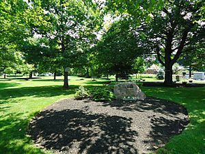
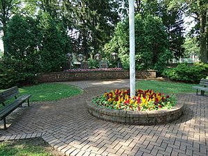
A brick walk with personalized bricks engraved with the names of many long-time Berkeley Heights residents runs from near the railroad station towards the planned New York Marts grocery store. A memorial to the victims of the September 11 terrorist attacks adjoins a wooded area alongside Park Avenue, just southwest of downtown.
Certain portions of Berkeley Heights are located in flood zones. Residential homes, as well as some commercial areas along the downtown Springfield Avenue area, are impacted by flooding.
Demographics
| Historical population | |||
|---|---|---|---|
| Census | Pop. | %± | |
| 1810 | 756 | — | |
| 1820 | 768 | 1.6% | |
| 1830 | 903 | 17.6% | |
| 1840 | 832 | −7.9% | |
| 1850 | 1,216 | 46.2% | |
| 1860 | 1,308 | 7.6% | |
| 1870 | 934 | −28.6% | |
| 1880 | 781 | −16.4% | |
| 1890 | 839 | 7.4% | |
| 1900 | 469 | −44.1% | |
| 1910 | 526 | 12.2% | |
| 1920 | 954 | 81.4% | |
| 1930 | 1,899 | 99.1% | |
| 1940 | 2,194 | 15.5% | |
| 1950 | 3,466 | 58.0% | |
| 1960 | 8,721 | 151.6% | |
| 1970 | 13,078 | 50.0% | |
| 1980 | 12,549 | −4.0% | |
| 1990 | 11,980 | −4.5% | |
| 2000 | 13,407 | 11.9% | |
| 2010 | 13,183 | −1.7% | |
| 2019 (est.) | 13,363 | 1.4% | |
| Population sources:1810-1920 1840 1850 1860-1870 1870 1880-1890 1890-1910 1910-1930 1930-1990 2000 2010 * = Lost territory in previous decade. |
|||
2020 Census
The 2020 United States census counted 13,285 people, and 3,718 families in the township. The population density was 2,135.8 per square mile. There were 4,660 households (4,484 of which were occupied).
2010 Census
As of the census of 2010, there were 13,183 people, 4,470 households, and 3,580 families residing in the township. The population density was 2,122.4 per square mile (819.5/km2). There were 4,596 housing units at an average density of 739.9 per square mile (285.7/km2)*. The racial makeup of the township was 85.64% (11,290) White, 1.49% (197) Black or African American, 0.02% (3) Native American, 10.43% (1,375) Asian, 0.00% (0) Pacific Islander, 0.75% (99) from other races, and 1.66% (219) from two or more races. [[Hispanic (U.S. Census)|Hispanic or Latino of any race were 5.12% (675) of the population.
There were 4,470 households out of which 41.7% had children under the age of 18 living with them, 71.1% were married couples living together, 6.5% had a female householder with no husband present, and 19.9% were non-families. 17.6% of all households were made up of individuals, and 10.4% had someone living alone who was 65 years of age or older. The average household size was 2.85 and the average family size was 3.26.
In the township, the population was spread out with 26.9% under the age of 18, 5.2% from 18 to 24, 20.5% from 25 to 44, 30.0% from 45 to 64, and 17.5% who were 65 years of age or older. The median age was 43.5 years. For every 100 females there were 90.6 males. For every 100 females ages 18 and old there were 87.5 males.
The Census Bureau's 2006-2010 American Community Survey showed that (in 2010 inflation-adjusted dollars) median household income was $132,089 (with a margin of error of +/- $11,331) and the median family income was $150,105 (+/- $17,689). Males had a median income of $105,733 (+/- $10,158) versus $55,545 (+/- $11,985) for females. The per capita income for the township was $56,737 (+/- $5,135). About 0.8% of families and 1.4% of the population were below the poverty line, including 1.7% of those under age 18 and 0.7% of those age 65 or over.
Parks and recreation
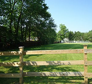
Located in Berkeley Heights are many municipal parks, including the largest one, Columbia Park (located along Plainfield Avenue). Columbia Park boasts tennis courts, two baseball fields, basketball courts, and a large children's play area. It is operated by the Recreation Commission. In addition to those located at each of the schools, athletic fields are located along Horseshoe Road (Sansone Field) and along Springfield Avenue (Passaic River Park).
There are three swimming clubs located in Berkeley Heights: the Berkeley Heights Community Pool (Locust Avenue), the Berkeley Swim Club (behind Columbia Park), and Berkeley Aquatic (off of Springfield Avenue). In May 2013, by a 4-1 margin, township voters rejected a proposed new location for the Berkeley Aquatic Club that would have been situated just across the township border with Warren Township.
The Watchung Reservation and Passaic Valley Park are in the township and maintained by Union County. The Watchung Reservation has hiking trails, horseback riding trails, a large lake (Lake Surprise), the deserted community of Feltville and picnic areas.
Economy
Berkeley Heights is home to the Murray Hill Bell Labs headquarters of Nokia. The transistor, solar cell, laser, and AT&T Unix (precursor to Unix) were invented in this facility when it was part of AT&T.
Berkeley Heights is also home to L'Oréal USA's New Jersey headquarters.
In 2003, Summit Medical Group signed a lease to build its main campus on the site of the former D&B Corporation headquarters located on Diamond Hill Road. Summit Medical Group merged with CityMD in 2019 to form Summit Health, which has 2,500 health care providers in the New York City area and Oregon.
Education
Public schools
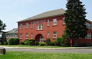
The Berkeley Heights Public Schools serves students in pre-kindergarten through twelfth grade. As of the 2018–19 school year, the district, comprised of six schools, had an enrollment of 2,582 students and 224.3 classroom teachers (on an FTE basis), for a student–teacher ratio of 11.5:1. Schools in the district (with 2018–19 enrollment data from the National Center for Education Statistics) are Mary Kay McMillin Early Childhood Center with 304 students in PreK-1st grade, Thomas P. Hughes Elementary School with 273 students in grades 2-5, Mountain Park Elementary School with 230 students in grades 2-5, William Woodruff Elementary School with 201 students in grades 2-5, Columbia Middle School with 601 students in grades 6-8, Governor Livingston High School with 965 students in grades 9-12.
The district's high school serves public school students of Berkeley Heights, along with approximately 300 students from neighboring Borough of Mountainside who are educated at the high school as part of a sending/receiving relationship with the Mountainside School District that is covered by an agreement that runs through the end of 2021–22 school year. Governor Livingston provides programs for deaf, hard of hearing and cognitively-impaired students in the district and those who are enrolled from all over north-central New Jersey who attend on a tuition basis.
Governor Livingston was the 30th-ranked public high school in New Jersey out of 305 schools statewide in New Jersey Monthly magazine's September 2018 cover story on the state's "Top Public High Schools".
Private schools
There are four private pre-kindergarten schools in Berkeley Heights. The Westminster Nursery School is located at the corner of Plainfield Avenue and Mountain Avenue, the Union Village Nursery is located bordering Warren Township at the corner of Mountain Avenue and Hillcrest Road, the Diamond Hill Montessori is located along Diamond Hill Road opposite McMane Avenue and Primrose on Springfield Avenue.
FlexSchool, a private school for twice-exceptional and gifted fifth through twelfth graders, is the only private secondary school in Berkeley Heights.
Infrastructure
Transportation
Roads and highways
As of May 2010[update], the township had a total of 65.73 miles (105.78 km) of roadways, of which 50.46 miles (81.21 km) were maintained by the municipality, 12.11 miles (19.49 km) by Union County and 3.16 miles (5.09 km) by the New Jersey Department of Transportation.
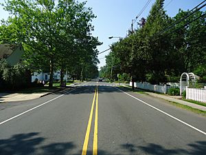
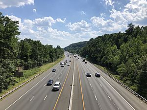
The most significant highway serving Berkeley Heights is Interstate 78, which runs from New York City to Pennsylvania. Other major roads in Berkeley Heights include Springfield Avenue, Mountain Avenue, Snyder Avenue, Plainfield Avenue, and Park Avenue. Springfield Avenue and Mountain Avenue run east–west, Snyder Avenue and Plainfield Avenue run north–south, while Park Avenue runs northeast–southwest. Each of these roads is heavily residential (except parts of Springfield Avenue) with only one travel lane in each direction.
Public transportation
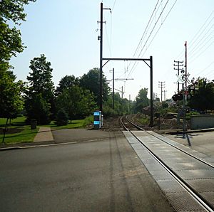
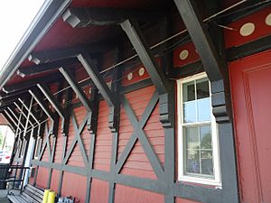
NJ Transit provide service at the Berkeley Heights station serving Hoboken Terminal, Newark Broad Street Station, and Penn Station in Midtown Manhattan as part of the Gladstone Branch. Berkeley Heights is also in close proximity of the Summit train station, which provides frequent commuter rail service to New York City.
NJ Transit offers local bus service on the 986 route. Lakeland Bus Lines also provides commuter bus service to the Port Authority Bus Terminal in Midtown Manhattan and a connection to Gladstone.
Freight rail transportation had been provided by Norfolk Southern via off-peak use of New Jersey Transit's Gladstone Branch line until a final run on November 7, 2008, after 126 years of service. The Berkeley Heights plant of Reheis Chemical located on Snyder Avenue was the last freight customer on the Gladstone Branch, receiving shipments of hydrochloric acid.
Newark Liberty International Airport is approximately 18 miles (29 km) east of Berkeley Heights.
Healthcare
The Summit Medical Group, located on Mountain Avenue, is the main medical facility in Berkeley Heights.
Public library
Originally opened in 1949, Berkeley Heights Public Library closed its doors to the public at its 290 Plainfield Avenue location. It was moved to a temporary home at 110 Roosevelt Avenue, otherwise known as the Little Flower Church Rectory. The library is a member of the Infolink region of libraries, the Morris Union Federation (MUF) and the Middlesex Union Reciprocal Agreement Libraries (MURAL).
Notable people
People who were born in, residents of, or otherwise closely associated with Berkeley Heights include:
- Al Aronowitz (1928–2005), rock journalist who claimed that Bob Dylan wrote his famous "Mr. Tambourine Man" in Aronowitz's former Berkeley Heights home.
- Steve Balboni (born 1957), former New York Yankee.
- BEDlight for BlueEYES, an alternative rock band.
- Dennis Boutsikaris (born 1952), actor.
- James Cagney (1899–1986), actor who resided in Free Acres.
- David Cantor (born 1954), actor.
- John Carlini, jazz guitarist.
- Ronald Chen (born 1958), former Public Advocate of New Jersey, nominated to fill the position on January 5, 2006, by Governor of New Jersey Jon Corzine.
- Christopher Durang (born 1949), playwright and actor.
- Cathy Engelbert (born 1965), CEO of Deloitte, first female CEO of a major U.S. accounting firm.
- Lauren Beth Gash (born 1960), lawyer and politician who served in the Illinois House of Representatives from 1993 to 2001.
- Gina Genovese (born 1959), businesswoman and politician who has served as mayor of Long Hill Township.
- Scott M. Gimple (born 1971), television and comic book writer.
- Bolton Hall (1854–1938), founder of Free Acres.
- MacKinlay Kantor (1904–1977), screenwriter and novelist, formerly resided in Free Acres.
- Harry Kelly (1871–1953), anarchist.
- Victor Kilian (1891–1979), actor.
- P. F. Kluge (born 1942), novelist.
- John R. Pierce (1910–2002), communications engineer, scientist, and father of the communications satellite.
- Jerry Ragonese (born 1986), professional lacrosse player for the Redwoods Lacrosse Club of the Premier Lacrosse League.
- Juliette Reilly (born 1993), singer and YouTube personality.
- Dennis Ritchie (1941–2011), creator of the C programming language and co-inventor of the UNIX operating system.
- Bertha Runkle (1879–1958), novelist and playwright.
- Peter Sagal (born 1965), playwright, screenwriter, actor, and host of the National Public Radio game show Wait Wait... Don't Tell Me!.
- Jill Santoriello, playwright and author of the new Broadway musical A Tale of Two Cities, graduated from Governor Livingston High School.
- Thorne Smith (1892–1934), author.
- Zenon Snylyk (1923–2002), soccer player.
- Betty Wilson (born 1932), politician who served in the New Jersey General Assembly from 1974 to 1976.
See also
 In Spanish: Berkeley Heights para niños


