
Bethania, Queensland facts for kids
Quick facts for kids BethaniaLogan City, Queensland |
|||||||||||||||
|---|---|---|---|---|---|---|---|---|---|---|---|---|---|---|---|

Albert Street, 2014
|
|||||||||||||||

Bethania
Location in Queensland
|
|||||||||||||||
| Population | 5,385 (2016 census) | ||||||||||||||
| • Density | 928/km2 (2,400/sq mi) | ||||||||||||||
| Postcode(s) | 4205 | ||||||||||||||
| Area | 5.8 km2 (2.2 sq mi) | ||||||||||||||
| Time zone | AEST (UTC+10:00) | ||||||||||||||
| Location | 30 km (19 mi) from Brisbane CBD | ||||||||||||||
| LGA(s) | Logan City | ||||||||||||||
| State electorate(s) | Waterford | ||||||||||||||
| Federal Division(s) | Forde | ||||||||||||||
|
|||||||||||||||
Bethania is a suburb in the City of Logan, Queensland, Australia. In the 2016 census Bethania had a population of 5,385 people.
Demographics
In the 2011 census, Bethania recorded a population of 4,590 people, 53.3% female and 46.7% male. The median age of the Bethania population was 41 years, 4 years above the national median of 37. 68.7% of people living in Bethania were born in Australia. The other top responses for country of birth were England 6.6%, New Zealand 6%, Scotland 1.4%, Philippines 0.9%, Germany 0.9%. 86.9% of people spoke only English at home; the next most common languages were 0.8% Spanish, 0.5% German, 0.5% Hindi, 0.4% Tagalog, 0.3% Samoan.
History

Bethania was founded by Germans during the 1860s and is home to many different nationalities. By 1866 a small township had developed. It is believed the name is derived from Bethany, the biblical village in Israel.
A Lutheran church was built in 1864 made from slabs on what is now the railway line. A cemetery was established beside the church with graves from 1866. In 1872 the present church was built close to the first church (27°41′29″S 153°09′41″E / 27.691361°S 153.161392°E). The road to the church became known as Church Road.
The first railway bridge was destroyed by flood in 1887. A new concrete, steel and timber bridge lasted until 1972 when it was replaced by a pre-stressed concrete bridge.
The suburb was affected badly by the 1974 Brisbane flood. Duck Island became part of the suburb when part of the river was silted up. Sand and gravel has been mined from the alluvial deposits in recent years.
Heritage listings
Bethania has a number of heritage-listed sites, including:
- Church Road: Bethania Lutheran Church
Transport
Bethania railway station provides access to regular Queensland Rail City network services to Brisbane and Beenleigh.
Education
Bethania Lutheran Primary School is a private primary (Prep-6) school for boys and girls at 66 Glastonbury Drive (27°41′39″S 153°09′28″E / 27.6943°S 153.1578°E). In 2018, the school had an enrolment of 287 students with 25 teachers (21 full-time equivalent) and 16 non-teaching staff (11 full-time equivalent).
Images for kids
-
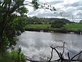
The Logan River and lower grazing lands prone to floods seen from Meadowbrook, 2013

