
Biratnagar facts for kids
Quick facts for kids
Biratnagar
बिराटनगर
Gograha (Old Name)
|
|
|---|---|

View of Sunrise in Biratnagar
|
|
| Nickname(s):
Industrial capital city of Nepal
|
|
| Nepal | Nepal |
| Development Region | Eastern |
| Zone | Koshi |
| District | Morang |
| Area | |
| • Total | 58.48 km2 (22.58 sq mi) |
| Elevation | 80 m (260 ft) |
| Population
(2011)
|
|
| • Total | 201.125 |
| Time zone | UTC+5:45 (Nepal Standard Time) |
| Postal code |
56600, 56613, 56614
|
| Area code(s) | 021 |
| Website | biratnagar.gov.np biratnagarmun.gov.np |
Biratnagar (Nepali: विराटनगर) is a major industrial city and the second largest city in Nepal. Its geographical location is 26°28'60"N 87°16'60"E. The city is located in the Morang District in the Kosi Zone of Nepal.
Related pages
Images for kids
-
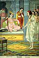
Biratnagar is named after King Virata
-
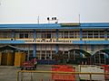
Biratnagar Airport Terminal
-
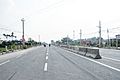
Koshi Highway across Biratnagar
-
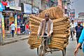
Rickshaw in Biratnagar
-
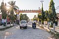
Morang Vyapar Sangh Gate
-
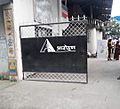
Entrance of Gurukul Theatre in Biratnagar
-
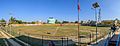
Sahid Rangsala


See also
 In Spanish: Biratnagar para niños

All content from Kiddle encyclopedia articles (including the article images and facts) can be freely used under Attribution-ShareAlike license, unless stated otherwise. Cite this article:
Biratnagar Facts for Kids. Kiddle Encyclopedia.