Black Rock, South Australia facts for kids
Quick facts for kids Black RockSouth Australia |
|||||||||||||||
|---|---|---|---|---|---|---|---|---|---|---|---|---|---|---|---|

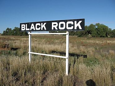
Black Rock Station Sign
|
|||||||||||||||
| Population | 36 (2016 census) | ||||||||||||||
| Elevation | 435 m (1,427 ft)(railway station) | ||||||||||||||
| Location |
|
||||||||||||||
| LGA(s) | District Council of Orroroo Carrieton | ||||||||||||||
| State electorate(s) | Stuart | ||||||||||||||
| Federal Division(s) | Grey | ||||||||||||||
|
|||||||||||||||
| Footnotes | Adjoining localities | ||||||||||||||
Black Rock (formerly known as Dalton) is a hamlet in South Australia on the Black Rock Plains at the intersection of the south–north RM Williams Way (B80) between Jamestown and Orroroo and the west–east Wilmington–Ucolta Road (B56) to Peterborough, in the Mid North section of the state.
It is also the site (and name of) a former railway siding on the now removed Peterborough–Quorn railway line.
Located 19 km south east of Orroroo, the town was originally laid out as "Dalton" and proclaimed on 15 December 1881. It is named after a nearby hill identified by Captain E C Frome in 1842. The town was renamed "Black Rock" in 1940
The town
Whilst people still live in Black Rock, the town is nearly empty.
A number of buildings still stand, including the Black Rock Hotel. This last traded commercially in the early 1980s.


