
Bonne Terre, Missouri facts for kids
Quick facts for kids
Bonne Terre, Missouri
|
|
|---|---|
|
City
|
|
.jpg)
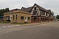
Bonne Terre, Missouri, May 2019
|
|
| Motto(s):
Good Earth, Good People
|
|

Location of Bonne Terre, Missouri
|
|
| Country | United States |
| State | Missouri |
| County | St. Francois |
| Area | |
| • Total | 4.10 sq mi (10.63 km2) |
| • Land | 4.07 sq mi (10.54 km2) |
| • Water | 0.04 sq mi (0.09 km2) |
| Elevation | 830 ft (253 m) |
| Population
(2010)
|
|
| • Total | 6,864 |
| • Estimate
(2019)
|
7,118 |
| • Density | 1,749.75/sq mi (675.55/km2) |
| Time zone | UTC-6 (Central (CST)) |
| • Summer (DST) | UTC-5 (CDT) |
| Area code(s) | 573 Exchange: 358 |
| FIPS code | 29-07102 |
| GNIS feature ID | 0755802 |
| Website | City of Bonne Terre, Missouri |
Bonne Terre ( bon-TAIR) is a city in St. Francois County, Missouri, United States with a population of 6,864 at the 2010 census. Situated in the Southeast Missouri Lead District, lead mining shaped the history and character of the area from the earliest French settlers in the 1720´s until today, even though Bonne Terre Mine established by St. Joseph lead mining company in 1864 closed in 1962. Mine tailing piles eroded, and contaminated the area as dust, posing residential hazards or were washed into the Big River. Only in 1992, the Bonne Terre Mine Tailings Site was listed as a Superfund Site; as of 2022 remediation is still ongoing.
The Bonne Terre Depot from 1909, the St. Joe Lead Company Administration Building and the Bonne Terre Mine, are listed on the National Register of Historic Places. The latter is spring water filled and became a scuba diving attraction.
Contents
History
The community was originally settled by the French in 1720 after lead ore was discovered. It was called La Bonne Terre, "the good soil." Bonne Terre was platted as a town in 1880.
The Bonne Terre Depot, Bonne Terre Mine, and St. Joe Lead Company Administration Building are listed on the National Register of Historic Places.
Lead mining
Bonne Terre was long an active surface lead miners camp. Major lead mining operations from the 1870s included the Desloge Lead Company, St. Joe Lead and Doe Run. The Desloge mines in Bonne Terre were started by Firmin V. Desloge, and above-ground works were bounded approximately by present-day Division Street on the west, Benham Street on the south, Route 67 on the east, and the township line to the north.
Geography
According to the United States Census Bureau, the city has a total area of 4.10 square miles (10.62 km2), of which 4.04 square miles (10.46 km2) is land and 0.06 square miles (0.16 km2) is water.
Demographics
| Historical population | |||
|---|---|---|---|
| Census | Pop. | %± | |
| 1890 | 3,719 | — | |
| 1920 | 3,815 | — | |
| 1930 | 4,021 | 5.4% | |
| 1940 | 3,730 | −7.2% | |
| 1950 | 3,533 | −5.3% | |
| 1960 | 3,219 | −8.9% | |
| 1970 | 3,622 | 12.5% | |
| 1980 | 3,797 | 4.8% | |
| 1990 | 3,871 | 1.9% | |
| 2000 | 4,039 | 4.3% | |
| 2010 | 6,864 | 69.9% | |
| 2019 (est.) | 7,118 | 3.7% | |
| U.S. Decennial Census | |||
2010 census
As of the census of 2010, there were 6,864 people, 1,634 households, and 1,063 families living in the city. The population density was 1,699.0 inhabitants per square mile (656.0/km2). There were 1,882 housing units at an average density of 465.8 per square mile (179.8/km2). The racial makeup of the city was 79.60% White, 18.72% Black or African American, 0.34% Native American, 0.20% Asian, 0.10% Native Hawaiian or Pacific Islander, 0.10% from other races, and 0.93% from two or more races. Hispanic or Latino of any race were 1.35% of the population.
There were 1,634 households, of which 38.2% had children under the age of 18 living with them, 43.9% were married couples living together, 15.9% had a female householder with no husband present, 5.3% had a male householder with no wife present, and 34.9% were non-families. 29.5% of all households were made up of individuals, and 13.1% had someone living alone who was 65 years of age or older. The average household size was 2.54 and the average family size was 3.14.
The median age in the city was 34.2 years. 17.3% of residents were under the age of 18; 12.8% were between the ages of 18 and 24; 37.1% were from 25 to 44; 22.3% were from 45 to 64; and 10.4% were 65 years of age or older. The gender makeup of the city was 67.1% male and 32.9% female.
Attractions
Bonne Terre is home to the Bonne Terre Mine site. The mine was the first in the network of St. Joe Minerals lead mines that led to Missouri producing 70 percent of the United States' lead in the Southeast Missouri Lead District. The mine was a target of Price's Raid during the American Civil War. This mine is open for tours and is also known as a scuba diving attraction.
Bonne Terre is also home to The Space Museum. The museum is open 9 a.m. to 5 p.m. Friday, Saturday and Monday; and 1 to 5 p.m. Sunday. The museum has a flag that went to the moon with astronaut Eugene Cernan on Apollo 17.
Education
North St. Francois County R-I School District operates three schools at Bonne Terre: North County Primary School, North Co. Sr. High School, and Unitec Career Center.
The town has a lending library, the Bonne Terre Memorial Library. The Limestone building in the style of Italian renaissance was built in 1905 by St. Joe Lead Company director Dwight Jones.
Notable people
- Will Compton
- Firmin V. Desloge
- Ray Sanders
- Jon Simmons
Images for kids
-
The Space Museum, exterior view, May 2019
.jpg)
See also
 In Spanish: Bonne Terre (Misuri) para niños
