
Bourne, Lincolnshire facts for kids
Quick facts for kids Bourne |
|
|---|---|
 Bourne town centre |
|

Bourne
|
|
| Population | 13,961 |
| OS grid reference | TF094202 |
| • London | 90 mi (140 km) S |
| Civil parish |
|
| District |
|
| Shire county | |
| Region | |
| Country | England |
| Sovereign state | United Kingdom |
| Post town | BOURNE |
| Postcode district | PE10 |
| Dialling code | 01778 |
| Police | Lincolnshire |
| Fire | Lincolnshire |
| Ambulance | East Midlands |
| EU Parliament | East Midlands |
| UK Parliament |
|
Bourne is a market town and civil parish in the South Kesteven district of Lincolnshire, England. It lies on the eastern slopes of the limestone Kesteven Uplands and the western edge of the Fens, 11 miles (18 km) north-east of Stamford, 12 miles (19 km) west of Spalding and 17 miles (27 km) north of Peterborough. The population at the 2011 census was 14,456. A 2019 estimate put it at 16,780.
Contents
The town

The town is located on a Roman road now known as King Street and was built around the natural springs, hence the name "Bourne" (or "Bourn", as the town was originally known) which derives from the Anglo-Saxon meaning "water" or "stream". It lies on the intersection of the A15 and the A151 roads. The civil parish includes the main township plus the hamlets of Cawthorpe, Dyke and Twenty. In former years Austerby was regarded as a separate settlement, with its own shops and street plan, but is now an area of Bourne known as The Austerby (52°45′47″N 0°22′12″W / 52.763°N 0.370°W).

The ecclesiastical parish of Bourne is part of the Beltisloe Deanery of the Diocese of Lincoln and is based at the Abbey Church of St Peter and St Paul, in Church Walk. The incumbent is Revd Chris Atkinson. Other religious denominations include Methodist, Baptist, United Reformed and Roman Catholic churches.
The town's economy was based on rural industries until the railway opened up a market for bottled mineral water. Although it is still focused on agriculture and food preparation for supermarkets, there are also important light engineering and tourism activities. The district has a fast-growing housing market, with considerable new building taking place in Bourne in the 2000s.
Agriculture

Sugar beet was first grown as an English crop in the Fenland east of Bourne by British Sugar Ltd. It had been developed in Germany and France in the early 19th century. Although Britain's demand for sugar was mostly fulfilled by European beet imports until shortly after 1900, the successful sugar beet production in areas such as that around Twenty, fulfilled the nation's sugar requirements during the 20th century's two world wars.
Much of Bourne's 19th-century affluence came from the corn-trade boom that followed the mechanisation of fen drainage. The production of wheat is still important. In the 21st century, hydroponic food production plants have been built on the edge of the fen.
Manufacturing


Although the Autocast foundry has closed because of the shrinking British car industry, there are a number of small machine shops and fabricators in the south and east of the town. These include Pilbeam Racing in Graham Hill Way and Trackline International, manufacturers of "crawler undercarriage systems". Bourne has two printing companies and manufacturers of double glazing and fibreglass mouldings.
Warehousing and distribution
In the same area are distribution warehouses for a large brewer and general transport and storage companies, and a game merchant operates from one of the smaller factory estates.
Retail
As well as town centre shops, there are garden centres in Cherry Holt Road, furniture and decorating shopping in Manning Road, and specialist suppliers of kitchen, decorative, catering and light engineering supplies.
History

The Ancient Woodland of Bourne Woods is still extant , although much reduced. It originally formed part of the ancient Forest of Kesteven and is now managed by the Forestry Commission.
The earliest documentary reference to Brunna, meaning stream, is from a document of 960, and the town appeared in the Domesday Book as Brune.
Bourne Abbey, (charter 1138), formerly held and maintained land in Bourne and other parishes. In later times this was known as the manor of Bourne Abbots. Whether the canons knew that name is less clear. The estate was given by the Abbey's founder, Baldwin fitz Gilbert de Clare, son of Gilbert fitz Richard, and later benefactors. The abbey was established under the Arrouaisian order. Its fundamental rule was that of Augustine and as time went on, it came to be regarded as Augustinian. The Ormulum, an important Middle English Biblical gloss, was probably written in the abbey in around 1175.
Bourne Castle was built on land that is now the Wellhead Gardens in South Street.

Bourne was an important junction on the Victorian railway system, but all such connections were severed after the Second World War (see Rail heading). The business stimulus it brought caused major development of the town, and many of the buildings around the medieval street plan were rebuilt, or at least refaced. Improved communications allowed a bottled water industry to develop, and to provide coal deliveries for the town's gas works.
The then local authority, Bourne Urban District Council, was very active in the interests of the town, taking over the gas works and the local watercress beds at times of financial difficulty and running them as commercial activities. Large numbers of good quality council houses were built by them in the early 20th century.
Bourne sent many men to both world wars, but was otherwise only lightly affected. During the Second World War a German bomber was shot down and crashed onto the Butcher's Arms public house in Eastgate. Nine people were killed, including the bomber's crew. In a separate incident, a number of bombs were dropped on the Hereward Camp approved school, a row of wooden huts adjacent to the woods that may have been mistaken for a military camp. Charles Richard Sharpe was injured in the second incident, but he was no stranger to fighting the Germans, having been awarded the Victoria Cross in the first conflict of the century.
Railways

The first local railway was the Earl of Ancaster's estate railway, which ran from the East Coast Main Line at Little Bytham, through the Grimsthorpe estate to Edenham.
Later Bourne had a railway station which was on both the Great Northern line from Essendine to Sleaford and the Midland and Great Northern Joint Railway connecting the Midlands to East Anglia. Timetabled passenger services on both these lines ceased by the end of February 1959 and the lines were closed to occasional use by the Beeching Axe. With the exception of the Red Hall, the principal station buildings were demolished in 1964, a year after the Beeching Report. The main goods shed survived, however, and remains an unusual edifice: a goods store of a wooden construction. The mechanism of the locomotive turntable is now in the Wansford depot of the Nene Valley Railway.
Shipping
The Bourne-Morton Canal or Bourne Old Eau connected the town to the sea in Roman times.
Until the mid-19th century, the present Bourne Eau was capable of carrying commercial boat traffic from the Wash coast and Spalding. This resulted from the investment following the Bourne Navigation Act of 1780. Passage became impossible once the junction of the Eau and the River Glen was converted from gates to a sluice in 1860.
Landmarks
Bourne buildings

There are currently 71 listed buildings in the parish of Bourne, the most important being Bourne Abbey and the Parish Church of St Peter and St Paul" (1138), which is the only one scheduled Grade I. The others are Grade II, the most colourful being the aptly named Red Hall (c. 1620), finished in red brick with ashlar quoins, many gabled and featuring a fine Tuscan porch. From 1860 to 1959, it was the town's railway station booking office and waiting room. At two stages, in the 1890s and 1960s, it came close to demolition but the building is now well preserved by Bourne United Charities. The former station booking office serves as the BUC's office.
Baldock's Mill (1800), once a corn-grinding water mill, together with the miller's house, has been converted by Bourne Civic Society to serve as the town's Heritage Centre. It houses many interesting artefacts, most recently a water-wheel has been installed and a newly created replica of a Charles Frederick Worth dress is on display.
The Baptist Church dates from 1835, but the church itself was established there in the 1640s. This building, the Methodist Church (1841) and the United Reformed Church (1846) are all still in active use.
Under threat
The Old Grammar School was a red-brick building with a Collyweston roof, built in the 17th century and largely rebuilt in 1738. The school closed in 1904, and the building, which stands in the Abbey churchyard, has since been used for a variety of purposes. The roof was condemned as unsafe in April 2003 but was repaired, although the building is no longer in regular use.
At the cemetery owned and run by the town council is a chapel built in 1855., In recent years, the building has not been used as a chapel, and the fabric has deteriorated. This is attributed to a lack of maintenance by the council due to financial constraints. However, the shallowness of the foundations is said to be the principal cause. The chapel now requires considerable expenditure if it is to survive, but on 23 January 2007 the town council took the decision to demolish it. In 2007, Bourne historian Rex Needle applied for and obtained a Grade II listing from the Department for Culture, Media and Sport, which secures the building from demolition for the foreseeable future. In 2008, the effort is now under way to identify a source of funding (estimated around £400,000) to render the building fit for long-term community use.
In July 2008, the Ostler Memorial in the town's cemetery, an ornate Gothic water fountain originally erected in the market place in 1860 to the memory of local benefactor John Lely Ostler (1811–59), but neglected in recent years, was also given Grade II status by the DCMS bringing the total number of listed buildings in Bourne to 71.
Nearby landmarks


- Bourne Wood; 400 acres (2 km²) of woodland which has been a resource since primeval times. There is now a sculpture trail and the wood forms part of the 19-mile Bourne Cycle Trail.
- Grimsthorpe Castle. A landed estate, large country house and tourist attraction. The castle's web site.
- Bowthorpe Oak, A tree old at the time of the Domesday survey. On private land, an admission charge is levied.
Sport
Bourne Town Football Club plays football in the United Counties Football League, whilst Bourne Cricket Club plays in the Lincolnshire ECB Premier League. These teams play their home games at the Abbey Lawn, a recreation ground privately owned by the Bourne United Charities. Also at "The Lawn" are the tennis and bowls clubs, Bourne Rugby Club is based outside the town at Milking Nook Drove. The hockey club plays elsewhere, as there is no suitable all-weather playing surface in the town. Bourne also hosts a number of other sporting clubs. The leisure centre is attached to Bourne Academy and caters for a number of indoor activities, including a swimming pool.
Motor sports

The racing-car marques English Racing Automobiles (ERA) and British Racing Motors (BRM) were both founded in Bourne by Raymond Mays, an international racing driver and designer. ERA started in 1934 and BRM's first car was unveiled in 1949 at Folkingham Airfield.
The former ERA and BRM workshops in Spalding Road are adjacent to Eastgate House, the Mays' family home in the town's Eastgate. The achievements of Raymond Mays are explored in a Memorial Room at the town's Heritage Centre (Baldock's Mill in South Street). It contains photographs, memorabilia and silverware won by BRM cars, Mays and drivers. A memorial to Raymond Mays was unveiled in South Street in 2003.
In 1975 Mike Pilbeam, BRM's former Chief Designer, set up Pilbeam Racing Designs and achieved success in hillclimbing in the 1980s and early 1990s.
Notable people
- Bourne is reputedly the birthplace of Hereward the Wake (in about 1035), although the 12th-century source of this information, De Gestis Herwardi Saxonis, refers only to his father as being "of Bourne" and to the father's house and retainers there.
- Robert Mannyng (1264–1340) is credited with putting the speech of the ordinary people of his time into recognisable form. He is better known as Robert de Brunne because of his long period of residence as a canon at Bourne Abbey. There he completed his life's work of popularising religious and historical material in a Middle English dialect that was easily understood at that time.
- William Cecil (1520–1598) became the first Lord Burghley after serving Queen Elizabeth I. He was born at a house in the centre of Bourne that is now the Burghley Arms.
- Charles Frederick Worth (1825–1895), son of a solicitor, lived at Wake House in North Street. He moved to Paris and became a renowned designer of women's fashion and the founder of haute couture. The French government awarded him the Légion d'honneur.
- Sir George White, MP for North West Norfolk, a seat he held for twelve years until he died in 1912. He was knighted for public service in 1907.
- Raymond Mays (1899–1980), son of a local businessman, was a successful motor racing driver and manufacturer.
Images for kids
-
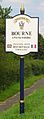
Signpost in Bourne
-
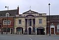
Bourne Town Hall (1821) by local architect Bryan Browning
-
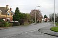
West Road


See also
 In Spanish: Bourne (Lincolnshire) para niños
