
Bradley County, Tennessee facts for kids
Quick facts for kids
Bradley County
|
||
|---|---|---|

The Bradley County courthouse in Cleveland
|
||
|
||
| Motto(s):
"Agriculture and Industry"
|
||

Location within the U.S. state of Tennessee
|
||
 Tennessee's location within the U.S. |
||
| Country | ||
| State | ||
| Founded | May 2, 1836 | |
| Named for | Edward Bradley, state legislator | |
| Seat | Cleveland | |
| Largest city | Cleveland | |
| Area | ||
| • Total | 331 sq mi (860 km2) | |
| • Land | 329 sq mi (850 km2) | |
| • Water | 2.7 sq mi (7 km2) 0.8%% | |
| Population
(2020)
|
||
| • Total | 108,620 |
|
| • Density | 330.15/sq mi (127.47/km2) | |
| Time zone | UTC−5 (Eastern) | |
| • Summer (DST) | UTC−4 (EDT) | |
| ZIP Codes |
37310, 37311, 37312, 37320, 37323, 37353, 37364
|
|
| Congressional districts | 3rd, 4th | |

Bradley County is a county located in the southeastern portion of the U.S. state of Tennessee. As of the 2020 census, the population was 108,620, making it the thirteenth most populous county in Tennessee. Its county seat is Cleveland. It is named for Colonel Edward Bradley of Shelby County, Tennessee, who was colonel of Hale's Regiment in the American Revolution and the 15th Regiment of the Tennessee Volunteers in the War of 1812. Bradley County is included in the Cleveland, Tennessee Metropolitan Statistical Area, which is also included in the Chattanooga-Cleveland-Dalton, TN-GA-AL Combined Statistical Area.
Contents
History
Red Clay State Park, the site of the last Cherokee council before the tribe's removal via Trail of Tears, is located in Bradley County.
Like many East Tennessee counties, Bradley County was largely opposed to secession on the eve of the Civil War. In Tennessee's Ordinance of Secession referendum on June 8, 1861, the county's residents voted against secession by a margin of 1,382 to 507. The bridge over the Hiwassee River was burned on November 8, 1861, by members of the East Tennessee bridge-burning conspiracy led by Alfred Cate.
Geography
According to the U.S. Census Bureau, the county has a total area of 331 square miles (860 km2), of which 329 square miles (850 km2) is land and 2.7 square miles (7.0 km2) (0.8%) is water.
Adjacent counties
- Meigs County (northwest)
- McMinn County (north)
- Polk County (east)
- Murray County, Georgia (southeast)
- Whitfield County, Georgia (south)
- Hamilton County (west)
State protected areas
- Chickamauga Wildlife Management Area (part)
- Charlotte Anne Finnel Neal Wildlife Management Area
- Red Clay State Park
Demographics
| Historical population | |||
|---|---|---|---|
| Census | Pop. | %± | |
| 1840 | 7,385 | — | |
| 1850 | 12,259 | 66.0% | |
| 1860 | 11,701 | −4.6% | |
| 1870 | 11,652 | −0.4% | |
| 1880 | 12,124 | 4.1% | |
| 1890 | 13,607 | 12.2% | |
| 1900 | 15,759 | 15.8% | |
| 1910 | 16,336 | 3.7% | |
| 1920 | 18,652 | 14.2% | |
| 1930 | 22,870 | 22.6% | |
| 1940 | 28,498 | 24.6% | |
| 1950 | 32,338 | 13.5% | |
| 1960 | 38,324 | 18.5% | |
| 1970 | 50,686 | 32.3% | |
| 1980 | 67,547 | 33.3% | |
| 1990 | 73,712 | 9.1% | |
| 2000 | 87,965 | 19.3% | |
| 2010 | 98,963 | 12.5% | |
| 2020 | 108,620 | 9.8% | |
| U.S. Decennial Census 1790-1960 1900-1990 1990-2000 2010-2020 |
|||

2020 census
| Race | Number | Percentage |
|---|---|---|
| White (non-Hispanic) | 87,830 | 80.86% |
| Black or African American (non-Hispanic) | 5,105 | 4.7% |
| Native American | 271 | 0.25% |
| Asian | 1,188 | 1.09% |
| Pacific Islander | 117 | 0.11% |
| Other/Mixed | 5,648 | 5.2% |
| Hispanic or Latino | 8,461 | 7.79% |
As of the 2020 United States census, there were 108,620 people, 39,992 households, and 26,516 families residing in the county.
2010 census
As of the census of 2010, there were 98,963 people, 37,947 households, and 26,867 families residing in the county. The population density was 298.98 persons per square mile. There were 41,395 housing units at an average density of 125.06 per square mile. The racial makeup of the county was 92.10% White, 4.27% Black or African American, 0.33% Native American, 0.86% Asian, 0.06% Native Hawaiian or Pacific Islander, and 1.45% from two or more races. Hispanics or Latinos (of any race) were 4.71% of the population. The largest ancestral groups were Irish 14.27%, German 12.62%, English 8.91%, Italian 2.39%, and Dutch 2.18%. An estimated 3.90% of the population was foreign-born, and an estimated 7.54% were veterans.
Of all of the households, 29.07% had children under the age of 18 living in them, 53.58% were married couples living together, 4.78% had a male householder with no wife present, 12.44% had a female householder with no husband present, and 29.2% were non-family households, with 23.8% of householders living alone. 33.27% of all households had individuals under the age of 18 living in them, and 26.36% had individuals aged 65 and older living in them. The average household size was 2.54 persons, and the average family size was 2.98 persons.
The population was spread out, with 22.97% under the age of 18, 62.88% ages 18 to 64, and 14.15% over the age of 65. The median age was 37.9 years. 51.32% of the population was female and 48.68% was male.
The median household income was $40,032, and the average per capita income was approximately $21,444. Males had a median income of $37,735 versus $28,585 for females. Approximately 11.6% of families and 16.0% of the population were below the poverty line, including 20.2% of those under the age of 18 and 10.8% of those age 65 or over.
Infrastructure
Transportation
Air
Hardwick Field, also known as Cleveland Municipal Airport, was the county's principal airport from 1955 to 2013. Cleveland Regional Jetport, located approximately two miles east of Hardwick Field opened on January 25, 2013, replacing Hardwick Field. It consists of a 6,200-by-100-foot (1,890 by 30 m) runway.
Rail
The county is served by the Norfolk Southern Railway, which forks in Cleveland and provides logistics for industries.
Highways
Interstate 75 traverses the county from the southwest to the north, passing through the western edge of Cleveland. There are four exits on I-75 in Bradley County: three in Cleveland and one in Charleston. U.S. Route 11 and U.S. Route 64 intersect in downtown Cleveland. U.S. 11 connects to Chattanooga to the southwest and Athens to the north. U.S. 64 connects to Murphy, North Carolina to the east. S.R. 60 connects Cleveland to Dayton to the northwest and Dalton, Georgia to the south. APD-40, made up of the U.S. 64 Bypass and a section of S.R. 60 forms a beltway and bypass route around the business district of Cleveland. The U.S. 11 Bypass bypasses downtown Cleveland to the west.
Principal highways


 Interstate 75
 U.S. Route 11
U.S. Route 11 Bypass U.S. Route 64
U.S. Route 64 Bypass U.S. Route 74
 S.R. 60
 S.R. 40
 S.R. 2
 S.R. 311
- Paul Huff Parkway
Secondary highways
 S.R. 74
 S.R. 306
 S.R. 308
 S.R. 312
 S.R. 313
 S.R. 317
Utilities
Cleveland Utilities is a city-owned corporation which provides electricity, water, and sewer service to the city of Cleveland and surrounding areas. The Calhoun-Charleston Utilities District provides water to Charleston. Volunteer Electric Cooperative (VEC) provides electricity to Charleston and the rest of Bradley County, except for a small portion in the southwestern part of the county along U.S. 11/64, including McDonald, which receives its electricity from Chattanooga-based EPB. The rest of the county is provided water by the Hiwassee Utilities Commission, Ocoee Utility District, Eastside Utility District, and Savannah Valley Utility District. Cleveland Utilities, VEC, and EPB all purchase their power from the Tennessee Valley Authority (TVA), which also provides power directly to heavy industries Olin, United Hydrogen, and Wacker. Chattanooga Gas, a subsidiary of Southern Company, provides natural gas to Cleveland and surrounding areas.
Healthcare
Prior to 2008, the county's two main hospitals were Bradley Memorial Hospital and Cleveland Community Hospital. They ran independently until 2008 when they were both purchased by SkyRidge Medical Center. In 2015, the two hospitals were purchased by Tennova Healthcare. Bradley Healthcare & Rehabilitation Center is a nursing home that serves the county. Bradley County Emergency Medical Services is an emergency medical service (EMS) agency of the county government that was established in 1972 and consists of six stations, eight ambulances, and two ancillary vehicles, along with more than 60 full-time employees and more than 25 part-time employees.
Communities

Cities
- Cleveland (county seat)
- Charleston
Census-designated places
- East Cleveland
- Hopewell
- South Cleveland
- Wildwood Lake
Unincorporated communities
- Coalhill
- Georgetown
- Hopewell Estates
- McDonald
- Prospect
- Tasso
Economy
With thirteen Fortune 500 manufacturers, Cleveland has the fifth largest industrial economy in Tennessee. Cleveland is home to a variety of industries, including household cooking equipment, foodstuff, textiles, furniture, storage batteries, pharmaceuticals, industrial cleaning products, photographic processing, industrial and domestic chemicals, and automotive parts. Major employers include Whirlpool, Johnston Coca-Cola, Mars, Incorporated, Procter & Gamble, Duracell, Hardwick Clothes, and Cleveland Chair Company. Wacker Polysilicon, Olin Corporation, Amazon, and Arch Chemicals have factories and distribution centers in Charleston. Resolute Forest Products, formerly Bowater, has a plant across the river from Charleston in Calhoun.
Agriculture in Bradley County has an annual market value of over $105 million. Bradley County ranks second in the state for the production of poultry and broilers, most of which is raised in the southern half of the county. Bradley County is also home to farms which raise beef cattle, dairy, and crops, such as corn, soybeans, and fruits and vegetables.
Education
Cleveland State Community College and Lee University are located in Bradley County. Public schools in the county are managed by the Bradley County Schools school district or the Cleveland City Schools school district. The county district has four public high schools: Bradley Central High School, Walker Valley High School, GOAL Academy, and REACH Adult High school. Cleveland High School is operated by the city school district. There is one State-accredited private Christian college preparatory school: Tennessee Christian Preparatory School.
Private schools
- Tennessee Christian Preparatory School
- Cleveland Christian School
- Bowman Hills Adventist School
- Shenandoah Baptist Academy
- United Christian Academy
- Vanguard Christian Academy
- Bachman Academy
Higher education
- Lee University
- Cleveland State Community College
- Pentecostal Theological Seminary
Images for kids
-
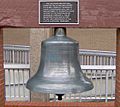
Meeleny Bell, located on the former Bradley County Courthouse from 1893 to 1963.
-
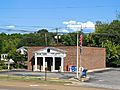
Charleston


See also
 In Spanish: Condado de Bradley (Tennessee) para niños
