
British Columbia Highway 1 facts for kids
Quick facts for kids
|
||||
|---|---|---|---|---|
| Trans-Canada Highway | ||||
|
A map of southern British Columbia with Hwy 1 highlighted in red
|
||||
| Route information | ||||
| Length | 1,047 km (651 mi) | |||
| Existed | 1961–present | |||
| Vancouver Island section | ||||
| Length | 116 km (72 mi) | |||
| South end | Dallas Road in Victoria | |||
| Major junctions |
||||
| North end | ||||
| Mainland section | ||||
| Length | 877 km (545 mi) | |||
| West end | ||||
| Major junctions |
|
|||
| East end | Alberta border at Kicking Horse Pass continues as |
|||
| Highway system | ||||
British Columbia provincial highways
|
||||
.svg)
British Columbia Highway 1 is part of the British Columbia section of the Trans-Canada Highway. It is 1,039 kilometers (646 miles) long across the southern part of British Columbia, including the part covered by ferries.
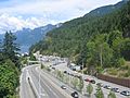
The highway starts near the provincial border with Alberta near Kicking Horse Pass, passign through the town of Field. Between the towns of Monte Creek and Cache Creek, the highway shares the same roadway with Highway 5 and Highway 97 for much of the distance. At West Vancouver on the Pacific coast of British Columbia, Highway 1 ends on the mainland at the Horseshoe Bay ferry terminal. The highway then resumes on Vancouver Island at the B.C. Ferry terminal near Departure Bay. The highway runs southward near the eastern coast of the island until it ends in the city of Victoria.
Images for kids
-
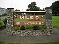
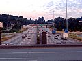
The beginning of Hwy 1 at the Mile Zero monument in Victoria
-
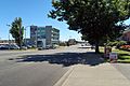
Vancouver Island section
-
Ferry traffic on Highway 1 at the Horseshoe Bay Ferry Terminal.
-
Ironworkers Memorial Second Narrows Crossing
-
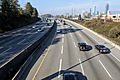
Highway 1 as it enters Vancouver from Burnaby.
-
British Columbia Highway 1 near Brentwood, Burnaby.
-
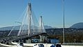
The new Port Mann Bridge, crossing the Fraser River
-
Fraser Canyon along British Columbia Highway #1 between Hope and Yale
-
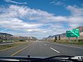
Highway 1 just east of Kamloops heading westbound.
-
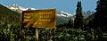
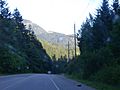
Summit of Rogers Pass
-
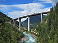
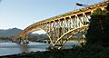
Highway 1 crossing the Park Bridge in the Kicking Horse Canyon


