
Brondesbury facts for kids
Quick facts for kids Brondesbury |
|
|---|---|
 One of the small station buildings of Brondesbury Park Station, higher than the line which is in cutting. It has small cornices at the hood of window height and a modillioned bulky cornice (ledge) above. It built in yellow-brown brick with complementary coloured red brick dressings. |
|
 Willesden Lane in Brondesbury |
|

Brondesbury
|
|
| Population | 13,023 (Brondesbury & Brondesbury Park) |
| OS grid reference | TQ245845 |
| London borough | |
| Ceremonial county | Greater London |
| Region | |
| Country | England |
| Sovereign state | United Kingdom |
| Post town | LONDON |
| Postcode district | NW6 |
| Dialling code | 020 |
| Police | Metropolitan |
| Fire | London |
| Ambulance | London |
| EU Parliament | London |
| UK Parliament |
|
| London Assembly |
|
Brondesbury, which includes Brondesbury Park, is an area in the London Borough of Brent, in London, England. The area is traditionally part of the Ancient Parish and subsequent Municipal Borough of Willesden, one of the areas that merged to form the modern borough of Brent.
Brondesbury railway station lies 4.1 miles north-west of Charing Cross, and its proximity to the originally Roman A5 road (the borough's eastern boundary) sometimes leads to addresses on the eastern, Camden, side of the road to also be informally described as part of Brondesbury.
It was a rural area until several decades after the coming of the railway in the Victorian era. Housing began to be built in earnest across Brondesbury in the late 1860s to 1890s and it became desirable enough to retain a suburban layout and most of the associated original wave of house building. It has long had British, Irish, Jewish, black and south Asian communities.
Contents
Transport
Rail/Underground
Brondesbury has two railway stations served by London Overground's North London Line between Richmond, Highbury & Islington and Stratford.
- Brondesbury Station
- Brondesbury Park Station
Kilburn tube station on the Jubilee line is a few metres from Brondesbury station on Kilburn High Road.
Geography
Location
 |
Willesden Green | Willesden Green, Cricklewood | West Hampstead | |
| Kensal Rise, Brondesbury Park | Kilburn, West Hampstead | |||
| Queen's Park | Kilburn Park, Kilburn | Kilburn |
Demography
Economic activity groups
Half of the area is Brondesbury Park ward, details of which are below:
| Status | Ward % | Borough % | National % |
|---|---|---|---|
| Economically Active | 78.0 | 74.3 | 76.8 |
| Retired | 2.5 | 2.6 | 4.9 |
| Student | 7.9 | 9.2 | 6.6 |
| Looking After Home Or Family | 4.8 | 5.9 | 4.9 |
| Long-Term Sick Or Disabled | 4.0 | 4.0 | 4.6 |
| Other inactive | 2.9 | 4.0 | 2.3 |
Narrowly, most of the other half forms the north of Kilburn electoral ward, equivalent details of which are below:
| Status | Ward % | Borough % | National % |
|---|---|---|---|
| Economically Active | 77.5 | 74.3 | 76.8 |
| Retired | 2.1 | 2.6 | 4.9 |
| Student | 7.4 | 9.2 | 6.6 |
| Looking After Home Or Family | 4.7 | 5.9 | 4.9 |
| Long-Term Sick Or Disabled | 4.9 | 4.0 | 4.6 |
| Other inactive | 3.6 | 4.0 | 2.3 |
Currently as the electoral wards are drawn about 20% of the area is in Queens Park ward. Its relevant statistics are as follows:
| Status | Ward % | Borough % | National % |
|---|---|---|---|
| Economically Active | 81.4 | 74.3 | 76.8 |
| Retired | 2.0 | 2.6 | 4.9 |
| Student | 6.3 | 9.2 | 6.6 |
| Looking After Home Or Family | 4.0 | 5.9 | 4.9 |
| Long-Term Sick Or Disabled | 3.4 | 4.0 | 4.6 |
| Other inactive | 3.0 | 4.0 | 2.3 |
Images for kids
-
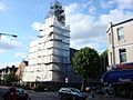
Church of the Transfiguration, Brondesbury Park

