
Brown County, Illinois facts for kids
Quick facts for kids
Brown County
|
|
|---|---|

Brown County Courthouse in Mount Sterling
|
|

Location within the U.S. state of Illinois
|
|
 Illinois's location within the U.S. |
|
| Country | |
| State | |
| Founded | 1839 |
| Named for | Jacob Brown |
| Seat | Mount Sterling |
| Largest city | Mount Sterling |
| Area | |
| • Total | 307 sq mi (800 km2) |
| • Land | 306 sq mi (790 km2) |
| • Water | 1.6 sq mi (4 km2) 0.5% |
| Population
(2010)
|
|
| • Total | 6,937 |
| • Estimate
(2019)
|
6,578 |
| • Density | 22.60/sq mi (8.724/km2) |
| Time zone | UTC−6 (Central) |
| • Summer (DST) | UTC−5 (CDT) |
| Congressional district | 18th |
| Website | https://www.browncoil.org |
Brown County is a county located in the U.S. state of Illinois. As of the 2010 census, the population was 6,937. Its county seat is Mount Sterling.
Siloam Springs State Park is located partly in this county.
Contents
History
Brown County was formed out of Schuyler County in 1839. It is named in honor of U.S. General Jacob Brown, who defeated the British at the Battle of Sackett's Harbor in 1813.
-
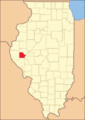
Brown County at the time of its creation in 1839

Geography
According to the U.S. Census Bureau, the county has a total area of 307 square miles (800 km2), of which 306 square miles (790 km2) is land and 1.6 square miles (4.1 km2) (0.5%) is water. The Illinois River flows along part of the county's eastern border.
Adjacent counties
- Schuyler County - north
- Cass County - east
- Morgan County - southeast
- Pike County - south
- Adams County - west
Major highways
 US Route 24
 Illinois Route 99
 Illinois Route 107
Climate and weather
| Weather chart for Mount Sterling, Illinois | |||||||||||||||||||||||||||||||||||||||||||||||
|---|---|---|---|---|---|---|---|---|---|---|---|---|---|---|---|---|---|---|---|---|---|---|---|---|---|---|---|---|---|---|---|---|---|---|---|---|---|---|---|---|---|---|---|---|---|---|---|
| J | F | M | A | M | J | J | A | S | O | N | D | ||||||||||||||||||||||||||||||||||||
|
1.6
32
15
|
1.9
38
20
|
3.1
50
30
|
3.9
63
41
|
5.1
73
51
|
3.9
82
61
|
3.9
87
65
|
3.5
84
63
|
3.6
78
54
|
3.3
66
43
|
3.2
50
31
|
2.4
37
20
|
||||||||||||||||||||||||||||||||||||
| temperatures in °F precipitation totals in inches source: The Weather Channel |
|||||||||||||||||||||||||||||||||||||||||||||||
|
Metric conversion
|
|||||||||||||||||||||||||||||||||||||||||||||||
In recent years, average temperatures in the county seat of Mount Sterling have ranged from a low of 15 °F (−9 °C) in January to a high of 87 °F (31 °C) in July, although a record low of −26 °F (−32 °C) was recorded in February 1905 and a record high of 113 °F (45 °C) was recorded in July 1936. Average monthly precipitation ranged from 1.55 inches (39 mm) in January to 5.14 inches (131 mm) in May.
Demographics

| Historical population | |||
|---|---|---|---|
| Census | Pop. | %± | |
| 1840 | 4,183 | — | |
| 1850 | 7,198 | 72.1% | |
| 1860 | 9,938 | 38.1% | |
| 1870 | 12,205 | 22.8% | |
| 1880 | 13,041 | 6.8% | |
| 1890 | 11,951 | −8.4% | |
| 1900 | 11,557 | −3.3% | |
| 1910 | 10,397 | −10.0% | |
| 1920 | 9,336 | −10.2% | |
| 1930 | 7,892 | −15.5% | |
| 1940 | 8,053 | 2.0% | |
| 1950 | 7,132 | −11.4% | |
| 1960 | 6,210 | −12.9% | |
| 1970 | 5,586 | −10.0% | |
| 1980 | 5,411 | −3.1% | |
| 1990 | 5,836 | 7.9% | |
| 2000 | 6,950 | 19.1% | |
| 2010 | 6,937 | −0.2% | |
| 2019 (est.) | 6,578 | −5.2% | |
| U.S. Decennial Census 1790-1960 1900-1990 1990-2000 2010-2017 |
|||
As of the 2010 United States Census, there were 6,937 people, 2,099 households, and 1,346 families living in the county. The population density was 22.7 inhabitants per square mile (8.8/km2). There were 2,462 housing units at an average density of 8.1 per square mile (3.1/km2). The racial makeup of the county was 76.1% white, 18.5% black or African American, 0.2% Asian, 0.2% American Indian, 4.4% from other races, and 0.6% from two or more races. Those of Hispanic or Latino origin made up 5.8% of the population. In terms of ancestry, 25.5% were German, 15.6% were American, 12.7% were Irish, and 6.1% were English.
Of the 2,099 households, 28.4% had children under the age of 18 living with them, 51.3% were married couples living together, 8.6% had a female householder with no husband present, 35.9% were non-families, and 32.2% of all households were made up of individuals. The average household size was 2.30 and the average family size was 2.88. The median age was 37.3 years.
The median income for a household in the county was $38,696 and the median income for a family was $50,341. Males had a median income of $34,648 versus $27,288 for females. The per capita income for the county was $17,133. About 9.9% of families and 12.0% of the population were below the poverty line, including 15.0% of those under age 18 and 9.2% of those age 65 or over.
The Illinois state prison, Western Illinois Correctional Center, located south east of Mount Sterling, has an average daily population of 2,066. The all-male population and racial makeup of the prison is so large, compared to the rest of the county, that it skews the census demographic data. This is evidenced by the lopsided age pyramid.[1]
Communities
City
Villages
Townships
Brown County is divided into these nine townships:
- Buckhorn
- Cooperstown
- Elkhorn
- Lee
- Missouri
- Mount Sterling
- Pea Ridge
- Ripley
- Versailles
Education
- Brown County Community Unit School District 1
- Meredosia-Chambersburg Community Unit School District 11
- Southeastern Community Unit School District 337
See also
 In Spanish: Condado de Brown (Illinois) para niños
