Buena Vista Township, New Jersey facts for kids
Quick facts for kids
Buena Vista Township, New Jersey
|
|
|---|---|
|
Township
|
|
| Township of Buena Vista | |
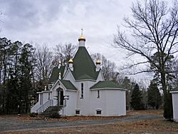
Russian Orthodox Church
|
|
| Motto(s):
"44 miles of opportunity"
|
|
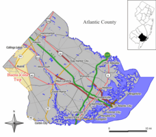
Map of Buena Vista Township in Atlantic County. Inset: Location of Atlantic County highlighted in the State of New Jersey.
|
|
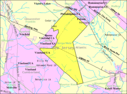
Census Bureau map of Buena Vista, New Jersey
|
|
| Country | |
| State | |
| County | Atlantic |
| Incorporated | March 5, 1867 |
| Named for | Battle of Buena Vista |
| Government | |
| • Type | Township |
| • Body | Township Committee |
| Area | |
| • Total | 41.58 sq mi (107.69 km2) |
| • Land | 41.08 sq mi (106.39 km2) |
| • Water | 0.50 sq mi (1.30 km2) 1.20% |
| Area rank | 49th of 565 in state 6th of 23 in county |
| Elevation | 82 ft (25 m) |
| Population | |
| • Total | 7,570 |
| • Estimate
(2019)
|
7,215 |
| • Rank | 303rd of 566 in state 12th of 23 in county |
| • Density | 184.4/sq mi (71.2/km2) |
| • Density rank | 514th of 566 in state 19th of 23 in county |
| Time zone | UTC−05:00 (Eastern (EST)) |
| • Summer (DST) | UTC−04:00 (Eastern (EDT)) |
| ZIP Code |
08310 - Buena
|
| Area code(s) | 609 exchange: 704 856 exchanges: 563, 697 |
| FIPS code | 3400108710 |
| GNIS feature ID | 0882048 |
Buena Vista Township ( BYOO-NUH-viss-tuh) is a township located in Atlantic County, New Jersey, United States. As of the 2010 United States Census, the township had a total population of 7,570, reflecting an increase of 134 (+1.8%) from the 7,436 counted in the 2000 Census, which had in turn declined by 219 (-2.9%) from the 7,655 counted in the 1990 Census.
Buena Vista was incorporated as a township by an act of the New Jersey Legislature on March 5, 1867, from portions of Hamilton Township. Portions of the township were taken on May 23, 1906, to create Folsom, and on September 1, 1948, to create Buena Borough. The name comes from the 1847 Battle of Buena Vista of the Mexican–American War.
The township is headquarters for Troop A of the New Jersey State Police, which covers more than 2,000 square miles (5,200 km2) and 1.7 million residents.
On April 26, 2004, the Buena Vista Township Committee voted to temporarily rename the community of Richland, a section of Buena Vista Township. For the first half of the month of May, Richland became Mojito, New Jersey, named after the Cuban rum drink. Bacardi had offered to give the township $5,000 for recreation projects in exchange for a sign placed on U.S. Route 40 commemorating the new name. Richland was chosen because it is home to the family-run Dalponte Farms, a major east coast supplier of mint, an essential ingredient of the mojito.
Contents
Geography
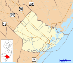
According to the United States Census Bureau, the township had a total area of 41.529 square miles (107.558 km2), including 41.054 square miles (106.329 km2) of land and 0.475 square miles (1.229 km2) of water (1.14%).
Collings Lakes (with a 2010 population of 1,706) is an unincorporated community and census-designated place (CDP) located within Buena Vista Township.
Other unincorporated communities, localities and place names located partially or completely within the township include Buena Acres, East Vineland, Lake Ann, Milmay, New Kuban, Newtonville, Pine Lake Estates and Richland.
The township is one of 56 South Jersey municipalities that are included within the New Jersey Pinelands National Reserve, a protected natural area of unique ecology covering 1,100,000 acres (450,000 ha), that has been classified as a United States Biosphere Reserve and established by Congress in 1978 as the nation's first National Reserve. Part of the township is included in the state-designated Pinelands Area, which includes portions of Atlantic County, along with areas in Burlington, Camden, Cape May, Cumberland, Gloucester and Ocean counties. 90% of the township's area is within the boundaries of the Pine Barrens.
Demographics
| Historical population | |||
|---|---|---|---|
| Census | Pop. | %± | |
| 1870 | 948 | — | |
| 1880 | 885 | −6.6% | |
| 1890 | 1,299 | 46.8% | |
| 1900 | 1,646 | 26.7% | |
| 1910 | 2,723 | 65.4% | |
| 1920 | 3,647 | 33.9% | |
| 1930 | 4,176 | 14.5% | |
| 1940 | 4,067 | −2.6% | |
| 1950 | 2,106 | −48.2% | |
| 1960 | 3,915 | 85.9% | |
| 1970 | 4,239 | 8.3% | |
| 1980 | 6,959 | 64.2% | |
| 1990 | 7,655 | 10.0% | |
| 2000 | 7,436 | −2.9% | |
| 2010 | 7,570 | 1.8% | |
| 2015 (est.) | 7,506 | −0.8% | |
| Population sources: 1870-2000 1870-1920 1870 1880-1890 1890-1910 1910-1930 1930-1990 2000 2010 * = Lost territory in previous decade. |
|||
2010 Census
As of the census of 2010, there were 7,570 people, 2,786 households, and 2,020 families residing in the township. The population density was 184.4 per square mile (71.2/km2). There were 3,008 housing units at an average density of 73.3 per square mile (28.3/km2)*. The racial makeup of the township was 78.18% (5,918) White, 13.45% (1,018) Black or African American, 0.46% (35) Native American, 1.06% (80) Asian, 0.04% (3) Pacific Islander, 4.12% (312) from other races, and 2.69% (204) from two or more races. [[Hispanic (U.S. Census)|Hispanic or Latino of any race were 11.48% (869) of the population.
There were 2,786 households out of which 27.1% had children under the age of 18 living with them, 55.6% were married couples living together, 11.7% had a female householder with no husband present, and 27.5% were non-families. 22.7% of all households were made up of individuals, and 11.2% had someone living alone who was 65 years of age or older. The average household size was 2.71 and the average family size was 3.19.
In the township, the population was spread out with 22.9% under the age of 18, 8.0% from 18 to 24, 23.1% from 25 to 44, 29.7% from 45 to 64, and 16.4% who were 65 years of age or older. The median age was 42.1 years. For every 100 females there were 95.0 males. For every 100 females ages 18 and old there were 91.8 males.
2000 Census
As of the 2000 United States Census there are 7,436 people residing in the township, organized into 2,648 households and 1,972 families. The population density is 179.8 people per square mile (69.4/km²). There are 2,827 housing units at an average density of 68.3 per square mile (26.4/km²). The racial makeup of the township is 77.34% White, 15.69% African American, 0.23% Native American, 0.22% Asian, 0.01% Pacific Islander, 4.07% from other races, and 2.43% from two or more races. 9.27% of the population are Hispanic or Latino of any race.
There are 2,648 households out of which 30.6% have children under the age of 18 living with them, 58.5% are married couples living together, 10.6% have a female householder with no husband present, and 25.5% are non-families. 21.0% of all households are made up of individuals and 10.6% have someone living alone who is 65 years of age or older. The average household size is 2.77 and the average family size is 3.20.
In the township the population is spread out with 24.7% under the age of 18, 7.4% from 18 to 24, 27.5% from 25 to 44, 25.0% from 45 to 64, and 15.3% who are 65 years of age or older. The median age is 39 years. For every 100 females there are 95.0 males. For every 100 females age 18 and over, there are 92.6 males.
The median income for a household in the township is $43,770, and the median income for a family is $50,403. Males have a median income of $36,064 versus $26,180 for females. The per capita income for the township is $18,382. 12.1% of the population and 7.8% of families are below the poverty line. Out of the total population, 13.2% of those under the age of 18 and 13.3% of those 65 and older are living below the poverty line.
Transportation
Roads and highways
As of May 2010[update], the township had a total of 121.52 miles (195.57 km) of roadways, of which 90.65 miles (145.89 km) were maintained by the municipality, 21.27 miles (34.23 km) by Atlantic County and 9.60 miles (15.45 km) by the New Jersey Department of Transportation.
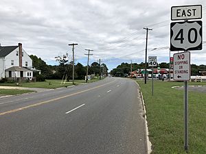
The main highways serving Buena Vista Township include U.S. Route 40, which runs from Buena southeastward across the township to Hamilton Township. New Jersey Route 54 also crosses the township, starting at U.S. Route 40 at the Buena border and continuing northeastward across the township to Folsom.
The closest limited access roads are Route 55 in neighboring Franklin and Vineland, as well as the Atlantic City Expressway in Hamilton Township.
Public transportation
NJ Transit provides service between the Atlantic City Bus Terminal in Atlantic City and Upper Deerfield Township on the 553 route.
Education
Students in public school for pre-kindergarten through twelfth grade from Buena Vista Township attend the Buena Regional School District, together with students from Buena Borough. Students are sent to the district's high school for grades 9 - 12 from both Estell Manor City and Weymouth Township as part of sending/receiving relationships with the respective school districts.
As of the 2017–18 school year, the district, comprised of five schools, had an enrollment of 1,795 students and 152.0 classroom teachers (on an FTE basis), for a student–teacher ratio of 11.8:1. Schools in the district (with 2017–18 enrollment data from the National Center for Education Statistics) are Collings Lakes Elementary School with 133 students in grades K-2, John C. Milanesi Elementary School with 288 students in grades PreK-2, Dr. J.P. Cleary Elementary School with 326 students in grades 3–5, Buena Regional Middle School with 421 students in grades 6-8 and Buena Regional High School with 569 students in grades 9-12.
Borough public school students are also eligible to attend the Atlantic County Institute of Technology in the Mays Landing section of Hamilton Township or the Charter-Tech High School for the Performing Arts, located in Somers Point.
Founded in 1959, St. Augustine Preparatory School is an all-male Catholic high school, operated under the jurisdiction of the Roman Catholic Diocese of Camden.
Notable people
People who were born in, residents of, or otherwise closely associated with Buena Vista Township include:
- John Armato (born 1948), politician who has represented the 2nd Legislative District in the New Jersey Assembly since 2018, after serving three years on the Buena Vista Township Committee.
- Liv Lux Miyake-Mugler, drag performer most known for competing on season 13 of RuPaul's Drag Race.
- Tony Siscone (born 1950), race car driver.
See also
 In Spanish: Municipio de Buena Vista (Nueva Jersey) para niños


