
Burraneer, New South Wales facts for kids
Quick facts for kids BurraneerSydney, New South Wales |
|||||||||||||||
|---|---|---|---|---|---|---|---|---|---|---|---|---|---|---|---|

Gunnamatta Bay, Burraneer
|
|||||||||||||||
| Population | 3,584 (2016 census) | ||||||||||||||
| Postcode(s) | 2230 | ||||||||||||||
| Elevation | 21 m (69 ft) | ||||||||||||||
| Location | 26 km (16 mi) south of Sydney CBD | ||||||||||||||
| LGA(s) | Sutherland Shire | ||||||||||||||
| State electorate(s) | Cronulla | ||||||||||||||
| Federal Division(s) | Cook | ||||||||||||||
|
|||||||||||||||
Burraneer is a bayside suburb in southern Sydney, in the state of New South Wales, Australia. Burraneer is 26 kilometres south of the Sydney central business district, in the local government area of the Sutherland Shire.
Burraneer sits on the peninsula of Burraneer Point, on the north shore of the Port Hacking estuary. Burraneer Bay forms the western border and Gunnamatta Bay the eastern border. Woolooware is the only adjacent suburb. Cronulla is located across Gunnamatta Bay. The suburbs of Dolans Bay, Port Hacking and Caringbah South are located across Burraneer Bay. The villages of Maianbar and Bundeena are located on the opposite bank of Port Hacking. Burraneer is a mostly residential suburb comprising predominantly large family homes with some offering expansive water views of the Port Hacking.
History
Burraneer is an Aboriginal word meaning point of the bay. It was named by Surveyor Robert Dixon in 1827, who chose many Aboriginal names for many of the bays in the area.
In 1858 Mary and Andrew Webster paid 108 pounds and 15 shillings plus a yearly peppercorn quit rent for their land here. The Websters sold their land to Dominick Dolan in 1863. James Wilson purchased his block of 252 acres (1.0 km2) for 252 pounds in 1862. In 1866, he sold his land to Thomas Holt (1811-1888), who added it to his huge 12,000-acre (49 km2) estate that stretched from Sutherland to Cronulla.
Transport
The closest railway station to Burraneer is Woolooware railway station, a station on the Cronulla branch line of the Sydney Trains Eastern Suburbs & Illawarra Line, or the T4 line. The station, like all NSW train stations, is opal active. All services are double deck electric trains of eight carriages traveling to Bondi Junction, stopping at major interchange stations such as Sutherland, Wolli Creek, Sydenham and Central. The station has two platforms and electronic indicator boards.
Sport and recreation
- Burraneer's nearest sporting club is Cronulla Seagulls FC, located in neighbouring Woolooware.
- Burraneer Bay Park has an area of bushland, a boardwalk, a playground and a bicycle/jogging track.
- There are a number of small park reserves, some of which have children's play equipment. Binaville Ave Reserve and Rutherford Reserve are located at the end of Woolooware Road.
- Lugano Avenue Small Craft Launching Facility, Burraneer Bay. Opened in 2020, the wharf is a small craft launch facility providing safe access for kayakers, rowers and paddlers.
- There are a number of publicly accessible wharves, beaches and bay accesses, such as Hospital Bay Wharf, located at the end of Gunnamatta Rd, Bulls Beach, parallel to Bulls Rd, accessed via Lugano Ave, and Bell Place Beach, accessed via pathway between number 5 & 7 Bell Place.
Demographics
According to the 2016 census of Population, there were 3,584 residents in Burraneer.
- 83.7% of people were born in Australia. The most common other countries of birth were England 3.1%, New Zealand 1.5%, Italy 0.7%, United States of America 0.6%, and Singapore 0.4%.
- 89.1% of people spoke only English at home.
- The most common responses for religion in Burraneer were Catholic 34.8%, Anglican 23.7%, No Religion 19.9%, Eastern Orthodox 4.1% and 6.9% did not state a religion.
- The average weekly household income in Burraneer was $2,860, a substantially significant inflation of 42% in comparison to the New South Wales average of $1,486.
Images for kids
-
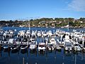
Burraneer Bay Marina
-
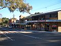
Shops on Woolooware Road


