
Butler County, Pennsylvania facts for kids
Quick facts for kids
Butler County
|
|
|---|---|

Butler County Courthouse
|
|

Location within the U.S. state of Pennsylvania
|
|
 Pennsylvania's location within the U.S. |
|
| Country | |
| State | |
| Founded | March 12, 1800 |
| Named for | Richard Butler |
| Seat | Butler |
| Largest city | Butler |
| Area | |
| • Total | 795 sq mi (2,060 km2) |
| • Land | 789 sq mi (2,040 km2) |
| • Water | 6.1 sq mi (16 km2) 0.8%% |
| Population
(2020)
|
|
| • Total | 193,763 |
| • Density | 246/sq mi (95/km2) |
| Time zone | UTC−5 (Eastern) |
| • Summer (DST) | UTC−4 (EDT) |
| Congressional districts | 15th, 16th, 17th |
|
Pennsylvania Historical Marker
|
|
| Designated: | June 11, 1982 |
Butler County is located in the western part of the U.S. state of Pennsylvania. As of the 2020 census, the population was 193,763. Its county seat is Butler. Butler County was created on March 12, 1800, from part of Allegheny County and named in honor of General Richard Butler, a hero of the American Revolution.
Butler County is part of the Pittsburgh, PA Metropolitan Statistical Area.
Contents
History
Some famous inventions and discoveries were made in Butler County. It was in Saxonburg that the designer of the Brooklyn Bridge, John Roebling, invented his revolutionary "wire rope." At what is now known as Oil Creek, Butler County resident William Smith and Edwin Drake first proved oil could be tapped from underground for consistent supply. The Jeep was developed in Butler County by American Bantam in 1941.
Famous politicians have lived in and traveled through Butler County. George Washington passed through during the French and Indian War. Butler's only U.S. Senator, Walter Lowrie, built a home in 1828 that still stands behind the Butler County Courthouse. The Butler County Historical Society's office is in this home.
Butler's highest ranked federal official ever is William J. Perry, Secretary of Defense under President Bill Clinton from 1994-1997. He graduated from Butler High School in 1945. In 1923, President Warren G. Harding's funeral train passed through Butler County on its way back to Washington D.C. John F. Kennedy spoke in front of the Butler County Courthouse during the United States presidential election, 1960. Hubert Humphrey also spoke in Butler during this time period. Then in 2004, Vice President Dick Cheney delivered a speech in Saxonburg to rally support for President George W. Bush during the United States presidential election, 2004.
Bret Michaels, lead singer of the rock band Poison was born here in 1963.
Geography
According to the U.S. Census Bureau, the county has a total area of 795 square miles (2,060 km2), of which 789 square miles (2,040 km2) is land and 6.1 square miles (16 km2) (0.8%) is water.
It is the location of Moraine State Park, with the 3,000-acre (12 km2) glacial lake, Lake Arthur. Lake Arthur is used for fishing and sailing, and the surrounding park is used for hiking and hunting.
Waterways
- Allegheny River (The river touches Butler County at its northeast and southeast corners. It is both a recreational and industrial waterway.)
- Connoquenessing Creek (recreational canoeing and kayaking)
- Lake Arthur at Moraine State Park (recreational boating, canoeing and kayaking)
- Slippery Rock Creek (recreational canoeing and kayaking)
- Little Connoquenessing Creek
- Bull Creek
- Muddy Creek
- Sullivan Run
- Semiconon Run
- Mulligan Run
Adjacent counties
- Venango County (north)
- Clarion County (northeast)
- Armstrong County (east)
- Westmoreland County (southeast)
- Allegheny County (south)
- Beaver County (southwest)
- Lawrence County (west)
- Mercer County (northwest)
Demographics
| Historical population | |||
|---|---|---|---|
| Census | Pop. | %± | |
| 1800 | 3,916 | — | |
| 1810 | 7,346 | 87.6% | |
| 1820 | 10,193 | 38.8% | |
| 1830 | 14,581 | 43.0% | |
| 1840 | 22,378 | 53.5% | |
| 1850 | 30,346 | 35.6% | |
| 1860 | 35,594 | 17.3% | |
| 1870 | 36,510 | 2.6% | |
| 1880 | 52,536 | 43.9% | |
| 1890 | 55,339 | 5.3% | |
| 1900 | 56,962 | 2.9% | |
| 1910 | 72,689 | 27.6% | |
| 1920 | 77,270 | 6.3% | |
| 1930 | 80,480 | 4.2% | |
| 1940 | 87,590 | 8.8% | |
| 1950 | 97,320 | 11.1% | |
| 1960 | 114,639 | 17.8% | |
| 1970 | 127,941 | 11.6% | |
| 1980 | 147,912 | 15.6% | |
| 1990 | 152,013 | 2.8% | |
| 2000 | 174,083 | 14.5% | |
| 2010 | 183,862 | 5.6% | |
| 2020 | 193,763 | 5.4% | |
| U.S. Decennial Census 1790-1960 1900-1990 1990-2000 2010-2019 |
|||
As of the census of 2000, there were 174,083 people, 65,862 households, and 46,827 families residing in the county. The population density was 221 people per square mile (85/km2). There were 69,868 housing units at an average density of 89 per square mile (34/km2). The racial/ethnic makeup of the county is 96.5% White, 0.9% Black or African American, 0.09% Native American, 0.8% Asian, 0.03% Pacific Islander, 0.17% from other races, 0.7% from two or more races; and 0.9% Hispanic or Latino of any race. 46.7% German, 24.8% Irish, 15.2% Italian, 9.9% English, 9.2% Polish, 6.3% American, 3.7% Scotch-Irish, and 3.1% French ancestry.
There were 65,862 households, out of which 32.90% had children under the age of 18 living with them, 59.80% were married couples living together, 8.10% had a female householder with no husband present, and 28.90% were non-families. 24.20% of all households were made up of individuals, and 10.40% had someone living alone who was 65 years of age or older. The average household size was 2.55 and the average family size was 3.04.
In the county, the population was spread out, with 24.60% under the age of 18, 8.80% from 18 to 24, 29.40% from 25 to 44, 23.00% from 45 to 64, and 14.30% who were 65 years of age or older. The median age was 38 years. For every 100 females, there were 95.40 males. For every 100 females age 18 and over, there were 91.80 males.
Recreation
Parks
There are 2 Pennsylvania state parks in Butler County.
- Jennings Environmental Education Center is the home of the only protected relict prairie in Pennsylvania.
- Moraine State Park The gently rolling hills, lush forests and sparkling waters disguise a land that has endured the effects of continental glaciers and massive mineral extraction. Each year over one million people visit the 16,725-acre (67.68 km2) park, yet never realize that many people helped restore the park from prior coal mining and oil and gas drilling practices. Today, the park is an outstanding example of environmental engineering achievement. During the third great ice advance about 140,000 years ago, a continental glacier dammed area creeks making three glacial lakes. To the north, Slippery Rock Creek filled giant Lake Edmund. To the southeast, extinct McConnells Run filled tiny Lake Prouty. In the middle, Muddy Creek filled the medium-sized Lake Watts.
Before the glacier dam. Slippery Rock and Muddy creeks flowed north while extinct McConnells Run flowed south. The glacier dammed Lake Prouty on the edge of the drainage divide. Eventually Lake Pouty spilled over and rushed to the south, carving Slippery Rock Creek Gorge. Lakes Watts and Edmund drained into the gorge, digging it deeper and making Slippery Rock and Muddy creeks flow south. Areas of the 400-foot (120 m) deep Slippery Rock Gorge may be seen at nearby McConnells Mill State Park.
The glacier created a landscape of rolling hills topped with hardwood trees and swamps in the valley bottoms. Moraines containing gravel, sand and clay were draped upon the landscape and silt was left on the extinct lake bottoms. Reference to: http://www.dcnr.state.pa.us/stateParks/parks/moraine/moraine_history.aspx
Trails
- Butler-Freeport Trail- The trail is a rail trail that connects the city of Butler with the borough of Freeport.
- North Country Trail- The trail passes through Jennings Environmental Education Center and Moraine State Park, as well as several State Game Lands.
- Washington's Trail- A regional scenic byway road trail that roughly follows the route George Washington and Christopher Gist took on the Venango Path from the Forks of the Ohio to Fort Le Boeuf in 1753.
- There is also a trail in Slippery Rock Township that connects with McConnells Mill State Park in Lawrence County.
Transportation
Airports
- Butler County Airport
- Butler Farm Show Airport
- Lakehill Airport
Major roads and highways

 I-76 / Penna Turnpike
 I-79
I-79 I-80
I-80 US 19
US 19 US 422
 PA 8
PA 8 PA 28
PA 28 PA 38
PA 38 PA 58
PA 58 PA 68
PA 68 PA 108
 PA 138
 PA 173
 PA 228
 PA 258
 PA 268
 PA 288
 PA 308
 PA 356
 PA 488
 PA 528
 PA 588
Transit
- Butler Transit Authority
Communities

Under Pennsylvania law, there are four types of incorporated municipalities: cities, boroughs, townships, and, in at most two cases, towns. The following cities, boroughs and townships are located in Butler County:
City
- Butler (county seat)
Boroughs
Townships
- Adams
- Allegheny
- Brady
- Buffalo
- Butler
- Center
- Cherry
- Clay
- Clearfield
- Clinton
- Concord
- Connoquenessing
- Cranberry
- Donegal
- Fairview
- Forward
- Franklin
- Jackson
- Jefferson
- Lancaster
- Marion
- Mercer
- Middlesex
- Muddy Creek
- Oakland
- Parker
- Penn
- Slippery Rock
- Summit
- Venango
- Washington
- Winfield
- Worth
Census-designated places
Census-designated places are geographical areas designated by the U.S. Census Bureau for the purposes of compiling demographic data. They are not actual jurisdictions under Pennsylvania law. Other unincorporated communities, such as villages, may be listed here as well.
- Homeacre-Lyndora
- Lake Arthur Estates
- Meadowood
- Meridian
- Nixon
- Oak Hills
- Shanor-Northvue
- Slippery Rock University
- Unionville
Unincorporated communities
Several of these communities, most notably Renfrew, Lyndora, Herman, Sarver, Cabot, Boyers, and Forestville, have post offices and zip codes, but aren't officially incorporated under Pennsylvania law, and exist entirely within townships.
Population ranking
The population ranking of the following table is based on the 2010 census of Butler County.
† county seat
| Rank | City/Town/etc. | Municipal type | Population (2010 Census) |
|---|---|---|---|
| 1 | † Butler | City | 13,757 |
| 2 | Fernway (former CDP) | CDP | 12,414 |
| 3 | Homeacre-Lyndora | CDP | 6,906 |
| 4 | Shanor-Northvue | CDP | 5,051 |
| 5 | Meridian | CDP | 3,881 |
| 6 | Zelienople | Borough | 3,812 |
| 7 | Slippery Rock | Borough | 3,625 |
| 8 | Fox Run (former CDP) | CDP | 3,282 |
| 9 | Seven Fields | Borough | 2,887 |
| 10 | Meadowood | CDP | 2,693 |
| 11 | Oak Hills | CDP | 2,333 |
| 12 | Slippery Rock University | CDP | 1,898 |
| 13 | Evans City | Borough | 1,833 |
| 14 | Mars | Borough | 1,699 |
| 15 | Saxonburg | Borough | 1,525 |
| 16 | Nixon | CDP | 1,373 |
| 17 | Prospect | Borough | 1,169 |
| 18 | Chicora | Borough | 1,043 |
| 19 | Unionville | CDP | 962 |
| 20 | Harrisville | Borough | 897 |
| 21 | Harmony | Borough | 890 |
| 22 | East Butler | Borough | 732 |
| 23 | Lake Arthur Estates | CDP | 594 |
| 24 | Valencia | Borough | 551 |
| 25 | Connoquenessing | Borough | 528 |
| 26 | Bruin | Borough | 524 |
| 27 | Callery | Borough | 394 |
| 28 | West Liberty | Borough | 343 |
| 29 | Eau Claire | Borough | 316 |
| 30 | Portersville | Borough | 235 |
| 31 | Petrolia | Borough | 212 |
| 32 | Karns City | Borough | 209 |
| 33 | Fairview | Borough | 198 |
| 34 | West Sunbury | Borough | 192 |
| 35 | Cherry Valley | Borough | 66 |
In popular culture
Butler County has often been used as a setting for films shot in the North Pittsburgh area. Such films include:
- Night of the Living Dead (1968)
- The Crazies (1973)
- The Prince of Pennsylvania (1988)
- Iron Maze (1991)
- Kingpin (1996)
- The Haunting Hour Volume One: Don't Think About It (2007)
- Homecoming (2008)
- Staunton Hill (2008)
- The Road (2008)
- I Am Number Four (2011)
- Death from Above (2011)
- The Avengers (2012) [1]
- A Separate Life (2012)
- Foxcatcher (2013)
Films set in Butler County, but not necessarily filmed there.
- Mrs. Soffel (1984)
- Night of the Living Dead (1990)
- Snow Angels (2008)
Novels set in Butler County.
Benjamin's Field, a trilogy by local author J. J. Knights
Education

Colleges and universities
- Butler County Community College's Homepage
- Slippery Rock University of Pennsylvania's Homepage
Technical schools
- Butler County Vo-Tech at bcvt.tec.pa.us
Public school districts
- Allegheny-Clarion Valley School District (part)
- Butler Area School District
- Freeport Area School District (part)
- Karns City Area School District
- Mars Area School District
- Moniteau School District
- Seneca Valley School District
- Slippery Rock Area School District
- South Butler County School District
Public Libraries
The Butler County Federated Library System (additionally known as the Library System of Butler County) includes the ten listed libraries. Each library is managed by its own Board of Directors. The majority of the funding for these libraries comes from state grants, user fines and donations with additional financial contributions from Butler County. The first Butler library originated in 1894 with the Literary Society of Butler in what is now known as the Little Red Schoolhouse. The Butler Area Public Library, built in 1921, was the last Carnegie library built in Pennsylvania. In the intervening 27 years the library was independently operated. From 1921 to 1941 the library quadrupled the number of patrons served. In 1987 the County Commissioners, through a resolution, founded the Butler County Federated Library System.
- Butler Area Public Library
- Chicora Community Library
- Cranberry Public Library
- Evans City Public Library
- Mars Area Public Library
- North Trails Public Library
- Prospect Community Library
- Slippery Rock Community Library
- South Butler Community Library
- Zelienople Area Public Library
Images for kids
-
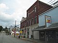
The downtown of Evans City
.jpg)
See also
 In Spanish: Condado de Butler (Pensilvania) para niños
