Camano Island facts for kids
Quick facts for kids
Camano Island, Washington
|
|
|---|---|

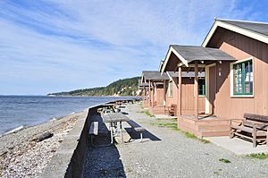
The island's western beach at Cama Beach State Park
|
|

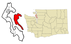
Location within Island County and Washington
|
|
| Country | United States |
| State | Washington |
| County | Island |
| Waterbody | Puget Sound |
| Named for | Jacinto Caamaño |
| Area | |
| • Total | 94.9 sq mi (245.9 km2) |
| • Land | 39.8 sq mi (103.0 km2) |
| • Water | 55.2 sq mi (142.9 km2) |
| Dimensions | |
| • Length | 15.6 mi (25.1 km) |
| • Width | 0.75–6.6 mi (1.21–10.62 km) |
| Elevation | 52 ft (16 m) |
| Population
(2020)
|
|
| • Total | 17,356 |
| • Density | 436.31/sq mi (168.59/km2) |
| Time zone | UTC-8 (Pacific (PST)) |
| • Summer (DST) | UTC-7 (PDT) |
| ZIP code |
98282
|
| FIPS code | 53-09365 |
| GNIS feature ID | 1503722 |
Camano Island is a large island in Possession Sound, a section of Puget Sound. It is part of Island County, Washington, and is located between Whidbey Island and the mainland (Snohomish County) by the Saratoga Passage to the west and Port Susan and Davis Slough to the east. The island has one road connection to the mainland, via State Route 532 over the Camano Gateway Bridge at the northeast end of the island, connecting to the city of Stanwood.
The island has a total area of 39.77 square miles (103.0 km2), making it one of the largest in the state of Washington. It has a year-round population of 15,661 as of the 2010 census. The population peaks at over 17,000 during the summer months due to part-time residents with vacation homes on the island. It is an unincorporated area with several small communities and shares civic facilities with nearby Stanwood, including its school district, and post office.
Camano Island is home to two state parks, Cama Beach and Camano Island State Park, and several county and local parks.
Demographics
| Estimated population | ||
|---|---|---|
| Year | Pop. | ±% p.a. |
| 1860 | 58 | — |
| 1870 | 157 | +10.47% |
| 1880 | 186 | +1.71% |
| 1895 | 200 | +0.48% |
| 1900 | 460 | +18.13% |
| 1910 | 678 | +3.96% |
| 1920 | 910 | +2.99% |
| 1930 | 679 | −2.89% |
| 1940 | 876 | +2.58% |
| 1950 | 1,160 | +2.85% |
| 1960 | 1,395 | +1.86% |
| 1970 | 2,600 | +6.42% |
| 1980 | 5,080 | +6.93% |
| 1990 | 7,329 | +3.73% |
| 2000 | 13,347 | +6.18% |
| 2010 | 15,661 | +1.61% |
| 2020 | 17,356 | +1.03% |
| Source: Kimball & Dean (1994) United States Census Bureau |
||
Camano Island has a large seasonal population of snowbirds and other part-time residents, which brings the summer population of the island to an estimated 17,000. The retiree population on the island began arriving in the mid-20th century, including residents from outside of Washington state. Based on per capita income, one of the more reliable measures of affluence, Camano ranks 99th of 522 areas in the state of Washington to be ranked.
Transportation
Camano Island is connected to mainland Washington by State Route 532, which travels from the north end of the island to Stanwood via two bridges over the Davis Slough and Stillaguamish River. The island has several connecting roads that travel along the west and east edges to various neighborhoods and the two state parks. Island Transit operates free bus services connecting Camano Island to Stanwood, with onward connections to Mount Vernon, Amtrak Cascades, and Everett.
Ferry connections to Coupeville and Everett existed historically, but the routes are no longer active. Local residents rejected a car ferry in 1999. A passenger-only Camano–Whidbey ferry has been proposed and studied by Island County.
See also
 In Spanish: Isla Caamaño para niños

