
Camp Hill, Queensland facts for kids
Quick facts for kids Camp HillBrisbane, Queensland |
|||||||||||||||
|---|---|---|---|---|---|---|---|---|---|---|---|---|---|---|---|

Playground in Whites Hill Reserve, Camp Hill
|
|||||||||||||||

Camp Hill
Location in Queensland
|
|||||||||||||||
| Population | 11,202 (2016 census) | ||||||||||||||
| • Density | 2,334/km2 (6,050/sq mi) | ||||||||||||||
| Postcode(s) | 4152 | ||||||||||||||
| Area | 4.8 km2 (1.9 sq mi) | ||||||||||||||
| Time zone | AEST (UTC+10:00) | ||||||||||||||
| Location | 8.1 km (5 mi) SE of Brisbane GPO | ||||||||||||||
| LGA(s) | City of Brisbane (Coorparoo Ward; Morningside Ward) |
||||||||||||||
| State electorate(s) |
|
||||||||||||||
| Federal Division(s) | Griffith | ||||||||||||||
|
|||||||||||||||
Camp Hill is an eastern suburb in the City of Brisbane, Queensland, Australia. In the 2016 census, Camp Hill had a population of 11,202 people.
Contents
Toponymy
Camp Hill is thought to have been named by teamsters who camped at a waterhole near Whites Hill in the suburb's south, while travelling between Brisbane and Cleveland.
History
The original early settlers in the area were farmers, with a strong German influence in the community in the early period. In the 1860s, McCann's Greenbank Dairy was in operation, and Peter Faust was also farming in that era.
In 1873, the White family purchased 53 acres (210,000 m2) on high land that became known as White's Hill, which is still the name of a locality within the suburb of Camp Hill. Robert White, who was a joiner, originally built a slab hut on the northern centre of the hill and was farming (dairy cows, pigs). By the 1920s, he'd built a road to the summit of the hill and built a large home on the summit. A two-storey tower at the northern end was included and was used as an observatory. This is now a public reserve.
It was in the 1880s that a real land and housing boom began, however. In 1882, Isaac Bennett established a rose farm on the corner of Bennett's and Old Cleveland Roads (this land was eventually subdivided). In 1886, John and Thirza Zahel acquired land between Dorothy Lane and Pampling Street and established a vineyard and orchard, and in 1890, the Fiveash family established a dairy as well as a fruit and vegetable farm on land at the corner of Clara St and Stanley Rd. The US Army had a significant impact on the area during the Second World War. A large US hospital was built on land to the rear of the Camp Hill Hotel. It accommodated up to 3,000 patients and staff. Now Arrol, Errey, Ascham, Morven, Aubrey and Arrowsmith Streets take up the site. These street follow the same pattern as the US constructed hospital roads.
Other local street names include Hobart, Sydney and Melbourne Avenue, which are the names of World War I ships as well as Australian capital cities.
Lossock Avenue and Tranters Avenue share an interesting history: William Lossock, owner and proprietor of Tranters Hotel in London, met the Brisbane architect who was subdividing land in the Camp Hill area when he visited London in the early 1920s. They became friends and the architect promised to name a street in the new estate after him, as well as one after the name of the Hotel.
Other significant dates:
- 1883 - Bus service to Stones Corner established.
- 1923 - 11 February - St. Thomas Catholic Church. On 28 January 1929, St. Thomas' School commenced
- 1925 - Tram line extended from to Camp Hill
- 1926 - Camp Hill State School, originally called Mt. Bruce State School
- 1926 - Church of the Annunciation (Church of England)
- 1928 - Camp Hill Methodist Church
- World War II - The Australian Army used White's Hill as an observation site
Trams and Trolleybuses
Between 1912 and 1926 the suburb was serviced by the Belmont Tramway, which was a steam tram service that connected with the Queensland Government Railway owned and operated Cleveland railway line at Norman Park. Initially the service was operated by the Belmont Shire Council. The service was suspended in 1924. The service was reinstated by the Brisbane City Council in 1925, but was again suspended in 1926. The line branched from the Cleveland line where Acfold Street (in Norman Park) now ends. It then crossed Bennetts Road (Belmont Junction station) and followed a corridor that now contains Bennett's Bushland Park, D'arcy Road, Oateson Skyline Drive (in Seven Hills, including Seven Hills station), Camp Hill Bowls Club (Mt Bruce Station), residences between Perth Street and Stephen Street, the Camp Hill State Infants and Primary School large oval, residences alongside Little Ferguson Road (City View Station) then between Margaret Street and Arrol Street, where it joined Old Cleveland Road.
The Belmont Tramway line remained in place until 1934, by which time the Brisbane City Council had extended its electric tramway from Coorparoo further along Old Cleveland Road, eventually becoming Route 06 between Fortitude Valley and Belmont (now Carina). Route 06 was replaced by a bus service when electric trams ceased operations in April 1969. As at 2016 Brisbane City Council's Route 204 still largely follows the former BCC Tram Route 06 along Old Cleveland Road, while Route 212 largely follows the former Belmont Tramway, although it travels to Carindale via Stanley Road rather than Old Cleveland Road. The tram tracks remain in Old Cleveland Road, Carina. Should the Eastern Busway be extended to Carindale, it is possible that these tracks may be removed, although they are heritage listed.
During the 1960s Brisbane City Council also operated an electric trolleybus line along the Macrossan Avenue-Stanley Road corridor with a branch line along Oateson Skyline Drive. Trolleybuses were replaced by conventional diesel buses coinciding with the closure of the city's electric tram system in 1969.
Transport
There has been no railway station in Camp Hill since the Belmont Tramway closed in 1926, however Coorparoo and Norman Park stations are located in neighbouring suburbs. Despite this, Camp Hill is well served by radial bus routes along the Old Cleveland Road, Stanley Road, and Chatsworth Rd corridors. Buses operate frequently and with a long span of service along Old Cleveland Road, between the Brisbane central business district and Carindale Shopping Centre bus station. The most significant stop is Camp Hill Stop 30 on Old Cleveland Road at Bruce Street, which is serviced by express, peak limited stops, and all-stops bus routes. Stop 30 is the site of the proposed Camp Hill busway station as part of the Eastern Busway planning. The suburb is situated within TransLink Zone 1, which makes it attractive to city commuters with respect to relatively cost effective transit travel.
Cycling and Walking
With hilly terrain and busy traffic conditions in Camp Hill, local recreational cycling opportunities are limited, aside from paved circuits on Lavarack Park and Perth Street Park. However, as at February 2016 several city wide cycle routes pass through Camp Hill. Old Cleveland Road is a radial route that includes formal bicycle lanes in neighbouring suburbs of Carina and Coorparoo, although not through Camp Hill. Stanley Road is a radial route that is line-marked as a Bicycle Awareness Zone (yellow stencil stylized bicycle marked on edge of vehicle travel lane). Oateson Skyline Drive - Wiles St is a circumferential route that includes formal bicycle lanes. The inner eastern suburbs bicycle route, also circumferential, includes bicycle lanes on Bennetts Road and then passes through back streets marked as Bicycle Awareness Zones between Old Cleveland Road at Ashton Street, and Chatsworth Road at Greens Road. Packs of cyclists are commonplace along Old Cleveland Road early on weekend mornings.
The hilly terrain and busy traffic conditions also impose some impediment to local walking opportunities. However, the grid structure of the road and street network and the presence of urban borders (verges) on all roadways promote relatively direct and safe walking conditions. The higher order local streets and the major roads mostly have paved footpaths on one or both sides. Old Cleveland Road has four signalised intersections with pedestrian control, which are all located adjacent to bus stops. Refuge islands support safe crossing of other roads and streets. Aside from local parks, nearby recreational walking attractions include Seven Hills Bushland Reserve to the north of Camp Hill, and Whites Hill Recreational Reserve immediately to the south.
Demographics
The 2011 Census recorded 10,533 residents in Camp Hill, of whom 51% were female and 49% were male. The median age of the population was 35; two years younger than the Australian median.
79.9% of people living in Camp Hill were born in Australia, compared to the national average of 69.8%. The other most common countries of birth were New Zealand (3.1%), England (3%), India (1%), Italy (0.7%), and South Africa (0.6%). 88% of people only spoke English at home, while the next most commonly spoken languages were Italian (1.2%), Greek (0.9%), Spanish (0.6%), Punjabi (0.5%), and Vietnamese (0.4%).
51.1% of households in the area consisted of couples with children, and 34.5% were couples without children. Separate houses accounted for nearly 85% of dwellings.
Amenities
Camp Hill has a large shopping centre in the "Whites Hill" area of the town (Centro Samuel Village) Which includes Woolworths, a Beer Wine Spirits and a few smaller stores. There are also a few smaller stores along Old Cleveland Road.
Camp Hill has a bowls club [1] located on Ferguson Road. The Whites Hill Reserve contains touch football and Holland Park Hawks facilities.
Education
Camp Hill State Infants and Primary School is a government primary (Prep-6) school for boys and girls at 676 Old Cleveland Road (27°29′34″S 153°04′43″E / 27.4929°S 153.0785°E). In 2017, the school had an enrolment of 807 students with 68 teachers (52 full-time equivalent) and 46 non-teaching staff (23 full-time equivalent). It includes a special education program.
St Thomas' Catholic School is a Catholic primary (Prep-6) school for boys and girls at 10 Stephen Street (27°29′14″S 153°04′19″E / 27.4871°S 153.0719°E). In 2017, the school had an enrolment of 330 students with 26 teachers (20 full-time equivalent) and 17 non-teaching staff (9 full-time equivalent).
Whites Hill State College is a government primary and secondary (Prep-12) school for boys and girls at 138 Burn Street (27°30′02″S 153°04′56″E / 27.5006°S 153.0821°E). In 2017, the school had an enrolment of 765 students with 77 teachers (71 full-time equivalent) and 48 non-teaching staff (32 full-time equivalent). It includes a special education program.
Images for kids
-
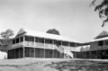
Additions to Camp Hill State School, August 1946
-
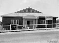
School of Arts hall at Camp Hill, 1940
-
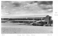
Camp Hill State High School, July 1959
-
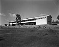
Whites Hill State School, Camp Hill, 1958
-
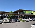
Camp Hill Marketplace, 2020


