
Canaveral National Seashore facts for kids
Quick facts for kids Canaveral National Seashore |
|
|---|---|
|
IUCN Category V (Protected Landscape/Seascape)
|
|

An eastward view of the shoreline at sunrise
|
|

Canaveral National Seashore
Location in Florida

Canaveral National Seashore
Location in the United States
|
|
| Location | Brevard County and Volusia County, Florida, United States |
| Nearest city | New Smyrna Beach, Florida and Titusville, Florida |
| Area | 57,662 acres (23,335 ha) |
| Established | January 3, 1975 |
| Visitors | 1,005,001 (in 2011) |
| Governing body | National Park Service |
| Website | Canaveral National Seashore |
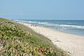
The Canaveral National Seashore (CANA) is a National Seashore located between New Smyrna Beach and Titusville, Florida, in Volusia and Brevard Counties. The park, located on a barrier island, was created on January 3, 1975, by an act of Congress. The park is split between Brevard and Volusia counties, with 9 miles of the seashore in Brevard County, and 15 miles of the seashore in Volusia County. CANA consists of 24 miles of beaches, dunes, mangrove wetlands, and a large portion of the Mosquito Lagoon. The Canaveral National Seashore is also the longest expanse of undeveloped land along the East Coast of Florida. The Canaveral National Seashore is home to more than 1,000 plant species and 310 bird species. CANA occupies 57,662 acres (23,335 ha) (including lagoons). There are 3 major beach sections in the seashore. The southern section is Playalinda Beach, the middle section is Klondike Beach, and the northern section is Apollo Beach.
Images for kids
-
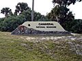
The New Smyrna Beach entrance to the park
-
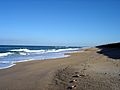
A SSE view down the shore
-
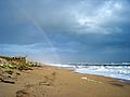
A NNW view up the shore
-
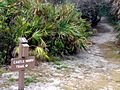
Castle Windy Trail in the park
-
Looking north on the southern part of the seashore


