
Cannock facts for kids
Quick facts for kids Cannock |
|
|---|---|
 Market Place |
|

Cannock
|
|
| Area | 9.24 km2 (3.57 sq mi) |
| Population | 29,018 (2011 Census) |
| • Density | 3,140/km2 (8,100/sq mi) |
| OS grid reference | SJ980101 |
| District |
|
| Shire county | |
| Region | |
| Country | England |
| Sovereign state | United Kingdom |
| Post town | CANNOCK |
| Postcode district | WS11 |
| Dialling code | 01543 |
| Police | Staffordshire |
| Fire | Staffordshire |
| Ambulance | West Midlands |
| EU Parliament | West Midlands |
| UK Parliament |
|
Cannock, as of the 2011 census, has a population of 29,018, and is the most populous of the three towns in the district of Cannock Chase in the central southern part of the county of Staffordshire in the West Midlands region of England.
Cannock lies to the north of the West Midlands conurbation on the M6, A34 and A5 roads, and to the south of Cannock Chase, an Area of Outstanding Natural Beauty (AONB). Cannock is served by a railway station on the Chase Line. The town comprises four district council electoral wards and the Cannock South ward includes the civil parish of Bridgtown, but the rest of Cannock is unparished.
Cannock forms part of the Cannock Built-up Area (population 86,121 in the 2011 census) which also includes Cheslyn Hay, Great Wyrley, Hednesford, Huntington, Heath Hayes and Wimblebury.
History
Cannock was called Chenet in the Domesday Book of 1086. It was called Chnoc c.1130, Cnot in 1156, Canot in 1157, and Canoc in 1198. Cannock is probably Old English cnocc meaning 'hillock', modified by Norman pronunciation by the insertion of a vowel to Canoc. The name may refer to Shoal Hill, north-west of the town.
Cannock was a small rural community until mining increased heavily during the mid-to-late 19th century. The area then continued to grow rapidly with many industries coming to the area because of its proximity to the Black Country and its coal reserves. Cannock's population continued to increase steadily in the 20th century and its slight fall since the 1981 census has been more than compensated for by house-building in the adjoining village of Heath Hayes. The last colliery to close in the town was Mid Cannock in 1967, and the last remaining colliery to close in the Cannock Chase area was Littleton (in Huntington) in 1993. There is now no heavy industry in the area, and Cannock is home to many commuters working in the surrounding towns and cities.
Cannock Chase German war cemetery is located nearby containing 4,885 German military dead from the First and Second World Wars. It is managed by the Commonwealth War Graves Commission.
Geography
Cannock is on a south-west facing slope, falling from the highest point on Cannock Chase (244 m) at Castle Ring, to about 148 m in the town centre and 111 m near Wedges Mills. The soil is light with a gravel and clay subsoil, and there are extensive coal measures.
Climate
Cannock has a moderate, temperate climate. See Penkridge weather station for details of average temperature and rainfall figures taken between 1981 and 2010 at the Met Office weather station in Penkridge (around 5 miles (8 km) north-west of Cannock).
Location
Cannock is about 20 miles (30 km) by road north-north-west of Birmingham, 80 miles (130 km) south-south-east of Manchester and 130 miles (210 km) north-west of London. It is 9 to 10 miles (14 to 16 km) by road from many of the nearest towns and cities (Aldridge, Lichfield, Stafford, Walsall, Willenhall and Wolverhampton), but Hednesford (2 miles (3 km)), Burntwood and Penkridge (5 miles (8 km)), Bloxwich and Brownhills (6 miles (10 km)) and Rugeley (7 miles (11 km)) are nearer.
Cities and towns below are in upper case. Only a few of the nearest villages are shown.
 |
PENKRIDGE | Huntington, STAFFORD | HEDNESFORD, RUGELEY, Armitage | |
| Brewood, SHIFNAL, TELFORD, Gailey | Cannock Wood, BURNTWOOD, Hammerwich, Heath Hayes, LICHFIELD | |||
| Featherstone, WOLVERHAMPTON | Great Wyrley, Cheslyn Hay, Landywood, BLOXWICH, WILLENHALL, WALSALL | Norton Canes, BROWNHILLS, ALDRIDGE |
Demography
In the decade to 2011 the number of dwellings rose by 7.8% to 13,152. The ward with the biggest increase (16.1%) was Cannock South. Of the town's 12,690 households in the 2011 census, 31.5% were one-person households including 13.9% where that person was 65 or over. 63.6% were one family with no others (9.0% all pensioners, 30.9% married or same-sex civil partnership couples, 12.3% cohabiting couples and 11.3% lone parents). 27.7% of households had dependent children including 5.5% with no adults in employment. 59.3% of households owned their homes outright or with a mortgage or loan.
Of the town's 23,717 residents in the 2011 census aged 16 and over, 33.5% were single (never married), 45.2% married, 0.15% in a registered same-sex civil partnership, 2.6% separated, 10.4% divorced and 8.2% widowed. 33.4% had no formal qualifications and 42.9% had level 2+ qualifications (meaning 5+ GCSEs (grades A*-C) or 1+ 'A' levels/ AS levels (A-E) or equivalent minimum).
72.7% of the 10,509 men aged 16 to 74 were economically active, including 45.1% working full-time, 5.6% working part-time and 12.6% self-employed. The male unemployment rate (Male unemployment)(of those economically active) was 9.9%. 60.7% of the 10,724 women aged 16 to 74 were economically active, including 26.8% working full-time, 23.5% working part-time and 3.1% self-employed. The female unemployment rate (of those economically active) was 7.5%.
Of people in employment aged 16 to 74, 13.5% worked in basic industries (ONS categories A, B, and D-F including 11.1% in construction), 14.2% in manufacturing, and 72.2% in service industries (ONS categories G-U including 19.5% in wholesale and retail trade and vehicle repair, 11.6% in health and social work, 7.4% in education, 6.2% in transport and storage, 5.8% in public administration, 5.6% in accommodation and catering, and 4.7% in administrative and support service activities). While 27.7% of households did not have access to a car or van, 76.1% of people in employment travelled to work by car or van.
75.5% of residents described their health as good or very good. The proportion who described themselves as White British was 95.6%, with all white ethnic groups making up 97.4% of the population. The ethnic make-up of the rest of the population was 1.0% mixed/multiple ethnic groups, 0.69% Indian/Pakistani/Bangladeshi, 0.34% Chinese, 0.17% other Asian, 0.35% Black and 0.065% other. 3.1% of Cannock's residents were born outside the United Kingdom.
Transport
Cannock is located close to the M6, M6 toll and M54 motorways. There is an extensive network of local buses radiating out from Cannock town centre. The town's main bus operator is Arriva Midlands, who operate the majority of services to and from Cannock bus station. Cannock railway station closed in 1965 as part of the Beeching Axe. It reopened in 1989 under British Rail and is part of the Rugeley - Cannock - Walsall - Birmingham line operated by London Midland. There are two trains per hour from the station to Rugeley, Walsall, and Birmingham. The journey time to Birmingham is around 45 minutes.
Twin town
- BBC Domesday Reloaded - Domesday Reloaded - Overview of Cannock
Images for kids
-
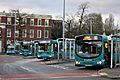
Arriva Midlands buses at Cannock Bus Station in December 2020
-
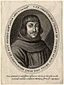
Walter Colman
-

Sir Patrick McLoughlin, 2017
-

Glenn Hughes, 2012
-

Jim Rhodes, 2010
-

Dave Norton, 2007


See also
 In Spanish: Cannock para niños
