
Cape Cleveland, Queensland facts for kids
Quick facts for kids Cape ClevelandTownsville, Queensland |
|||||||||||||||
|---|---|---|---|---|---|---|---|---|---|---|---|---|---|---|---|

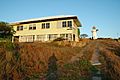
Tender departing the RV Solander, one of the research vessels at the Australian Institute of Marine Science.jpg
|
|||||||||||||||

Cape Cleveland
Location in Queensland
|
|||||||||||||||
| Population | 155 (2016 census) | ||||||||||||||
| • Density | 0.6920/km2 (1.792/sq mi) | ||||||||||||||
| Postcode(s) | 4810 | ||||||||||||||
| Area | 224.0 km2 (86.5 sq mi) | ||||||||||||||
| Time zone | AEST (UTC+10:00) | ||||||||||||||
| Location |
|
||||||||||||||
| LGA(s) | City of Townsville | ||||||||||||||
| State electorate(s) | Burdekin | ||||||||||||||
| Federal Division(s) | Dawson | ||||||||||||||
|
|||||||||||||||
Cape Cleveland is a rural locality in the City of Townsville, Queensland, Australia. In the 2016 census Cape Cleveland had a population of 155 people.
Contents
History
The area takes its name from the headland Cape Cleveland, named by Captain Cook on his first voyage to the Pacific in 1770. Cook gave no reason for the name, but it is possible it was in honour of John Clevland, a former Secretary to the British Admiralty. Cook's original choice of name was "Iron Head", but this was crossed and replaced in a revision of his log shortly after leaving the cape.
Heritage listings
Cape Cleveland has a number of heritage-listed sites, including:
- Cape Cleveland: Cape Cleveland Light
Education
There are no schools in Cape Cleveland. The nearest government primary schools are Giru State School in neighbouring Giru to the south-east and Wulguru State School in Wulguru to the west. The nearest government secondary school is William Ross State High School in Annandale, Townsville.
Images for kids
-
Cape Cleveland Light keepers house and lighthouse

