Carseldine, Queensland facts for kids
Quick facts for kids CarseldineBrisbane, Queensland |
|||||||||||||||
|---|---|---|---|---|---|---|---|---|---|---|---|---|---|---|---|

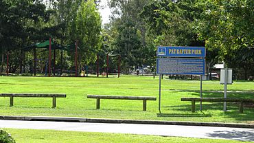
Pat Rafter Park
|
|||||||||||||||
| Population | 9,541 (2016 census) | ||||||||||||||
| • Density | 1,908/km2 (4,940/sq mi) | ||||||||||||||
| Postcode(s) | 4034 | ||||||||||||||
| Area | 5.0 km2 (1.9 sq mi) | ||||||||||||||
| Time zone | AEST (UTC+10:00) | ||||||||||||||
| Location | 14.9 km (9 mi) N of Brisbane GPO | ||||||||||||||
| LGA(s) | City of Brisbane (Bracken Ridge Ward) |
||||||||||||||
| State electorate(s) | Aspley | ||||||||||||||
| Federal Division(s) | Petrie | ||||||||||||||
|
|||||||||||||||
Carseldine is a suburb in the City of Brisbane, Queensland, Australia. In the 2016 census Carseldine had a population of 9,541 people.
Contents
Demographics
In the 2016 census, Carseldine recorded a population of 9,541 people; 52.9% female and 47.1% male.
The median age of the Carseldine population was 40 years of age, 2 years above the Australian median. Children aged under 15 years made up 16.7% of the population and people aged 65 years and over made up 22.1% of the population.
64.1% of people living in Carseldine were born in Australia, compared to the national average of 66.7%; the next most common countries of birth were India 4.6%, New Zealand 4.1%, England 3.1%, Philippines 1.9% and South Africa 1.6%.
73.8% of people only spoke English at home. Other languages spoken at home included Mandarin 1.8%, Hindi 1.8%, Cantonese 1.5%, Italian 1.5% and Malayalam 1.3%.
The most common responses for religion were Catholic 30.2%, No Religion 21.9% and Anglican 12.6%.
History
Carseldine was named after the fencing contractor William Carseldine who settled in Bald Hills in 1858. He also owned land in what is now Carseldine.
Transport
The suburb includes Carseldine railway station, located on the eastern side of the suburb. This provides Carseldine with regular train services, connecting to the Brisbane central business district and northern suburbs. Also, Carseldine is well serviced by buses operated by the Brisbane City Council.
In the 2016 census, 15.4% of employed people travelled to work on public transport and 67.9% travelled by car (either as driver or as passenger).
Education
There are no schools in Carseldine. The nearest government primary schools are Aspley East State School in neighouring Aspley to the south, Bald Hills State School in neighbouring Bald Hills to the north-east, and Taigum State School in Taigum to the east. The nearest government secondary school is Aspley State High School in neighbouring Aspley to the south.


