
Carver County, Minnesota facts for kids
Quick facts for kids
Carver County
|
|
|---|---|
.jpg)
Carver County Sheriff's Office and Justice Center in Chaska, Minnesota
|
|

Location within the U.S. state of Minnesota
|
|
 Minnesota's location within the U.S. |
|
| Country | |
| State | |
| Founded | February 20, 1855 |
| Named for | Jonathan Carver |
| Seat | Chaska |
| Largest city | Chaska |
| Area | |
| • Total | 376 sq mi (970 km2) |
| • Land | 354 sq mi (920 km2) |
| • Water | 22 sq mi (60 km2) 5.8%% |
| Population
(2020)
|
|
| • Total | 106,922 |
| • Estimate
(2021)
|
108,626 |
| • Density | 302/sq mi (117/km2) |
| Time zone | UTC−6 (Central) |
| • Summer (DST) | UTC−5 (CDT) |
| Congressional districts | 3rd, 6th |
| Website | www.co.carver.mn.us |
Carver County is a county in the U.S. state of Minnesota. The county is mostly farmland and wilderness with many unincorporated townships. As of the 2020 census, the population was 106,922. Its county seat is Chaska. Carver County is named for explorer Jonathan Carver, who in 1766–67, traveled from Boston to the Minnesota River and wintered among the Sioux near the site of New Ulm. Carver County is part of the Minneapolis-St. Paul-Bloomington, MN-WI Metropolitan Statistical Area.
Contents
Geography
According to the U.S. Census Bureau, the county has a total area of 376 square miles (970 km2), of which 354 square miles (920 km2) is land and 22 square miles (57 km2) (5.8%) is water. It is Minnesota's second-smallest county by land area and third-smallest by total area.

Carver is one of seven southern Minnesota counties with no forest soils; only prairie ecosystems of savannas and prairies can be found in Carver County. It is also one of 17 Minnesota counties where savanna soils dominate.
Lakes

Carver County is home to seven lakes, 235 acres or larger. Carver's largest and most notable lake is Waconia Lake. The lake is Minnesota's 73rd largest lake and the Twin Cities' second largest lake, with an area of 2,996 acres.
| Township | Lakes |
|---|---|
| Benton Township | Barlous Lake, Benton Lake, Maria Lake, Meuwissen Lake, Myers Lake, Rice Lake, Winkler Lake |
| Camden Township | Berliner Lake, Eagle Lake, Smith Lake |
| Dahlgren Township | Aue Lake |
| Hancock Township | Assumption Lake, Gaystock Lake, Maria Lake, Miller Lake, |
| Hollywood Township | Lippert Lake |
| Laketown Township | Carl Krey Lake, Lake Auburn, Lake Virginia, Lake Waconia, Lake Zumbra, Lunsten Lake, Marsh Lake, Parley Lake, Piersons Lake, Reitz Lake, Schutz Lake, Stieger Lake, Sunny Lake, Turbid Lake, Wasserman Lake |
| San Francisco Township | Hallquist Lake, Kelly Lake, Long Lake, Scott Lake, |
| Waconia Township | Burandt Lake, Donders Lake, Goose Lake, Hydes Lake, Lake Minnewashta, Lake Patterson, Lake Waconia, Rutz Lake, Swan Lake |
| Watertown Township | Buck Lake, Goose Lake, Lippert Lake, Mud Lake, Oak Lake, Swede Lake |
| Young America Township | Barnes Lake, Brand Lake, Braunworth Lake, Tiger Lake, Young America Lake |
Major highways
 U.S. Highway 212
 Minnesota State Highway 5
 Minnesota State Highway 7
 Minnesota State Highway 25
 Minnesota State Highway 41
 Minnesota State Highway 284
Adjacent counties
- Wright County (north)
- Hennepin County (northeast)
- Scott County (southeast)
- Sibley County (southwest)
- McLeod County (west)
National protected area
Climate and weather
In recent years, average temperatures in the county seat of Chaska have ranged from a low of 4 °F (−16 °C) in January to a high of 81 °F (27 °C) in July, although a record low of −41 °F (−41 °C) was recorded in January 1970 and a record high of 105 °F (41 °C) was recorded in July 1988. Average monthly precipitation ranged from 0.66 inches (17 mm) in February to 5.05 inches (128 mm) in August.
| Climate chart for Carver County, Minnesota | ||||||||||||||||||||||||||||||||||||||||||||||||||||||||||||||||||||||||||||||||||||||||||||||||
|---|---|---|---|---|---|---|---|---|---|---|---|---|---|---|---|---|---|---|---|---|---|---|---|---|---|---|---|---|---|---|---|---|---|---|---|---|---|---|---|---|---|---|---|---|---|---|---|---|---|---|---|---|---|---|---|---|---|---|---|---|---|---|---|---|---|---|---|---|---|---|---|---|---|---|---|---|---|---|---|---|---|---|---|---|---|---|---|---|---|---|---|---|---|---|---|---|
|
||||||||||||||||||||||||||||||||||||||||||||||||||||||||||||||||||||||||||||||||||||||||||||||||
Demographics
| Historical population | |||
|---|---|---|---|
| Census | Pop. | %± | |
| 1860 | 5,106 | — | |
| 1870 | 11,586 | 126.9% | |
| 1880 | 14,140 | 22.0% | |
| 1890 | 16,532 | 16.9% | |
| 1900 | 17,544 | 6.1% | |
| 1910 | 17,455 | −0.5% | |
| 1920 | 16,946 | −2.9% | |
| 1930 | 16,936 | −0.1% | |
| 1940 | 17,606 | 4.0% | |
| 1950 | 18,155 | 3.1% | |
| 1960 | 21,358 | 17.6% | |
| 1970 | 28,331 | 32.6% | |
| 1980 | 37,046 | 30.8% | |
| 1990 | 47,915 | 29.3% | |
| 2000 | 70,205 | 46.5% | |
| 2010 | 91,042 | 29.7% | |
| 2020 | 106,922 | 17.4% | |
| 2021 (est.) | 108,626 | 19.3% | |
| U.S. Decennial Census 1790–1960 1900–1990 1990–2000 2010–2020 |
|||

2010
The ethnic makeup of the county, according to the 2010 census, was the following:
- 93.7% White
- 1.5% Black
- 0.3% American Indian
- 2.9% Asian
- 0.0% Native Hawaiian or Pacific Islander
- 1.6% Two or more races
- 0.3% Other races
- 4.1% Hispanic or Latino (of any race)
There were 33,486 households, out of which 42.1% had children under the age of 18 living with them, 62.9% were married couples living together, 7.6% had a female householder with no husband present, and 25.9% were non-families. 21.0% of all households were made up of individuals, and 6.9% had someone living alone who was 65 years of age or older. The average household size was 2.74 and the average family size was 3.22.
The median income for a household in the county was $83,773, and the median income for a family was $96,913. Males had a median income of $66,150 versus $46,696 for females. The per capita income for the county was $37,457. About 3.3% of families and 4.9% of the population were below the poverty line, including 5.5% of those under age 18 and 7.8% of those age 65 or over.
2000
As of the 2000 United States Census, there were 70,205 people, 24,356 households, and 18,778 families in the county. The population density was 198/sqmi (76.6/km2). There were 24,883 housing units at an average density of 70.3/sqmi (27.1/km2). The racial makeup of the county was 95.95% White, 0.59% Black or African American, 0.18% Native American, 1.56% Asian, 0.01% Pacific Islander, 0.87% from other races, and 0.82% from two or more races. 2.55% of the population were Hispanic or Latino of any race. 44.3% were of German, 12.1% Norwegian, 7.1% Irish and 6.2% Swedish ancestry.
There were 24,356 households, out of which 45.20% had children under the age of 18 living with them, 66.40% were married couples living together, 7.30% had a female householder with no husband present, and 22.90% were non-families. 18.10% of all households were made up of individuals, and 6.10% had someone living alone who was 65 years of age or older. The average household size was 2.84 and the average family size was 3.26.
The county population contained 31.50% under the age of 18, 6.90% from 18 to 24, 34.70% from 25 to 44, 19.50% from 45 to 64, and 7.50% who were 65 years of age or older. The median age was 34 years. For every 100 females there were 100.00 males. For every 100 females age 18 and over, there were 98.00 males.
The median income for a household in the county was $65,540, and the median income for a family was $73,577 (these figures had risen to $78,035 and $89,100 respectively as of a 2007 estimate). Males had a median income of $47,271 versus $32,107 for females. The per capita income for the county was $28,486. About 2.30% of families and 3.50% of the population were below the poverty line, including 3.60% of those under age 18 and 6.90% of those age 65 or over.
Communities
Cities
Townships
- Benton Township
- Camden Township
- Dahlgren Township
- Hancock Township
- Hollywood Township
- Laketown Township
- San Francisco Township
- Waconia Township
- Watertown Township
- Young America Township
Unincorporated communities
Ghost town
Notable residents
- Abigail and Brittany Hensel
- Prince (musician)
- Wendelin Grimm
- Steve Strachan (sheriff)
- Arc Carnes (artist) -
Images for kids
-
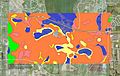
Soils of the Minnesota Landscape Arboretum area
See also
 In Spanish: Condado de Carver para niños
