
Ceará facts for kids
Quick facts for kids
State of Ceará
|
|||
|---|---|---|---|
|
|||
| Motto(s):
Terra da Luz (Land of Light)
|
|||

Location of State of Ceará in Brazil
|
|||
| Country | |||
| Capital and Largest City | Fortaleza | ||
| Area | |||
| • Total | 146,348.3 km2 (56,505.4 sq mi) | ||
| Area rank | 17th | ||
| Population
(2012)
|
|||
| • Total | 8,606,005 | ||
| • Rank | 8th | ||
| • Density | 58.804954/km2 (152.30413/sq mi) | ||
| • Density rank | 11th | ||
| Demonym(s) | Cearense | ||
| GDP | |||
| • Year | 2011 | ||
| • Total | R$ 84,360,000,000 (12th) | ||
| • Per capita | R$ 9,666 (List of Brazilian states by gross domestic product) | ||
| HDI | |||
| • Year | 2005 | ||
| • Category | 0,723 | ||
| Time zone | UTC-3 (BRT) | ||
| • Summer (DST) | UTC-02 (Brasília Summer) | ||
| Postal Code |
60000-000 to 63990-000
|
||
| ISO 3166 code | BR-CE | ||
| Website | ceara.gov.br | ||


Ceará is one of the 26 states of Brazil. It is in the northeastern part of the country, on the Atlantic coast. Ceará has many beaches, which brings a lot of tourism.
Geography
Ceará has an area of 148,016 km². It shares borders on the east by the states of Rio Grande do Norte and Paraíba, on the south by Pernambuco state, and on the west by Piauí. Its northern border is the Atlantic Ocean. Its capital is Fortaleza.
| States of Brazil | |
|---|---|
| Acre | Alagoas | Amapá | Amazonas | Bahia | Ceará | Espírito Santo | Goiás | Maranhão | Mato Grosso | Mato Grosso do Sul | Minas Gerais | Pará | Paraíba | Paraná | Pernambuco | Piauí | Rio de Janeiro | Rio Grande do Norte | Rio Grande do Sul | Rondônia | Roraima | Santa Catarina | São Paulo | Sergipe | Tocantins | |
| Federal District: Brazilian Federal District | |
Images for kids
-

Panorama of Fortaleza in 1811.
-
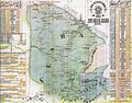
Map of Ceara State in 1924, (Portuguese edition)
-
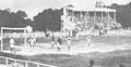
Campo do Prado in 1927
-
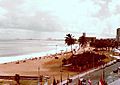
Fortaleza in 1980
-
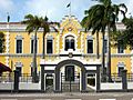
Colégio Militar de Fortaleza
-
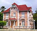
German culture house in Fortaleza
-
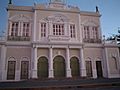
José de Alencar Theatre in Fortaleza
-
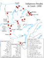
Map showing indigenous groups in Ceará.
-
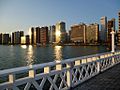
City Fortaleza.
-
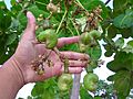
Cashew in Ceará
-
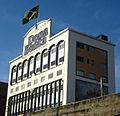
J Macêdo, one of the largest pasta industries in Brazil.
-
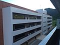
Public Library of Sobral.
-
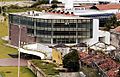
Academic Building at UNILAB.
-
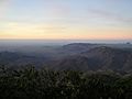
Guaramiranga, in Maciço de Baturité, Ceará
-
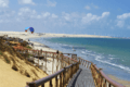
Canoa Quebrada Beach in Aracati
-
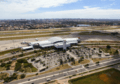
View of Fortaleza's International Airport.
-
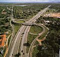
View of Fortaleza's BR-116 entrance.
-
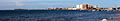
Port of Fortaleza
-
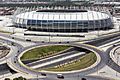
Arena Castelão in Fortaleza
-

UNILAB
-
UECE


.jpg)


.png)
.png)

.jpg)


See also
 In Spanish: Ceará para niños
