Celeryville, Ohio facts for kids
Quick facts for kids
Celeryville, Ohio
|
|
|---|---|

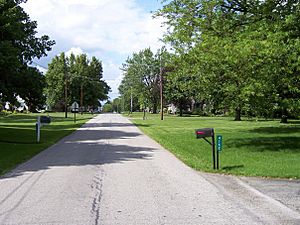
Broadway Road in Celeryville
|
|

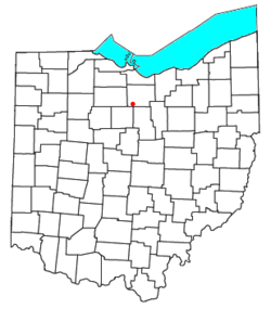
Location in Ohio
|
|
| Country | United States |
| State | Ohio |
| County | Huron |
| Townships | New Haven, Richmond |
| Area | |
| • Total | 0.52 sq mi (1.34 km2) |
| • Land | 0.52 sq mi (1.34 km2) |
| • Water | 0 sq mi (0.0 km2) |
| Elevation | 943 ft (287 m) |
| Population
(2010)
|
|
| • Total | 210 |
| • Density | 407/sq mi (157.0/km2) |
| Time zone | UTC-5 (Eastern (EST)) |
| • Summer (DST) | UTC-4 (EDT) |
| ZIP code |
44890
|
| Area code(s) | 419 |
| FIPS code | 39-12854 |
| GNIS feature ID | 1038919 |
Celeryville is an unincorporated community and census-designated place (CDP) on the boundary between New Haven and Richmond townships in Huron County, Ohio, United States. Celeryville is located approximately 1 mile (1.6 km) south of Willard, and the community relies on Willard's social services. As of the 2010 census the population of the community was 210.
Geography
Celeryville is located at 41.029N, -82.731W. State Route 103 and Bullhead Road are the proprietary roads that bound and serve Celeryville.
Education
The Willard Area School District serves residents of Celeryville. The community is also the home of Celeryville Christian School, a pre-K-8 school.
See also
 In Spanish: Celeryville (Ohio) para niños

All content from Kiddle encyclopedia articles (including the article images and facts) can be freely used under Attribution-ShareAlike license, unless stated otherwise. Cite this article:
Celeryville, Ohio Facts for Kids. Kiddle Encyclopedia.
